
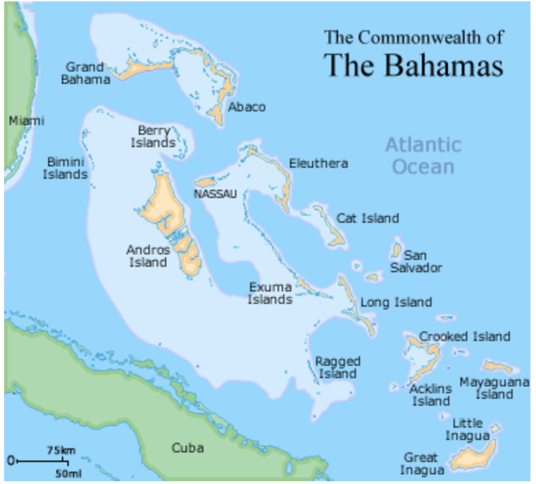
The Bahamas
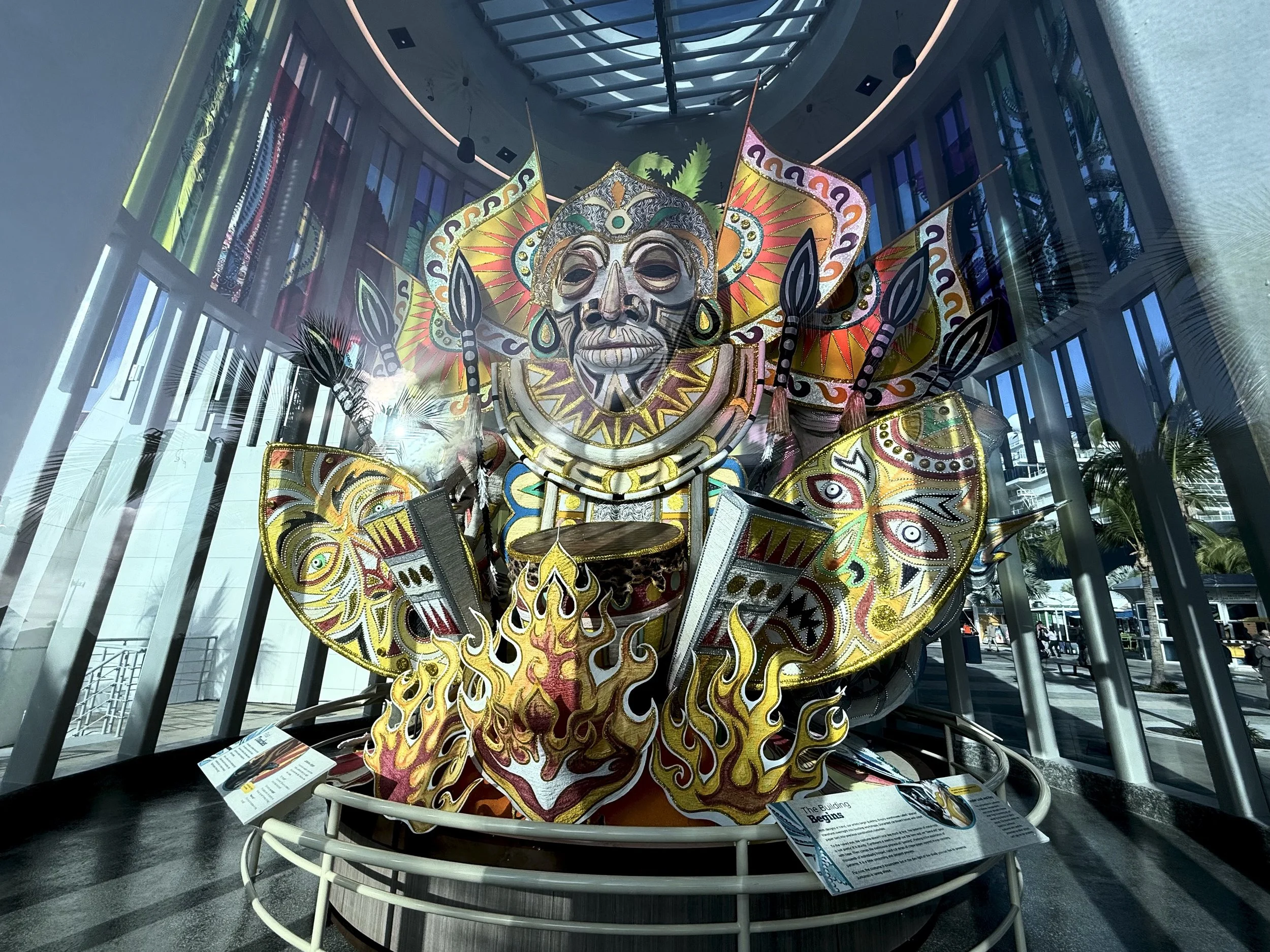
Large Junkanoo Costume at the Museum of Junkanoo
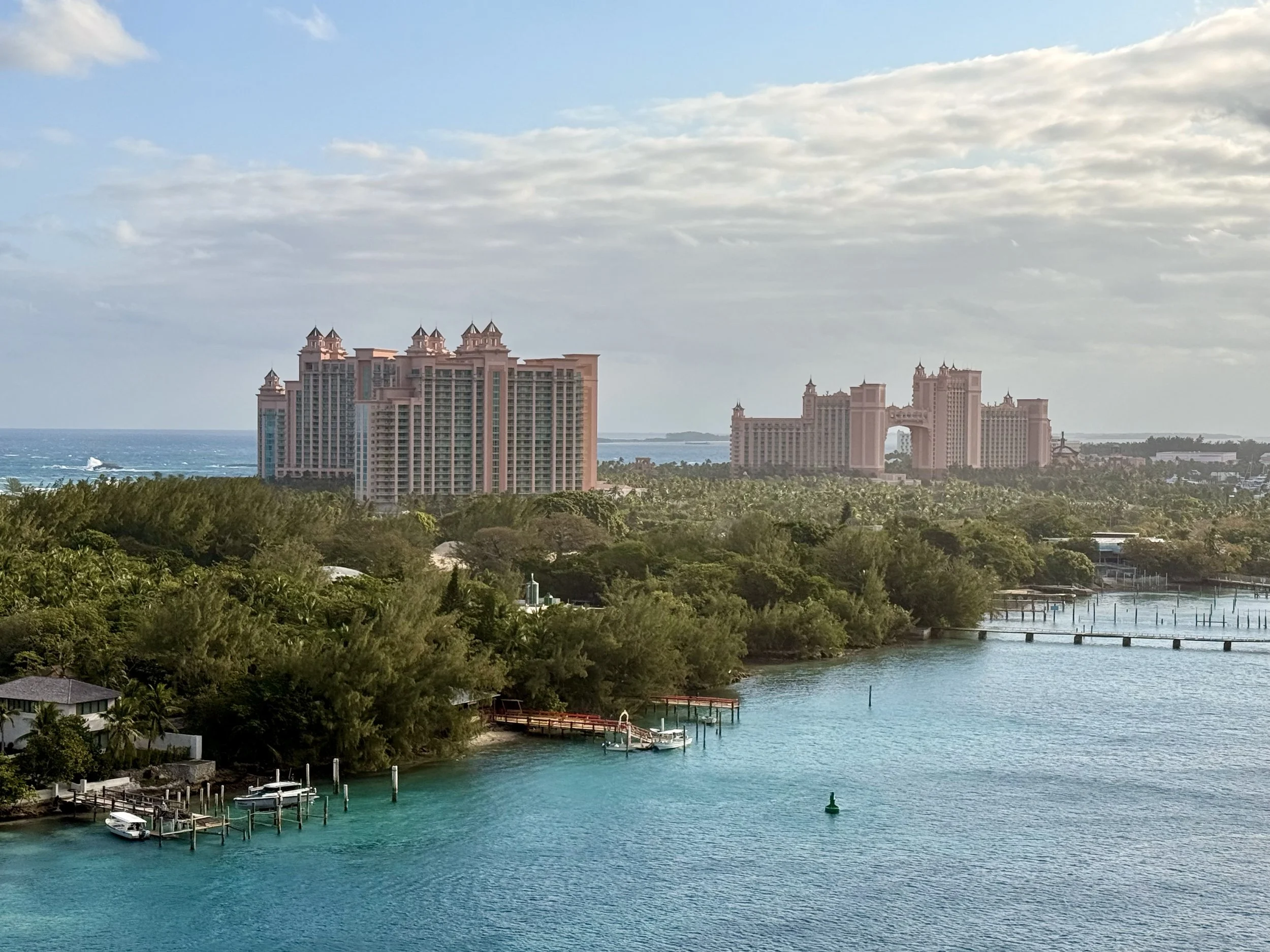
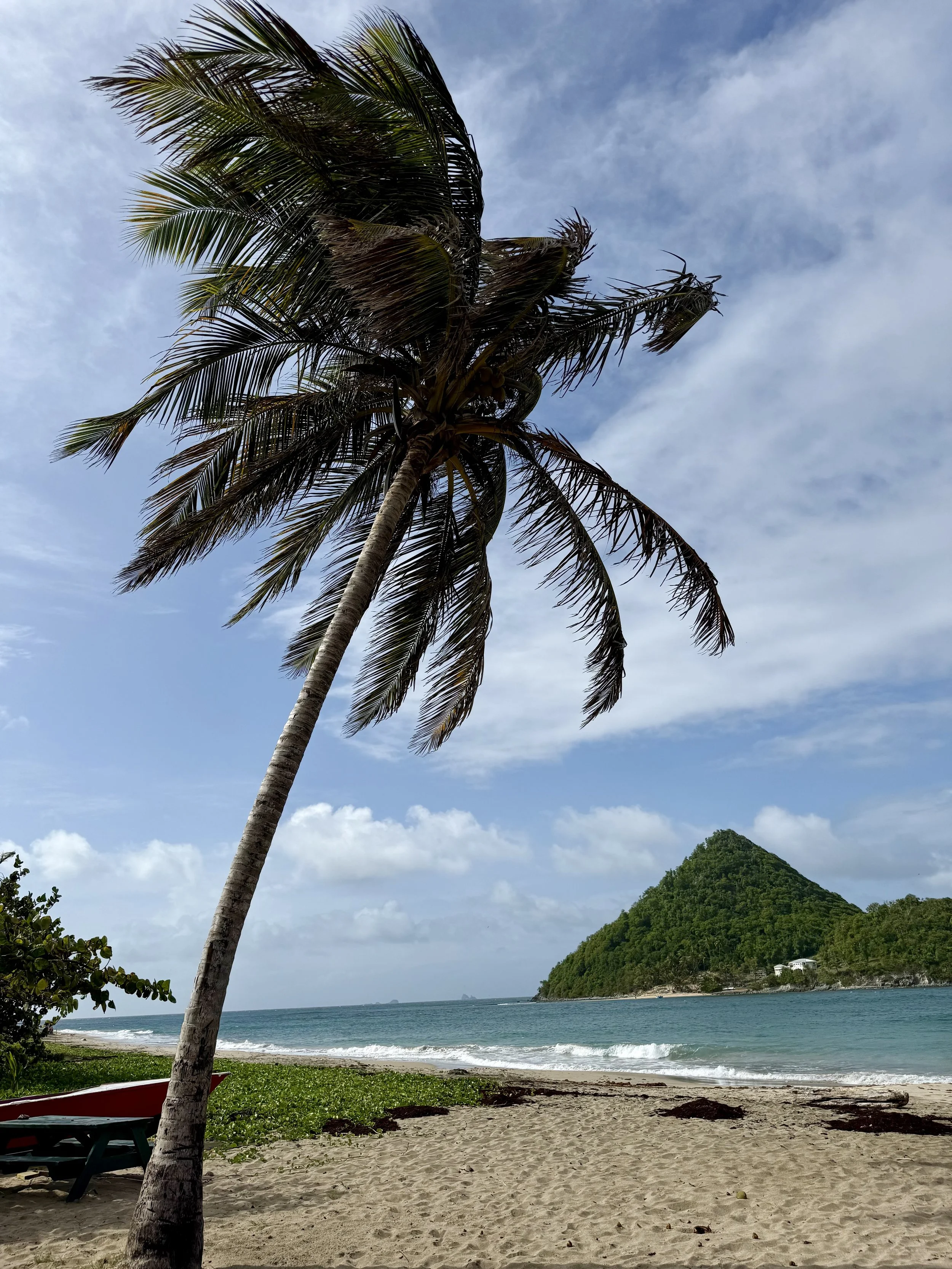
When people say, “I’m going to the Bahamas,” they are usually talking about Nassau. Images of turquoise water and the towering Atlantis Paradise Island resort immediately come to mind. And while that image is real, it is only one version of the country.
The Bahamas is not one island. It is an archipelago of more than 700 islands and cays stretched across roughly 100,000 square miles of ocean. Only about 30 of those islands are inhabited. The others are made up of uninhabited cays, protected marine areas, sandbars, mangroves, and privately owned islands that remain largely undeveloped. Some are no more than thin strips of sand that appear and disappear with the tide.
I have visited multiple times, and each visit has shown me something different. I first visited as a child in the 1980s. Even then, Nassau was busy with tourists, but it still felt small and personal. The shops were smaller. There were more craftspeople carving wooden sculptures by hand and weaving straw bags and baskets. It felt closer to the people who actually lived there.
Over the years, the islands have evolved, especially Nassau. Today, there is an entire cruise port village built specifically for the cruise industry. Inside the gated area, there are shops, bars, and a small museum. It is clean, organized, and designed for quick stops.
Beyond the gates, Bay Street stretches with rows of shops and restaurants. You will find people offering tours, renting scooters and four-wheelers, and guiding visitors toward beaches.
Keep walking.
As you move farther from the port, you begin to see what the island is really like. Residential homes. Churches. Historic buildings that reflect the island’s long colonial history.
The island is walkable in the downtown area, but there are also local buses called jitneys and plenty of taxis to take you farther out. Driving is on the left, a reminder of the country’s British roots.
Overview and History
The Bahamas sits just southeast of Florida. Flights from Miami can take less than an hour, which has made it one of the most visited destinations in the Caribbean for decades. Its proximity is part of the appeal, but so is the water. The color is exactly what people expect. The shallow banks and white sand reflect sunlight in a way that produces that bright turquoise tone the country is known for.
Tourism is the backbone of the economy, along with offshore financial services. Because of that, infrastructure in the main hubs is well-developed. Large resorts, marinas, cruise ports, and international airports support millions of visitors each year. But that development is not evenly spread across the archipelago. Once you move beyond Nassau and Grand Bahama, the scale changes quickly.
Long before tourism shaped the modern economy, the islands were inhabited by the Lucayan Taíno people. In 1492, Christopher Columbus arrived, landing on what is believed to be San Salvador Island. Spain initially claimed the territory, but Britain established colonial control in the 1700s. Nassau later gained a reputation as a pirate stronghold during the Golden Age of Piracy, a period that still lingers in the island’s storytelling and historical sites.
The Bahamas remained under British rule until July 10, 1973, when it gained independence. Today, it is an independent nation within the Commonwealth. British influence remains visible in the government structure and legal system. English is the official language, though Bahamian dialect reflects strong African and Caribbean influences shaped by migration, trade, and centuries of maritime life.
The Major Islands of the Bahamas
While Nassau and Grand Bahama receive the majority of visitors, they represent only a fraction of the country.
Other inhabited islands include The Exumas, Eleuthera, Harbour Island, Andros, Abaco Islands, Bimini, Long Island, Cat Island, and San Salvador Island.
Each island operates at a different scale. Some are built around boating and second homes. Others are quiet fishing communities. Some lean into boutique tourism. Others feel almost untouched.
Nassau – New Providence
Nassau is the capital and the country’s busiest tourism hub. Cruise ships dock at Prince George Wharf, and from there, most visitors spill straight onto Bay Street. For many, this stretch of downtown becomes their entire impression of the country.
Downtown Nassau is compact and walkable. If you follow the historic walking route shown on local maps, you can reach most major landmarks on foot.
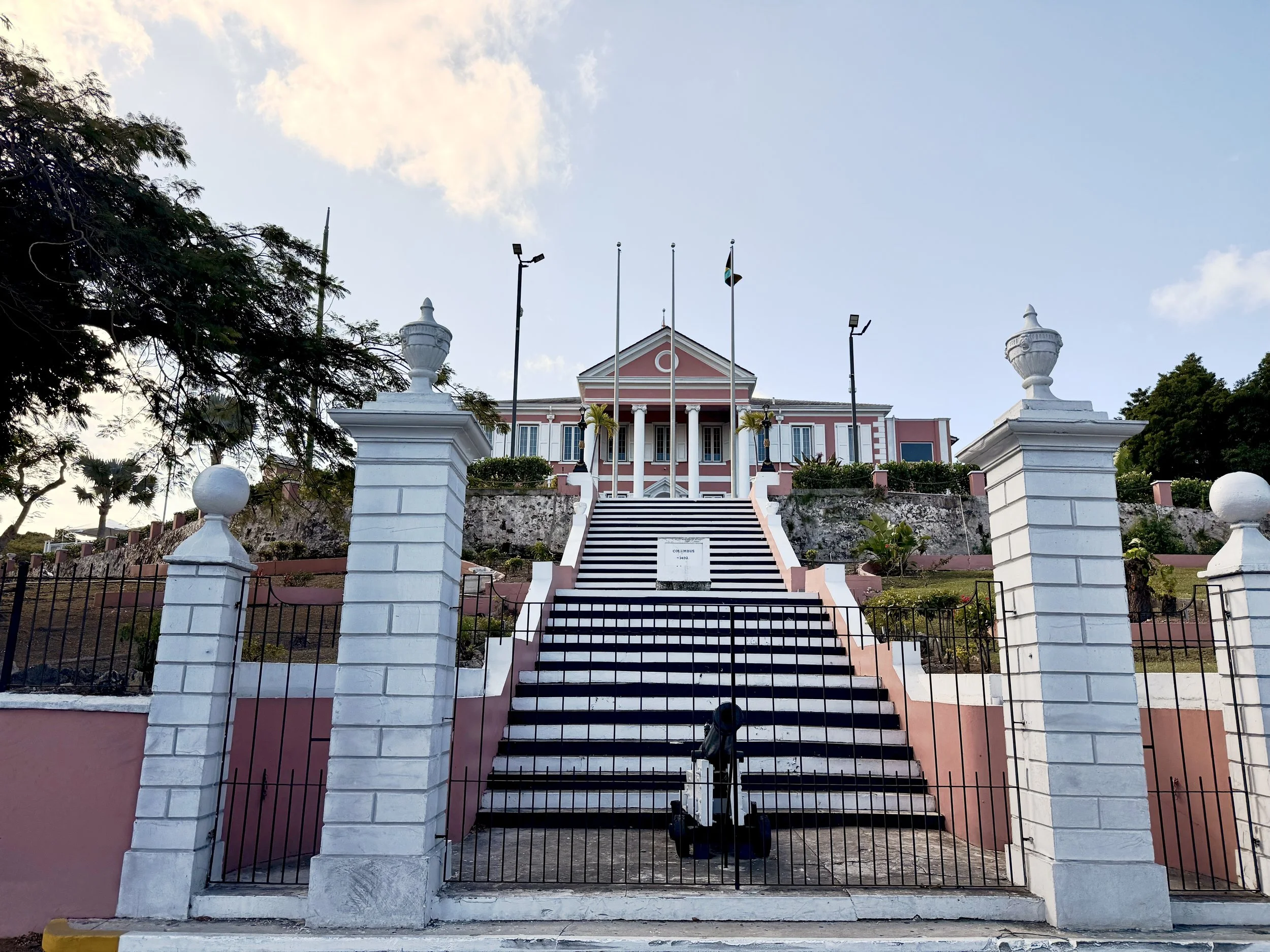
Start near Parliament Square, where the pink colonial government buildings sit across from the harbor. Just a few blocks away is Christ Church Cathedral, one of the oldest churches in The Bahamas. Continue uphill and you reach the Queen’s Staircase, carved out of limestone in the late 1700s by enslaved people. At the top sits Fort Fincastle and the Water Tower, both offering views over the city and port.
Along the way you pass Pompey Square and the Pompey Museum, which focuses on the history of slavery and emancipation in The Bahamas. Near Bay Street, the Straw Market remains one of the most visited stops, filled with woven bags, straw hats, wood carvings, and souvenir items. It is worth knowing that the market can feel crowded and compact, especially when cruise ships are in port. The stalls are lined up side by side in tight rows, and vendors are positioned closely together. Be prepared for narrow walkways and a busy atmosphere. If you prefer more space, visiting later in the afternoon after ships depart can make a difference.
If you head west from Bay Street, you can reach the Pirates of Nassau Museum, which leans into the island’s pirate history, and the National Art Gallery of The Bahamas, housed in a restored colonial mansion. Not far from there is Graycliff, known for its historic hotel, restaurant, and chocolate shop.
For those interested in food and spirits, John Watling’s Distillery sits on the Buena Vista Estate and is open for tours and tastings within walking distance of downtown.
What It Costs
Nassau pricing varies depending on how you experience it.
Museum entry fees generally range from $10 to $15.
Distillery tours may cost around $15 to $20 depending on the package.
A taxi ride across town can range from $15 to $30 depending on distance.
Beach day passes at resort properties can exceed $100.
Because many goods are imported, food and beverage prices can feel high compared to mainland U.S. cities. The Bahamian dollar is pegged one to one with the U.S. dollar, and U.S. cash is widely accepted.
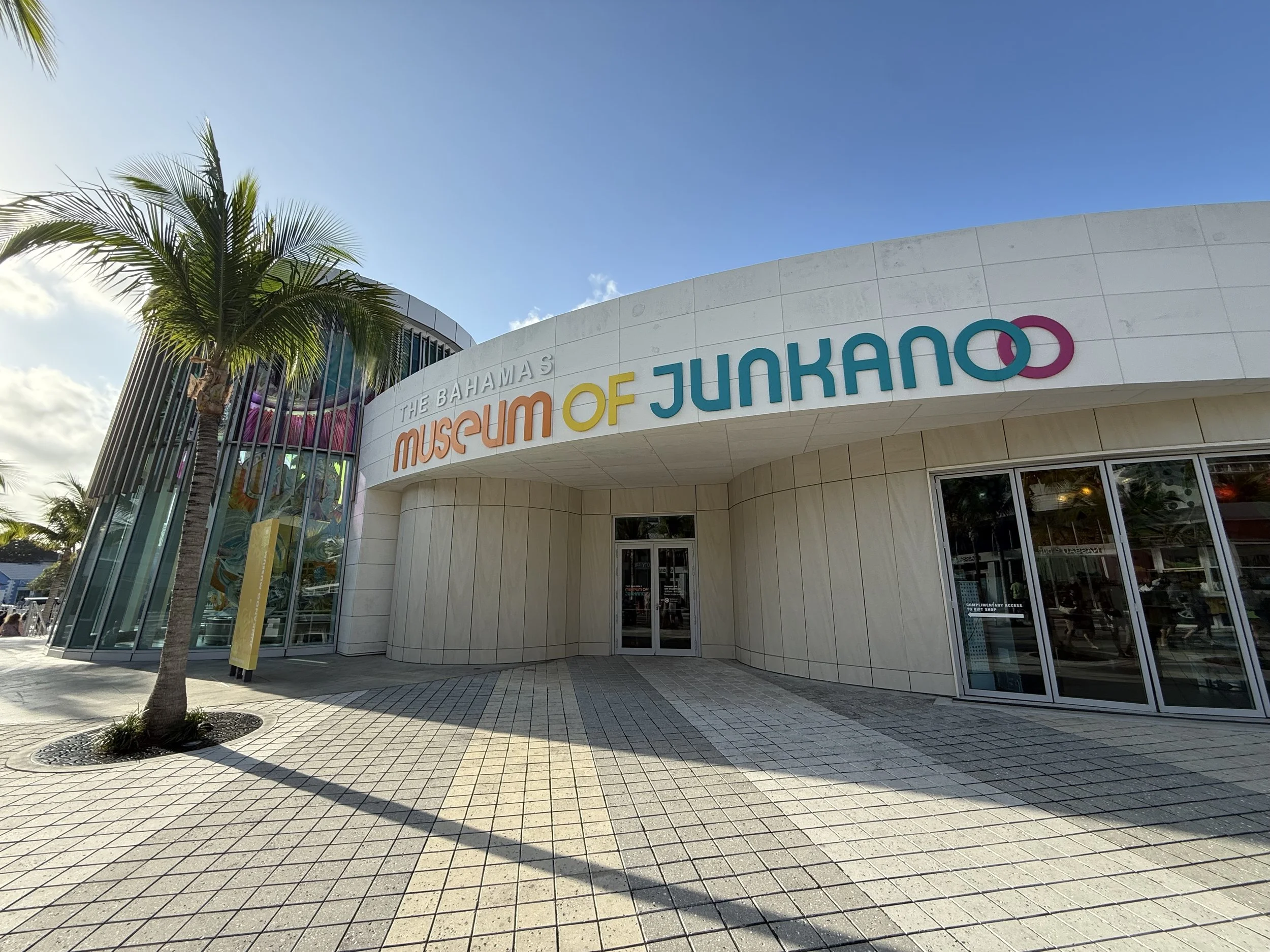
Junkanoo
If you happen to be in Nassau on December 26 or January 1, the city looks completely different.
Junkanoo is the country’s largest cultural festival. Groups spend months designing elaborate costumes made from crepe paper, cardboard, and sequins. On parade day, musicians fill the streets with drums, horns, and cowbells. It begins early in the morning and continues for hours as groups compete in music, choreography, and costume categories.
This is not staged resort entertainment. It is community-based and competitive, rooted in African traditions and centuries of cultural resilience.
Safety and Practical Notes
The downtown cruise corridor is heavily trafficked and generally well monitored. Police presence is visible around the port and Parliament Square. As with any city, awareness matters. Stay in well populated areas, especially at night, and confirm taxi rates before departing since most operate on zone pricing rather than meters.
Jitneys run fixed routes for a few dollars per ride, though they do not always follow strict timetables. Taxis are easy to find near the port.
Freeport – Grand Bahama Island
Freeport sits on Grand Bahama Island and offers a different experience from Nassau. While cruise ships do dock here, the atmosphere feels more spread out and less compressed around a single downtown corridor.
Freeport itself was developed as a planned city in the mid 20th century, and that structure shows. Roads are wider. Neighborhoods feel more suburban. Tourism is present, but it does not dominate every block the way it can in Nassau.
Major Highlights and Things to Do
One of the most important natural attractions on Grand Bahama is Lucayan National Park. The park is home to one of the longest underwater cave systems in the world. Visitors can walk through mangroves and pine forest trails before reaching Gold Rock Beach, which opens into a wide stretch of sand at low tide. When the water recedes, the beach seems to go on for miles.
Port Lucaya Marketplace serves as the island’s main tourist center. It includes restaurants, bars, and souvenir shops. It is more relaxed than Bay Street in Nassau and easier to navigate.
Grand Bahama is also known for:
• Reef diving and snorkeling
• Dolphin encounters
• Deep sea fishing
• Beach days at Taino Beach
The island appeals to travelers who want access to nature without the scale of Nassau’s cruise traffic.
What It Costs
Pricing in Freeport can be slightly lower than Nassau depending on the activity.
National park entry fees are generally modest, often under $10 to $15.
Snorkeling or diving excursions range from $75 to $150 depending on the tour length.
Taxi rides vary by zone, typically starting around $15 to $25.
Resort properties range widely in price. Some mid-range hotels are available, but beachfront resorts will reflect higher Caribbean pricing.
As with the rest of The Bahamas, many goods are imported, which impacts food prices.
Getting Around
Freeport is not as walkable as downtown Nassau. Rental cars are common and often recommended if you want to explore beyond Port Lucaya.
Taxis are available, but distances between attractions can be longer than visitors expect. Confirm pricing before departing since taxis operate on fixed zone rates rather than meters.
Safety and Practical Notes
Grand Bahama is generally considered calm and less crowded than Nassau. Tourist areas such as Port Lucaya and resort zones are well trafficked. As always, use common sense, especially at night or in unfamiliar areas.
One thing to note is that Grand Bahama has been significantly impacted by hurricanes in recent years. Some areas continue to rebuild, and travelers may notice ongoing recovery efforts. Hurricane season, which runs from June 1 through November 30, affects this island just as it does the rest of the country.
The Exumas
The Exumas feel completely different from Nassau. This chain includes 365 cays and stretches across some of the clearest water in the country. Much of the experience here revolves around boats. If you are not on the water, you are usually planning to be.
The main populated areas visitors use as a base include Great Exuma and Staniel Cay. From there, most activities happen by boat.
Major Highlights and Things to Do
The swimming pigs on Big Major Cay are the most photographed attraction in The Bahamas. Boats approach the shoreline and the pigs swim out expecting food. Their origin story varies. Some say sailors left them there years ago. Others suggest they survived a shipwreck. Today, the experience is part of organized tours and is carefully managed.
Another well known stop is Thunderball Grotto, a cave system made famous by a James Bond film. At low tide, you can swim into the grotto through openings in the rock and snorkel inside.
Sandbars are another highlight. Depending on the tide, stretches of white sand appear in the middle of open water, surrounded by nothing but turquoise. These are not permanent beaches. They shift and disappear with the tide.
Snorkeling, private boat charters, and half day island hopping tours are the primary activities.
What It Costs
The Exumas can be expensive.
Half day boat tours typically range from $150 to $250 per person depending on how many stops are included. Private charters can run well over $1,000 for the day.
Small guesthouses may start in the mid hundreds per night, while luxury stays are significantly higher.
Food costs are also elevated due to import expenses and limited grocery options.
Getting Around and Practical Notes
Most visitors fly into Exuma International Airport on Great Exuma. From there, rental cars are available. On smaller cays like Staniel Cay, golf carts are common for getting around.
The Exumas feel safe and quiet, but they are remote. Medical facilities are limited compared to Nassau, and supplies are not as readily available. Planning ahead matters here more than in the capital.
The appeal of the Exumas is space. Wide water. Fewer crowds. Less traffic.
Eleuthera and Harbour Island
Eleuthera stretches long and narrow, bordered by the Atlantic Ocean on one side and the Caribbean on the other. The drive along the island often feels quiet, with stretches of road framed by low brush and ocean views.
One of the most visited sites is the Glass Window Bridge. On one side, the Atlantic appears deep and dark blue. On the other, the Caribbean side is calmer and lighter. The contrast is immediate.
Eleuthera is also known for its pink sand beaches, though the most famous stretch is actually on nearby Harbour Island.
Harbour Island
Harbour Island is often associated with honeymoons and boutique stays. Pink Sands Beach carries a subtle blush tone created by crushed coral and marine organisms. The island itself is small and walkable. Many visitors use golf carts rather than cars.
Unlike Nassau, there are no cruise terminals here. The pace is slower. The hotels are smaller. Restaurants are more intimate.
Things to Do
On Eleuthera, activities center around beaches, fishing, and exploring smaller settlements. There are historic churches, lighthouses, and quiet coves that do not appear on cruise itineraries.
On Harbour Island, days often revolve around the beach and evening dining. It attracts couples and travelers looking for a quieter atmosphere.
What It Costs
Eleuthera can be more affordable than Harbour Island, depending on where you stay. Harbour Island, however, is known for boutique properties that can run several hundred dollars per night and climb significantly during peak season.
Golf cart rentals on Harbour Island typically range from $50 to $100 per day. Meals at sit-down restaurants can easily reach $30 to $50 per person.
Getting Around and Safety
Eleuthera requires a rental car if you want to explore beyond one settlement. The island is long and spread out. Harbour Island relies heavily on golf carts and walking.
Both islands are generally quiet and considered safe, but they are less built up. Nightlife is minimal compared to Nassau. Services such as hospitals and major shopping centers are limited.
Andros
Andros is the largest island in The Bahamas, but it is also one of the least developed. It feels less like a resort destination and more like a place shaped by nature.
The island is known for its blue holes, which are deep limestone sinkholes found inland and offshore. Some are surrounded by pine forest. Others sit in tidal flats. Divers and researchers come here specifically to explore them.
Andros is also home to the Andros Barrier Reef, one of the largest barrier reef systems in the world. Snorkeling and diving here focus less on staged tours and more on ecosystem exploration.
Bonefishing is a major draw. Anglers travel from around the world for the island’s shallow flats.
Things to Do
• Visit inland blue holes
• Snorkel or dive sections of the barrier reef
• Explore mangrove ecosystems
• Go bonefishing with a local guide
• Visit small settlements like Fresh Creek or Nicholls Town
There are no mega resorts here. Accommodations tend to be small lodges, eco focused stays, and fishing camps.
What It Costs
Because Andros is less commercial, pricing varies widely.
Guided fishing trips can run several hundred dollars for a full day.
Lodge stays can range from moderate to high depending on services included.
There are fewer casual dining options, so many stays include meals.
Travel requires more planning. Most visitors fly from Nassau into one of the island’s smaller airports.
Eco Tourism
Andros is central to The Bahamas’ eco tourism identity. Its mangroves help protect the coastline. Its reef systems support marine biodiversity. Blue holes attract scientific research.
This is not the island for nightlife or shopping. It is the island for quiet, water, and ecosystem based travel.
Medical facilities and large grocery stores are limited. Visitors should plan ahead.
The Abaco Islands
Abaco Islands have long been known for boating, sailing, and second home communities. The chain includes Great Abaco and smaller cays like Elbow Cay and Green Turtle Cay.
The settlements here feel different from Nassau. Streets are quieter. Many communities are centered around marinas.
Hope Town on Elbow Cay is one of the most recognizable spots, known for its candy striped lighthouse and pastel houses.
Things to Do
• Sail between cays
• Explore Hope Town and its lighthouse
• Snorkel and dive offshore reefs
• Visit small settlements by boat
• Spend time in marinas and waterfront restaurants
The Abacos have historically attracted sailors and long stay visitors rather than short cruise stops.
Hurricane Impact
It is important to acknowledge that the Abacos were severely impacted by Hurricane Dorian in 2019. Recovery and rebuilding have been ongoing. Some areas are fully operational, while others continue to rebuild.
Travelers should research specific towns and accommodations before booking.
What It Costs
Boat rentals and sailing charters can be significant expenses, often ranging from several hundred to several thousand dollars depending on the vessel and duration.
Hotels and rental homes vary widely. Smaller guesthouses may be more affordable than luxury marina properties.
Rental cars and golf carts are common depending on the cay.
Safety and Practical Notes
The Abacos are generally quiet and considered safe. As with the rest of The Bahamas, services may be limited outside main settlements.
Food and Culture
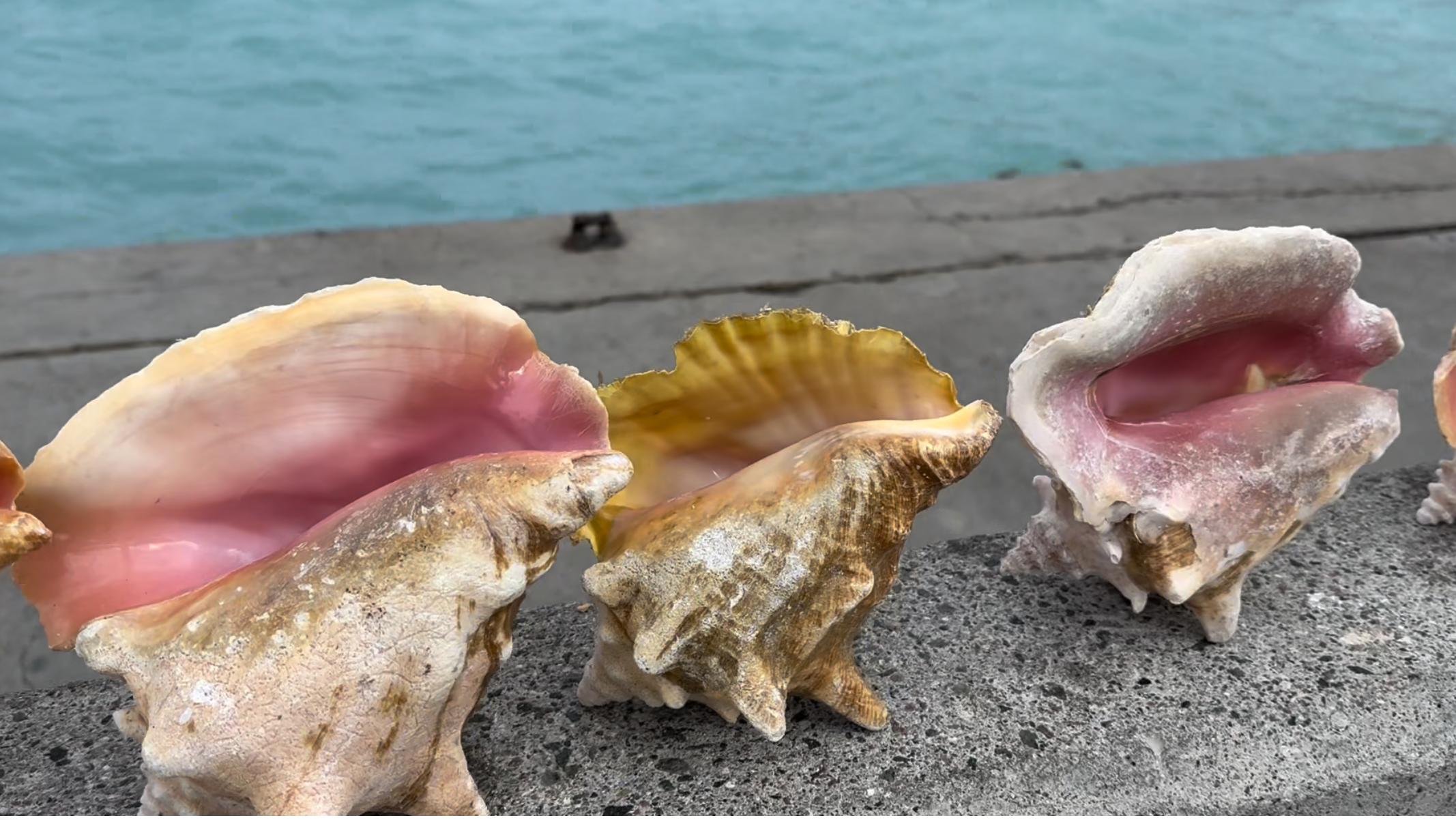
Food in The Bahamas centers heavily around the sea. Conch is the national staple and shows up everywhere. It is served cracked and fried, stewed, or prepared fresh in conch salad with lime juice, onions, peppers, and tomatoes. You will often see piles of cleaned conch shells stacked outside roadside stands as proof that it was prepared that day.
Rock lobster is another favorite, especially during season. Stew fish, peas and rice, johnnycake, baked macaroni and cheese, and fried plantains are common side dishes. The flavors are straightforward and filling rather than elaborate. Seafood is the focus.
Because many goods are imported, grocery prices can be high across the islands. Dining inside resort areas reflects premium pricing, while smaller local spots may be more moderate but still influenced by import costs.
Culturally, The Bahamas is shaped by African heritage, British governance, and maritime history. Junkanoo is the country’s most prominent festival and one of the clearest expressions of national identity.
Outside of Junkanoo, music remains central to daily life. Storytelling, church gatherings, and fishing culture still anchor many communities, especially on the outer islands.
Climate, Wet Season, and Hurricanes
The Bahamas has two primary seasons, though the weather rarely feels extreme outside of storms.
The dry season runs from November through April. Temperatures are warm but more comfortable, humidity is lower, and rainfall is lighter. This is peak tourism season, which means higher hotel rates and more visitors.
The wet season runs from May through October. Rain typically comes in short, heavy bursts followed by sunshine rather than steady all day storms. Humidity increases, and temperatures feel warmer, especially in late summer.
Hurricane season officially runs from June 1 through November 30, with the highest activity typically between August and October. Not every week brings storms, but this is the period when the Atlantic is most active. Some islands, particularly those in the northern Bahamas such as Grand Bahama and the Abacos, have experienced significant hurricane impacts in recent years. Travel insurance and flexible planning are important during this window. If weather stability is a priority, late winter and early spring are generally the most predictable times to visit.
The Best Time to Visit
Deciding when to go depends entirely on whether you are looking for the energy of peak season or the solitude of the off-season. Because the archipelago is so vast, the "perfect" time can shift depending on which island you’ve chosen as your base.
Late February to Mid-April
For most travelers, this is the ideal window. The humidity of the summer has vanished, and the "Northers" (cool fronts from the U.S. mainland) that can chill the water in January have usually settled down. The air is crisp, the water is comfortable for long snorkeling sessions, and the sky is that reliable, high-pressure blue.
Note: This coincides with Spring Break. If you are heading to Nassau or Paradise Island, expect high energy and crowded beaches. If you want quiet during this time, head to Andros or the deeper cays of the Exumas.
May and June
If you can handle a bit more heat, May and June are hidden gems. The water is noticeably warmer than in the winter months—almost like a bathtub—making it the best time for divers and those who want to spend hours in the ocean. Tourism starts to dip, so you can often find better rates on boutique hotels in Eleuthera or Harbour Island before the peak of hurricane season arrives.
September to November
This is the most unpredictable time to visit. While it is the height of hurricane season, it is also when the islands feel the most "local." Many seasonal restaurants on the Family Islands may close for renovations or staff breaks, and the humidity is at its peak. However, if no storms are on the horizon, the ocean is often glass-calm, and you can find yourself as the only person on a miles-long stretch of sand.
Practical Advice: If you travel during this window, travel insurance is non-negotiable. You should also book "flex" flights, as a tropical system can change your plans with forty-eight hours' notice.
December and January
This is the most popular time for those escaping the cold. Nassau is at its most vibrant during this time, especially with the buildup to Junkanoo. The trade-off is that the water can be "brisk"—sometimes dipping into the low 70s (°F)—which might feel chilly to those used to tropical heat. If you plan on swimming during these months, look for resorts with heated pools or bring a thin rash guard for snorkeling.

Additional Information
The Bahamian dollar is pegged one to one with the U.S. dollar, and U.S. currency is widely accepted. In most tourist areas, prices may be quoted interchangeably in either currency.
Moving between islands requires planning. The archipelago covers a wide area, so inter island travel is typically done by domestic flights, ferries on select routes, or private boats. It is not as simple as driving from one island to another.
Law enforcement operates under the Royal Bahamas Police Force. Officers are visible in major tourist areas, particularly around cruise ports and downtown Nassau. As with any destination, awareness and common sense go a long way. Stay in well-populated areas at night, confirm taxi rates before departure, and follow local guidance if venturing into unfamiliar neighborhoods.
Medical facilities are strongest in Nassau and more limited on smaller islands, something to consider when planning remote stays.
Key Takeaways
• The Bahamas is an archipelago, not a single island. Nassau is only one part of the country.
• Cruise stops show one version of the islands. Staying longer or venturing beyond New Providence changes the experience.
• Costs are higher than many U.S. travelers expect due to imports and resort pricing.
• Inter-island travel requires planning. You cannot simply “drive” from island to island.
• Hurricane season runs from June through November. Travel insurance matters.
• Each island group feels different. Nassau is active. The Exumas are water focused. Eleuthera is quieter. Andros is largely undeveloped.
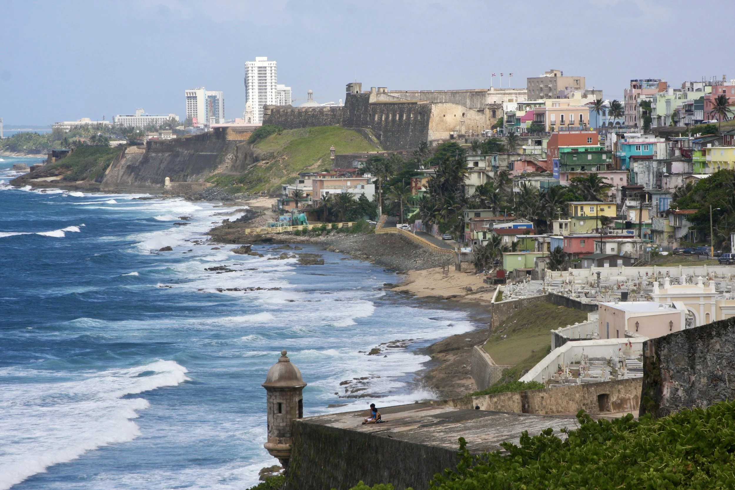
Puerto Rico, The Island Of Enchantment
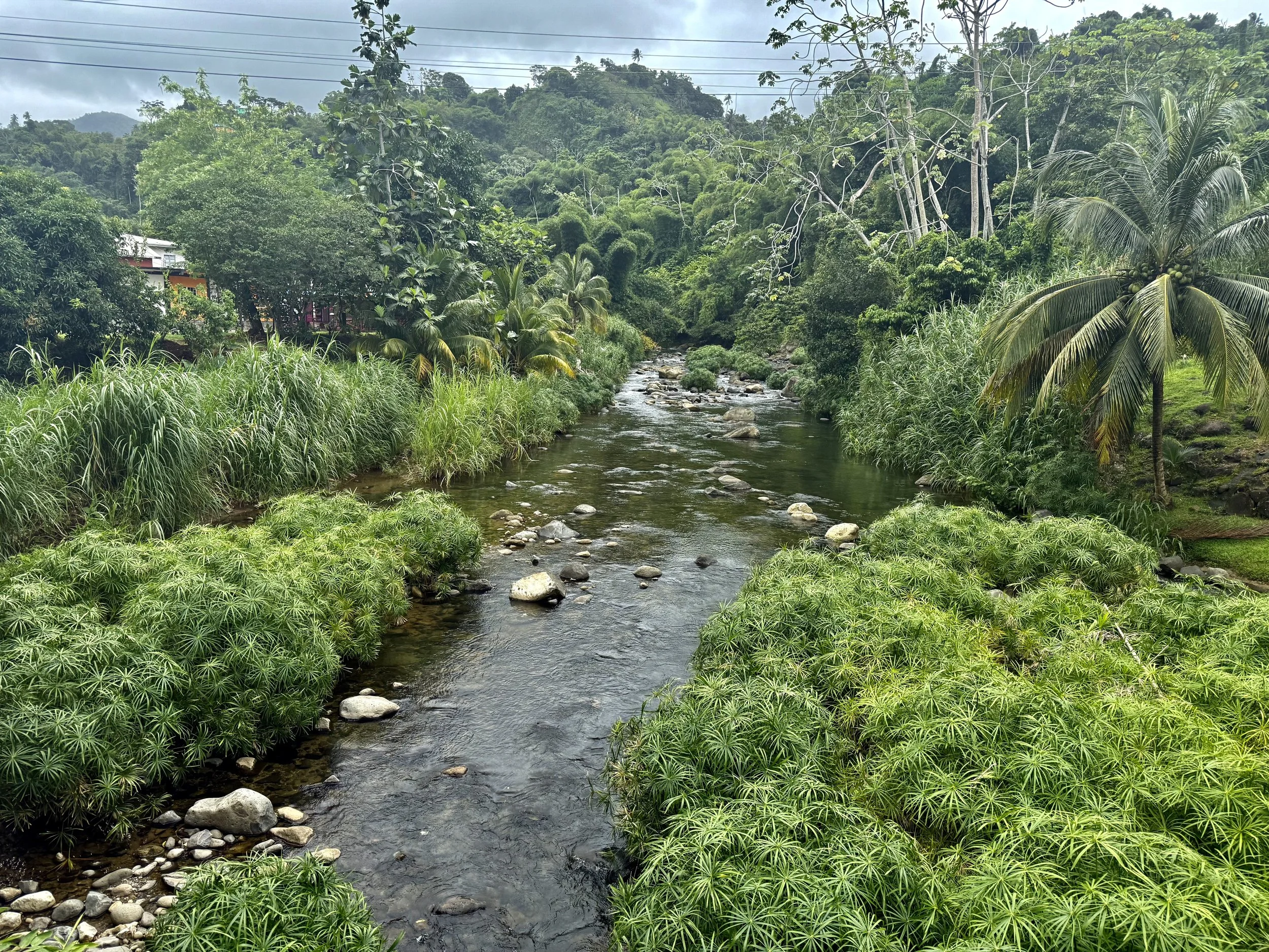
I have been to Puerto Rico a few times now, and every visit showed me something different. I have driven the highways, taken the smaller mountain roads, stopped at tiny stalls for food, and spent full days walking through Old San Juan. I have seen the natural bridges on the far coast and spent time in the rainforest. Puerto Rico is the kind of place where you can experience a little of everything without traveling far.
The island sits in the northeastern Caribbean. Most visitors stay in and around San Juan, but the landscape changes fast once you leave the city. The interior is full of winding mountain roads and small towns. The coastline shifts between beaches, rocky edges, and stretches where the waves carve the shoreline. It is easy to move from historic areas to the forest to the beach in the same day.
How to Get There
Most travelers fly into Luis Muñoz Marín International Airport outside San Juan. Flights come in from many major US cities, and the airport is close to hotels, beaches, and the historic district.
Cruise travelers can also arrive through the San Juan cruise port, which sits right beside Old San Juan.
Travel Requirements for US Travelers
US citizens do not need a passport to visit Puerto Rico. Travel works the same as flying to any other state. A standard government issued ID is enough, and there are no customs lines when you arrive or return. This applies whether you fly or take a round trip cruise from the United States.
A Bit About the Culture
Puerto Rico blends Spanish, Taíno, and African influences. You see this in the architecture, local food, music, and the way towns are laid out. Plazas still act as natural gathering points. Street markets and food stalls appear throughout the week. Festivals and community events are common.
Old San Juan reflects the island’s colonial history with forts, stone walls, and narrow streets. Modern coastal districts show a different side of the island with restaurants, beachfront apartments, and open walking paths. Inland towns follow a slower pace centered around small businesses and agriculture.
Getting Around
Driving is the easiest way to explore the island. Highways around San Juan feel similar to mainland expressways, while mountain roads are narrower with sharp curves. Navigation apps work well. Gas stations are spread out enough for comfortable travel, though it is smart to fill up before heading inland.
In the city, you can use taxis, rideshare services, and some bus routes. Ferries from Ceiba run to Culebra and Vieques, and boat tours leave from Fajardo for nearby islands.
Major Cities and Regions
San Juan
The capital is the main hub for beaches, restaurants, nightlife, and historic sites. Most visitors start here.
Old San Juan
Old San Juan sits on a peninsula with cobblestone streets, colorful buildings, and some of the best waterfront views on the island. The layout is straightforward. Shops and restaurants sit between small plazas, and the forts anchor the ends of the historic district.
Castillo San Felipe del Morro overlooks the Atlantic with wide grassy areas and stone structures.
Castillo San Cristóbal spreads through tunnels, courtyards, and lookout points closer to the center.
Outside the old city, the neighborhoods turn into modern beachfront areas. Condado and Ocean Park have a mix of hotels, apartments, restaurants, and long stretches of beach. Isla Verde is known for its wide sandy shoreline and mix of local businesses and resorts.
Condado, Ocean Park, and Isla Verde
Condado, Ocean Park, and Isla Verde sit right along the coast just outside Old San Juan, and each one has its own feel even though they all share the same stretch of shoreline.
Condado is the busiest of the three. It has high rise hotels, restaurants, shops, and a steady flow of people walking between the beach and the main streets. The beach here is long with steady waves, and the area feels active from morning into the evening. It is one of the easiest neighborhoods to navigate on foot, especially if you want quick access to food or the water without needing a car.
Ocean Park sits right next to Condado but has a different pace. It is more residential, with smaller guesthouses, low rise apartments, and local restaurants tucked into quiet streets. The beach is open and wide, and it is popular with people who want more space or prefer a simpler beach day. You will see joggers, families, and people walking dogs in the early morning, and in the afternoon the area tends to stay relaxed.
Isla Verde stretches farther east and has some of the widest beaches in the San Juan area. The water stays calm on many days, making it a good option for swimming. Resorts, apartments, and local businesses line the main road, and everything sits within a short walk of the sand. Even with the hotels, the area feels a little more spread out compared to Condado.
All three neighborhoods make it easy to move between the beach, restaurants, and your hotel without much effort. If you want the most activity, Condado is usually the center of things. If you want a quieter day but still want to stay close to San Juan, Ocean Park and Isla Verde work well.
Ponce
Ponce sits on the southern coast and has a completely different feel from San Juan. The city centers around a group of plazas, historic buildings, and museums that show another side of Puerto Rico’s history. The architecture here leans more toward Spanish Creole styles, and some of the older structures stand out immediately, especially around the main square.
Plaza Las Delicias is the center point. It is surrounded by the Ponce Cathedral and the Parque de Bombas, a bright red and black firehouse that has become one of the most recognizable landmarks in the city. The area around the plaza is walkable, with cafes, local shops, and small restaurants.
Ponce also has several museums that highlight art and regional history, including the Ponce Museum of Art, which is one of the most well known art museums in the Caribbean. The city’s layout is more open than Old San Juan, and the pace is slower, which makes it easy to spend time just walking or sitting in the plazas.
Outside the historic center, you can reach the boardwalk area called La Guancha, where you will find food stands, views of the water, and space to walk along the shore. This part of the city gives you a look at daily life on the southern coast.
Overall, Ponce shows a different side of Puerto Rico. It has a strong sense of local identity, a quieter rhythm, and historic areas that feel distinct from the northern part of the island.
Mayagüez and the West Coast
The west coast of Puerto Rico has a different feel from the north and east. The towns are smaller, the roads move at an easier pace, and the coastline shifts between calm beaches, rocky stretches, and areas where the water drops off quickly near the shore. It is a good region if you want less crowded spots and long scenic drives.
Mayagüez sits near the center of this coastline and works as a practical base for exploring the towns around it. The city itself has plazas, local restaurants, and a waterfront area, but most people use Mayagüez as a jumping off point. From here you can reach several well known west coast beaches within a short drive.
Nearby areas include:
Rincón, which is known for its surfing beaches and relaxed town center. The waves here can be strong depending on the season, and the sunsets are some of the clearest you will see on the island.
Añasco has quieter beaches and open shoreline where people spread out more.
Cabo Rojo is farther south on the west side and has some of the most dramatic coastal views, including cliffs, salt flats, and long stretches of clear water. The Cabo Rojo Lighthouse area is one of the most visited viewpoints on this side of the island.
Driving along the west coast gives you easy access to pull offs, beach entrances, and small food spots. It is a good region if you want to move at a slower pace and see parts of the island that feel more local and less built up.
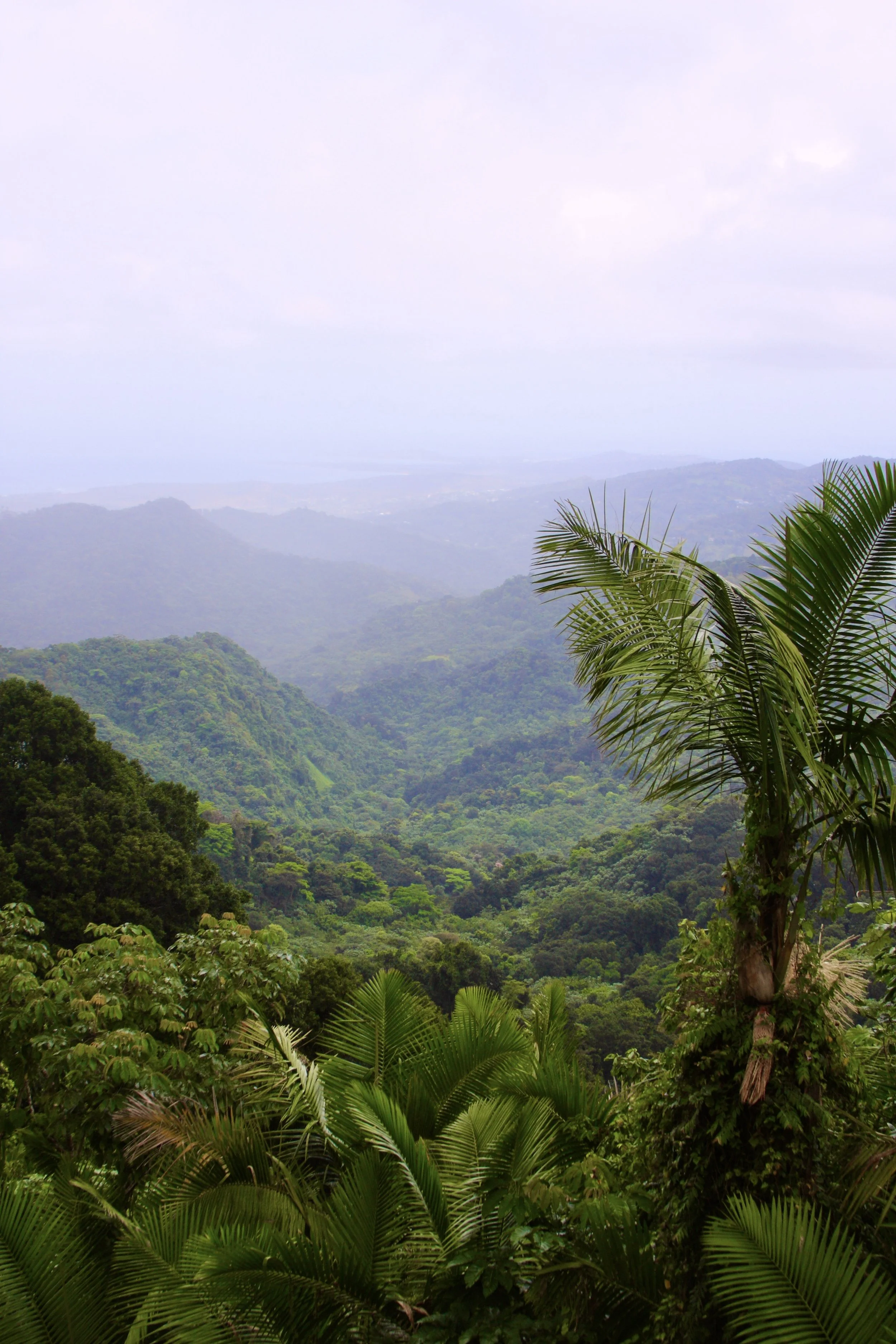
Inland and the Mountain Region
Puerto Rico’s interior rises quickly once you leave the coast. The flat shoreline turns into winding roads, hillside homes, and pockets of dense forest. Small towns sit along the ridges, and many of them have local bakeries, produce stands, and small restaurants that serve daily specials. The drives can be slow because of the curves, but the scenery makes up for it.
The most well known area in the interior is El Yunque National Forest, located on the eastern side of the island. It is the only tropical rainforest in the US National Forest system, and it is one of the easiest mountain regions to explore. The trails here tend to be short and manageable. Some lead to waterfalls, others to rivers or small natural pools, and a few take you up to lookout points where you can see the canopy spread out below.
Even if you do not plan to hike, the drive through El Yunque is worth it. The air feels cooler, and the forest shifts between open views and stretches where the trees sit right up against the road. In the nearby towns you will find roadside food stands, small shops, and local spots where people stop after visiting the forest.
The mountain region as a whole gives you a different view of Puerto Rico. It is quieter than the coastal areas, and you see more of the island’s day to day life through the small businesses and local traffic that runs through these roads.
Fajardo and Ceiba
Fajardo and Ceiba sit on the eastern side of Puerto Rico, and they are the main departure points for anyone heading to the smaller islands. Most ferries, boat tours, and snorkeling trips start here, which makes this part of the coast busier in the mornings and quieter once everyone heads out on the water.
Fajardo is known for its marinas and protected bays. This is where you find most of the guided tours to places like Cayo Icacos, the bioluminescent bay, and several snorkeling spots just offshore. The coastline around Fajardo has calm areas where the water stays shallow and clear, and many tour companies use these spots for beginner friendly snorkeling or paddle excursions.
Ceiba is where the main ferry terminal is located. The ferry system connects to Vieques and Culebra, and the terminal runs on a set schedule that locals use just as much as visitors. The area around the terminal is straightforward, with parking areas and ticket offices, and it is designed to get people boarded quickly.
Both towns sit close to major roads, so it is easy to reach them from San Juan. You will find bakeries, roadside food spots, and small shops along the way, especially as you get closer to the coast. This region is practical rather than flashy. It is where you go when you want access to the water, quieter beaches, and the smaller islands that sit just offshore.
Smaller Islands
Vieques
Vieques sits just off the eastern coast and feels quieter and more open than the main island. The beaches here are wide, calm, and spread out enough that you can usually find space even on busy days. The island has a mix of dirt roads, small towns, and long stretches of open landscape where the shoreline shifts between soft sand and rocky patches.
The biggest draw is Mosquito Bay, one of the brightest bioluminescent bays in the world. Most people visit at night on a guided tour. When the conditions are right, the water glows when you move your hand or paddle through it. The bay sits in a protected area, and the tours are run by operators who keep group sizes controlled so the environment stays healthy.
Beyond the bay, Vieques has beaches that range from secluded coves to long open stretches. Some require a short walk or a drive down a narrow road, but the scenery makes it worth the effort.
Culebra
Culebra is smaller than Vieques and easier to navigate in a single day. It is known for Flamenco Beach, a long curved beach with clear water, soft sand, and a backdrop of green hills. Flamenco is one of the most visited beaches in the Caribbean, and for good reason — it is simple, open, and consistently beautiful.
The island has other beaches you can reach with short drives or walks, many of them quieter than Flamenco. Town areas are compact, with a few shops, local restaurants, and small guesthouses. The water around Culebra tends to stay clear, which makes it a good choice for snorkeling.
Cayo Icacos
Cayo Icacos is an uninhabited island near Fajardo. There are no buildings, roads, or facilities, which is part of what makes it appealing. Most people reach it by booking a boat tour from the mainland. The water around the island is shallow and bright, and the area is popular for snorkeling and swimming.
The beach is simple and open, and you can walk along the shoreline or find a quiet spot to sit. Because it is uninhabited, the experience depends on the time of day and how many boats arrive, but once the crowds spread out, it stays peaceful.
Caja de Muertos
Caja de Muertos sits off the southern coast near Ponce. It is quieter than Vieques or Culebra and stays low key throughout the year. The island has hiking trails that lead to different viewpoints, including one that takes you up to a lighthouse overlooking the coastline.
The beach here is protected, and the water stays clear and calm on most days. It is the kind of place where you spend the day walking, swimming, and taking in the scenery without much noise or activity around you. Boats to Caja de Muertos usually run from Ponce, and the trip is short enough to make it an easy day outing.
Food in Puerto Rico
Food is one of the easiest ways to experience the island because so much of it comes from everyday places.
Lechoneras
Lechoneras serve roasted pork cooked slowly over charcoal. You pick your cut and add sides like rice, beans, or plantains.
The most famous stretch is the Ruta del Lechón in Guavate:
https://discoverpuertorico.com/profile/la-ruta-del-lechon/9232
Panaderías
Panaderías are local bakeries that also serve sandwiches, pastries, and hot plates. They are quick, affordable, and everywhere.
Roadside Stands
These pop up along highways, coastal routes, and mountain roads. Many serve a small menu of empanadillas, fritters, grilled meats, or fruit.
Traditional Dishes
•Mofongo •Arroz con gandules •Pastelón •Asopao •Tembleque
Day Trip Ideas
From San Juan
• Walk Old San Juan
• Condado or Ocean Park for beach time
• Piñones for food stalls and the coastal walkway
East Coast
• El Yunque for short hikes and waterfalls
• Fajardo for boat tours and bioluminescent bay trips
• Cayo Icacos for snorkeling
West Coast
• Rincón for beach towns and surfing
• Mayagüez and nearby coastal routes
• Natural bridges and cliff views on the far west coast
South
• Ponce’s historic center
• Caja de Muertos by ferry
• Scenic drives along the southern coastline
Helpful Links
San Juan National Historic Site
https://www.nps.gov/saju/index.htm
El Yunque National Forest
https://www.fs.usda.gov/elyunque
El Yunque Timed Entry Reservations
https://www.recreation.gov/timed-entry/10087
Ferries to Culebra and Vieques
https://www.puertoricoferry.com/
General Island Information
https://www.discoverpuertorico.com/
Need More Help Planning Your Trip
Check out my Puerto Rico Travel Guide
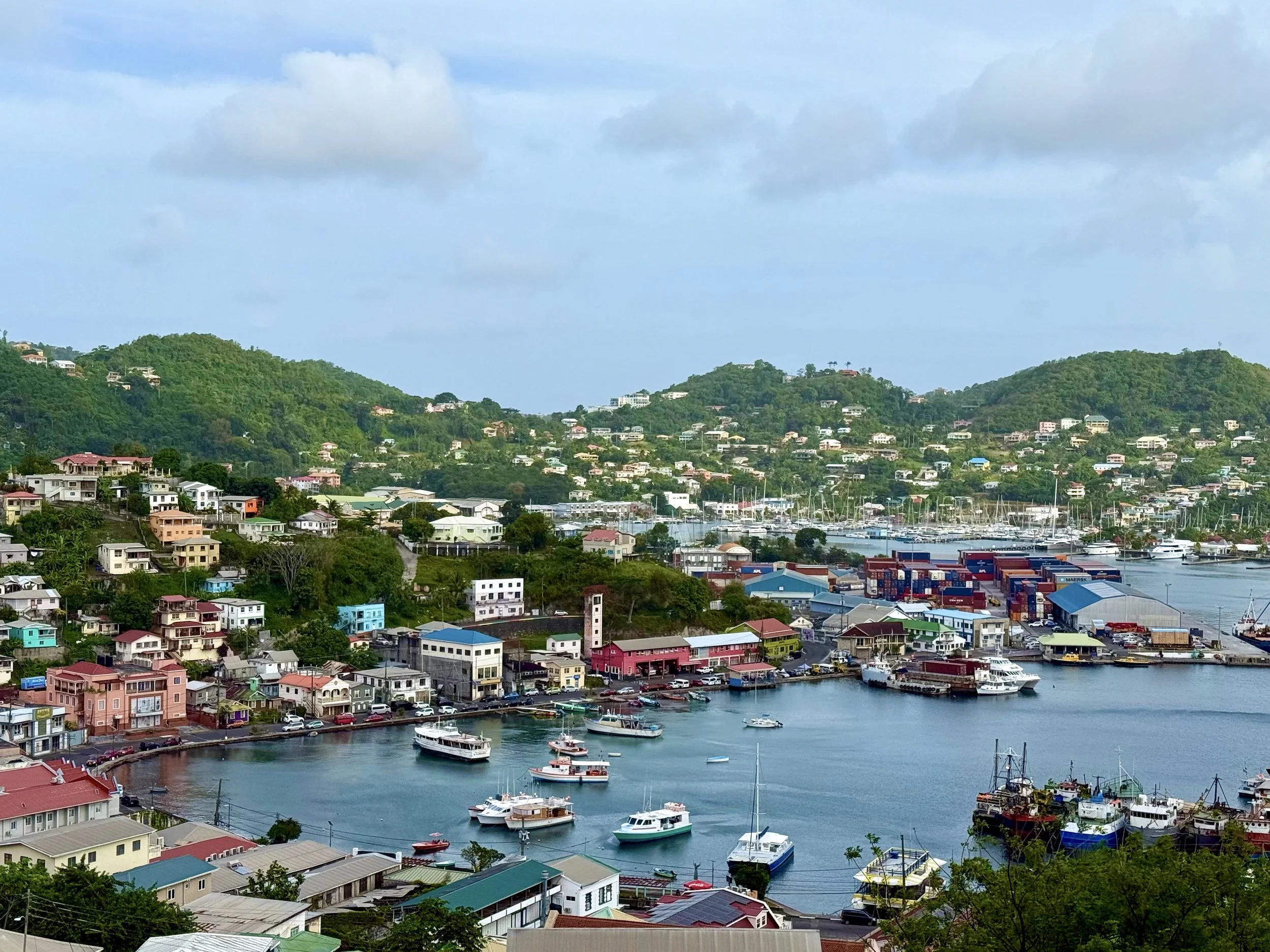
2 Days in Grenada: Spice Markets, Scenic Drives, and Seaside Sunsets
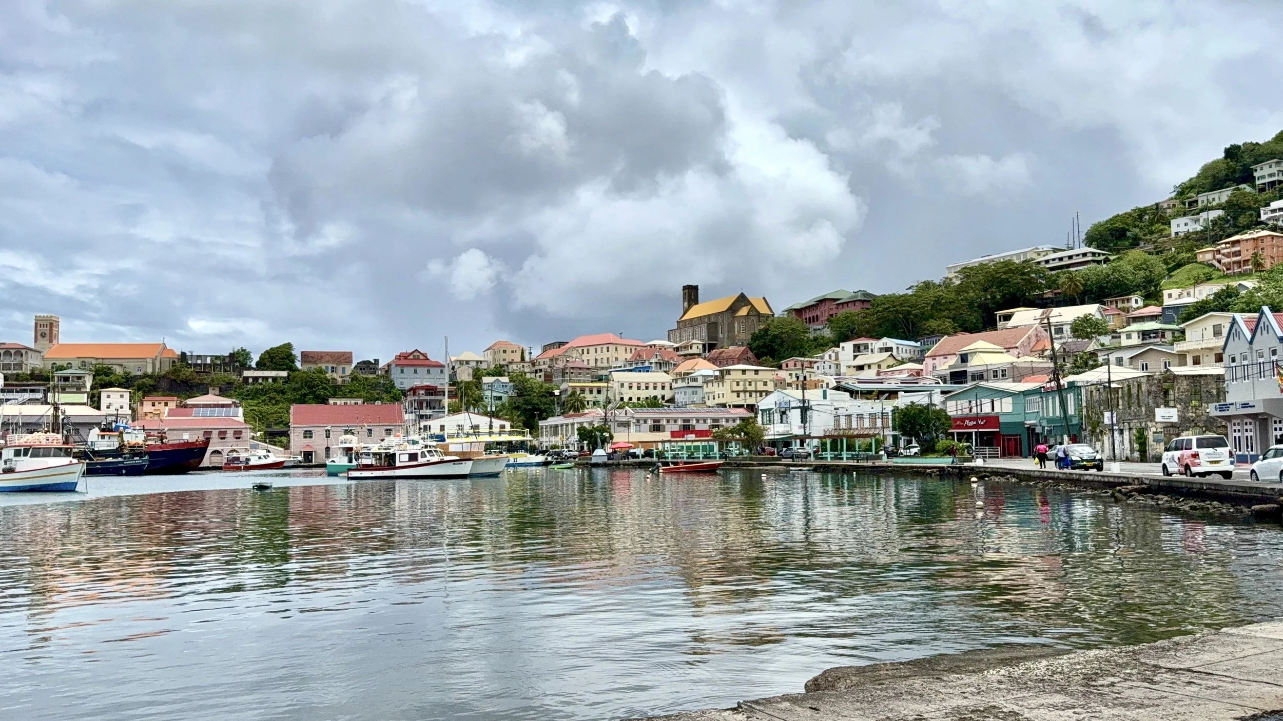
I flew into Maurice Bishop International Airport (GND) from Trinidad and caught a taxi straight to Mandela Court Hotel in Lance aux Épines. It’s a quiet, mostly residential area, close enough to beaches and restaurants without being caught in the crowds. The hotel itself is elegant and understated, with Mediterranean-style architecture, soft pastel walls, and tall windows that let in plenty of light. My suite had a full kitchen and a comfortable living space, which made it feel more like a short-term apartment than a traditional hotel room. The central atrium is airy and bright, with polished tile floors, modern furniture, and a dramatic staircase that winds up both sides of the lobby. Out back, there’s a small pool surrounded by lounge chairs, perfect for cooling off between outings. It’s a relaxed, low-key spot, ideal if you want space and comfort without the resort bustle.
Day 1: Island Loop and Spice Lessons
That afternoon, I set out on a private tour around Grenada. We began at the bustling Saturday market in St. George’s, where vendors packed the sidewalks and traffic crawled through the crowd. A light rain had just started, giving the pavement a slick sheen as people moved at an unhurried pace under umbrellas. The stalls were filled with fresh produce, local spices, live chickens, household goods, and the occasional rack of knockoff sneakers. The air smelled faintly of herbs and something frying nearby. It was a grounded, everyday kind of busy, a window into real island life.
Our next stop was a neighborhood spice shop. Grenada is known as “The Spice Island” and is one of the world’s top producers of nutmeg, cinnamon, and cloves. I got a quick demo, sampled raw spices, talked with the shopkeepers, and picked up a few things to bring home. It’s also where I learned about nutmeg syrup, which is used in local desserts and drinks.
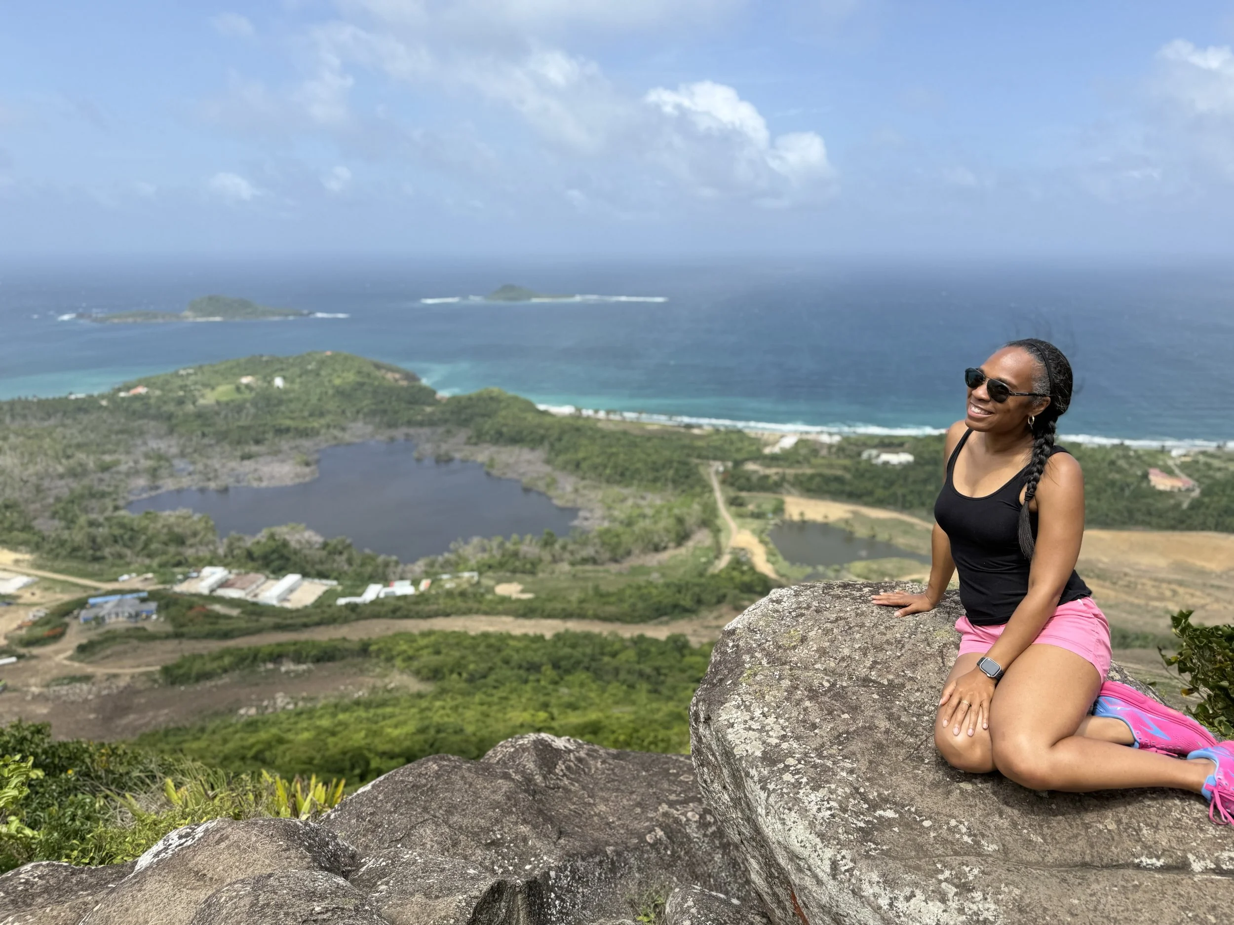
From there, we passed a rainbow eucalyptus tree, then headed into the island’s mountainous interior. We stopped at Morne Qua Qua, the highest drivable point on the island, located near Grand Etang National Park. The lookout offers panoramic views of the rainforest and, on clear days, a glimpse of the coastline. I also walked a short trail out to Grand Etang’s crater lake, formed in the caldera of an extinct volcano. A lone mona monkey lingered near the trail, most likely hoping for snacks, though visitors are advised not to feed them.
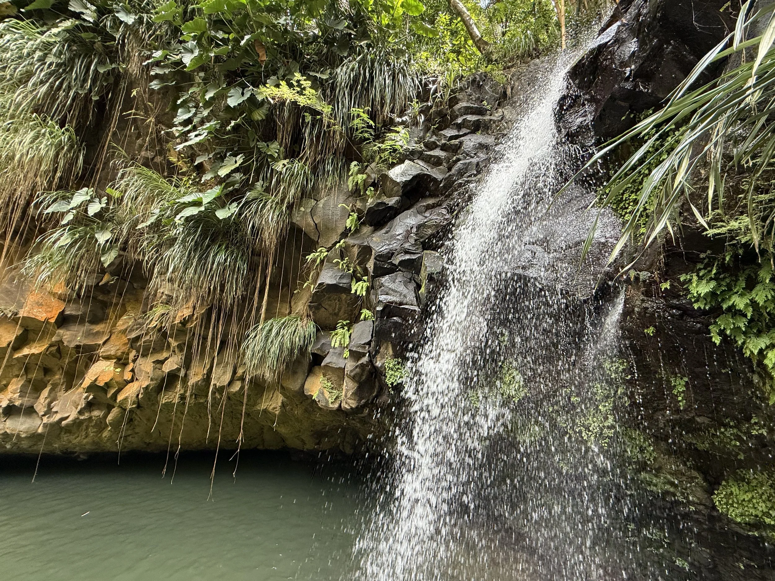
We made a brief stop at Annandale Falls, a popular spot where visitors often swim or watch local cliff divers leap from the rocks. I didn’t do either, just took a short walk around, looked at the falls, and continued on.
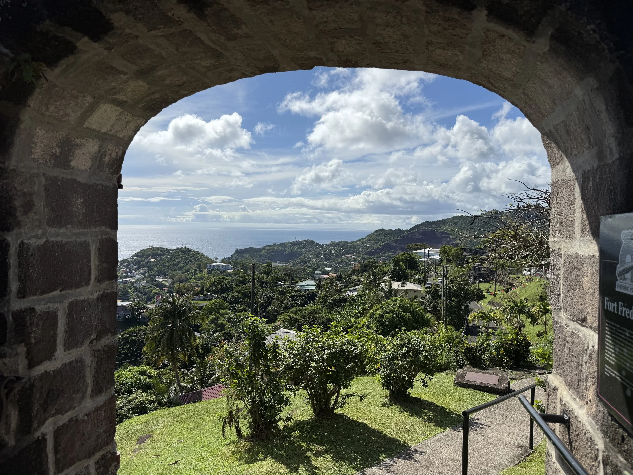
I made a quick stop at Fort Frederick, perched on Richmond Hill just outside St. George’s. Built by the French in the 1700s, it’s one of the best-preserved forts on the island, and one of the few where the cannons face inland instead of out to sea, thanks to a history of surprise land attacks. The fort itself is relatively small, but the panoramic views are what make it worth the visit. From the top, you can see Grand Anse Beach on one side, the Carenage on the other, and the lush hills rolling inland. There’s no real signage to guide you, but admission is free, and you can wander around on your own. It’s a quiet spot, not crowded when I went, with a steady breeze and plenty of photo ops. If you’re driving, it’s a quick stop that doesn’t take more than 30–45 minutes unless you want to linger.
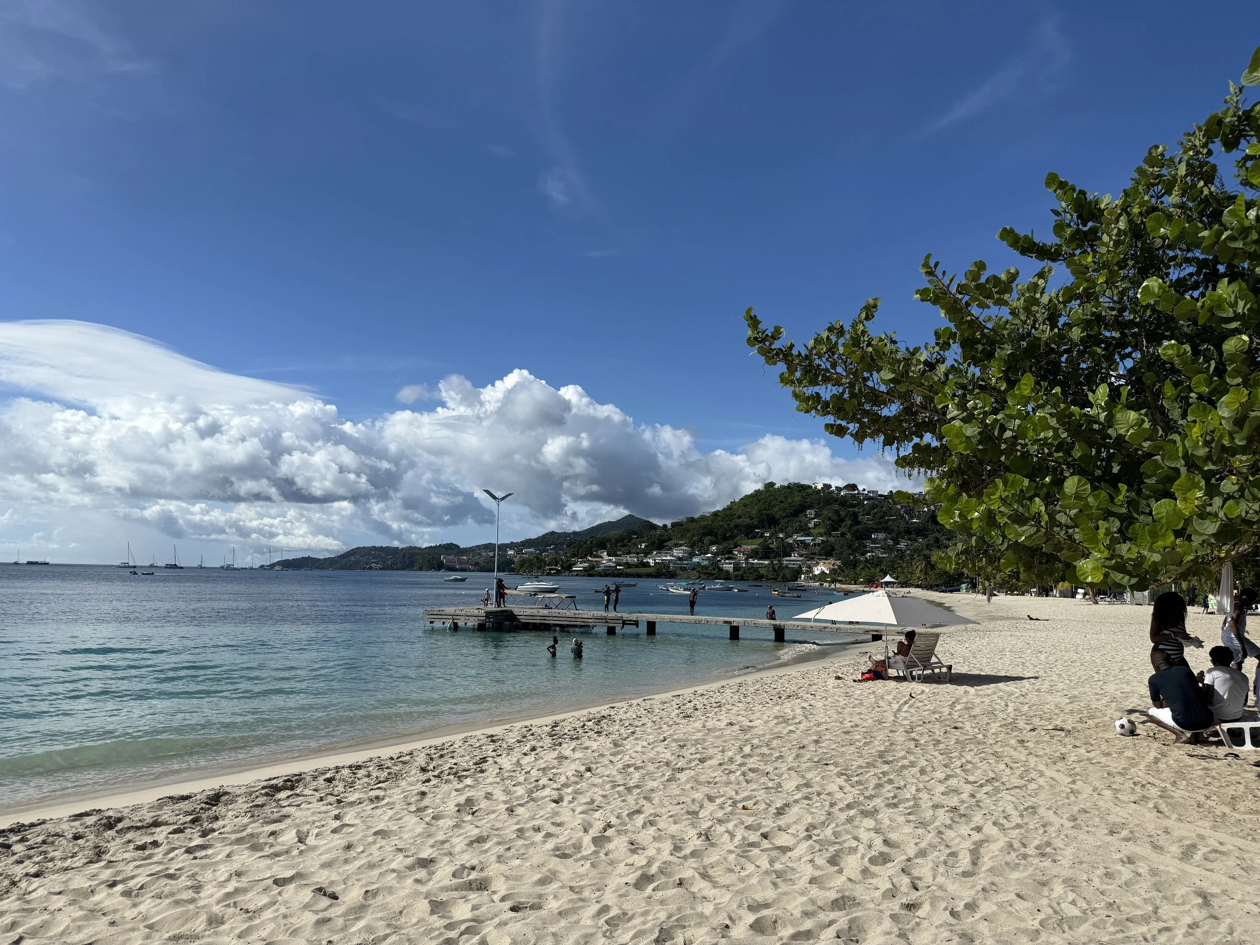
Later, I made a quick pass through Grand Anse Beach, a postcard-famous stretch of soft sand and turquoise water—but I didn’t linger. It was mid-afternoon and hot. I ended the day at La Plywood, a casual beachfront bar built from scrap wood, where I sat inside and watched the sun go down through the open walls. We listened to live music and ate fries and fish tacos. After sunset, the lights came on, and the bugs seemed to materialize from nowhere. The place was suddenly buzzing with small flying insects I couldn’t identify. To escape them, I took a walk along the beach and watched the stars come out as the waves slapped the coastline.
Day 2: Beach Loops and Back Roads
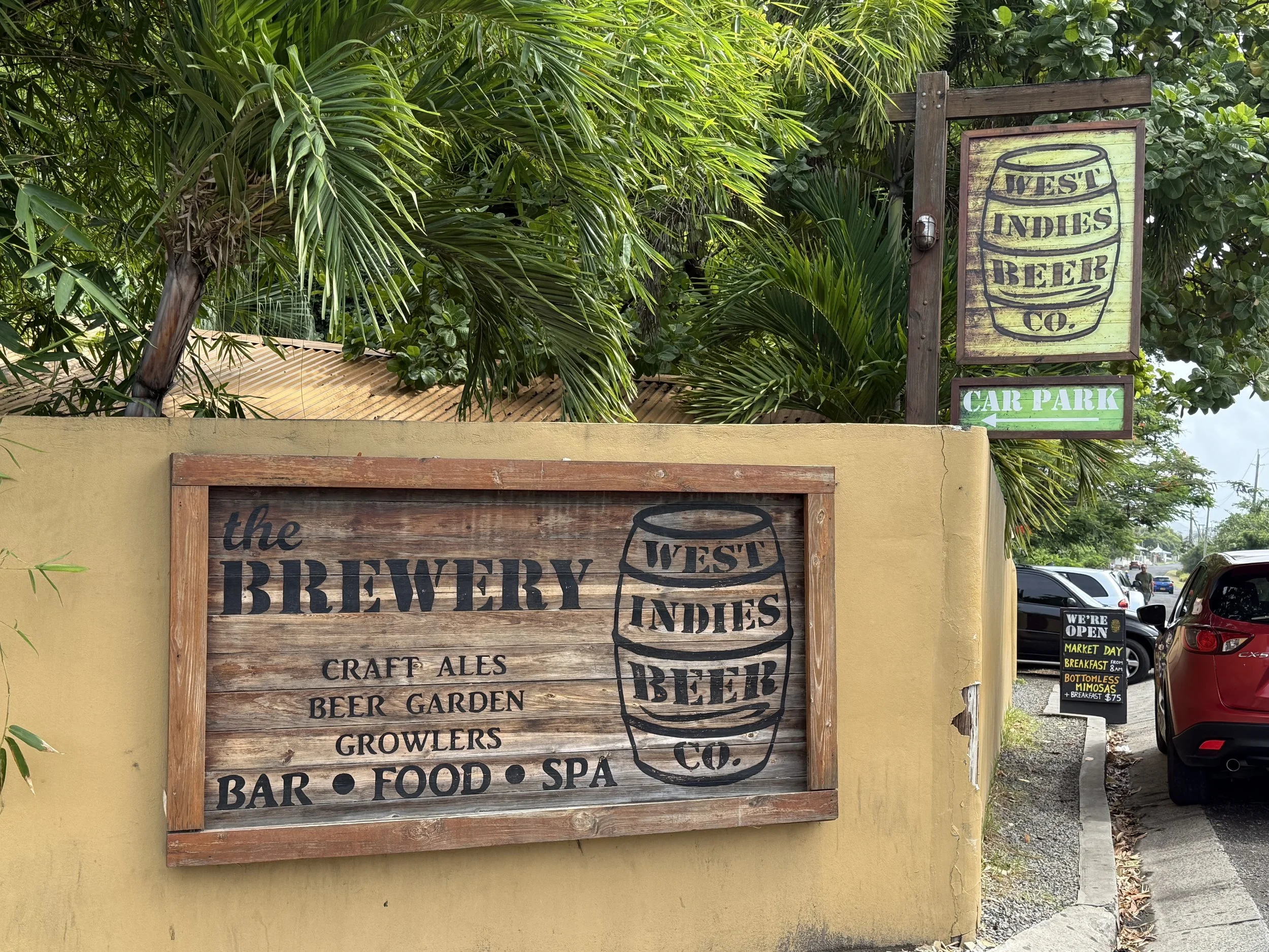
I started the morning with a walk to West Indies Beer Company, a laid-back brewpub that doubles as a community hangout. On Sunday mornings, it draws a steady mix of locals and expats—some there for brunch, others catching up over a drink. Formula 1 was playing on the TVs, and the bar was already half full by the time I arrived. I ordered an egg and cheese sandwich, which took its time coming out. No rush, though—the pace matched the atmosphere. Some folks were chatting at the bar, others sat in pairs or small groups at the outdoor tables. After eating, I strolled down to Lance aux Épines Beach, which was quiet and practically empty.
Later, I drove north for a hike up to the Welcome Stone, a steep, short climb that rewards you with wide, sweeping views over Levera National Park and the island’s northeastern coast. Definitely worth the stop.
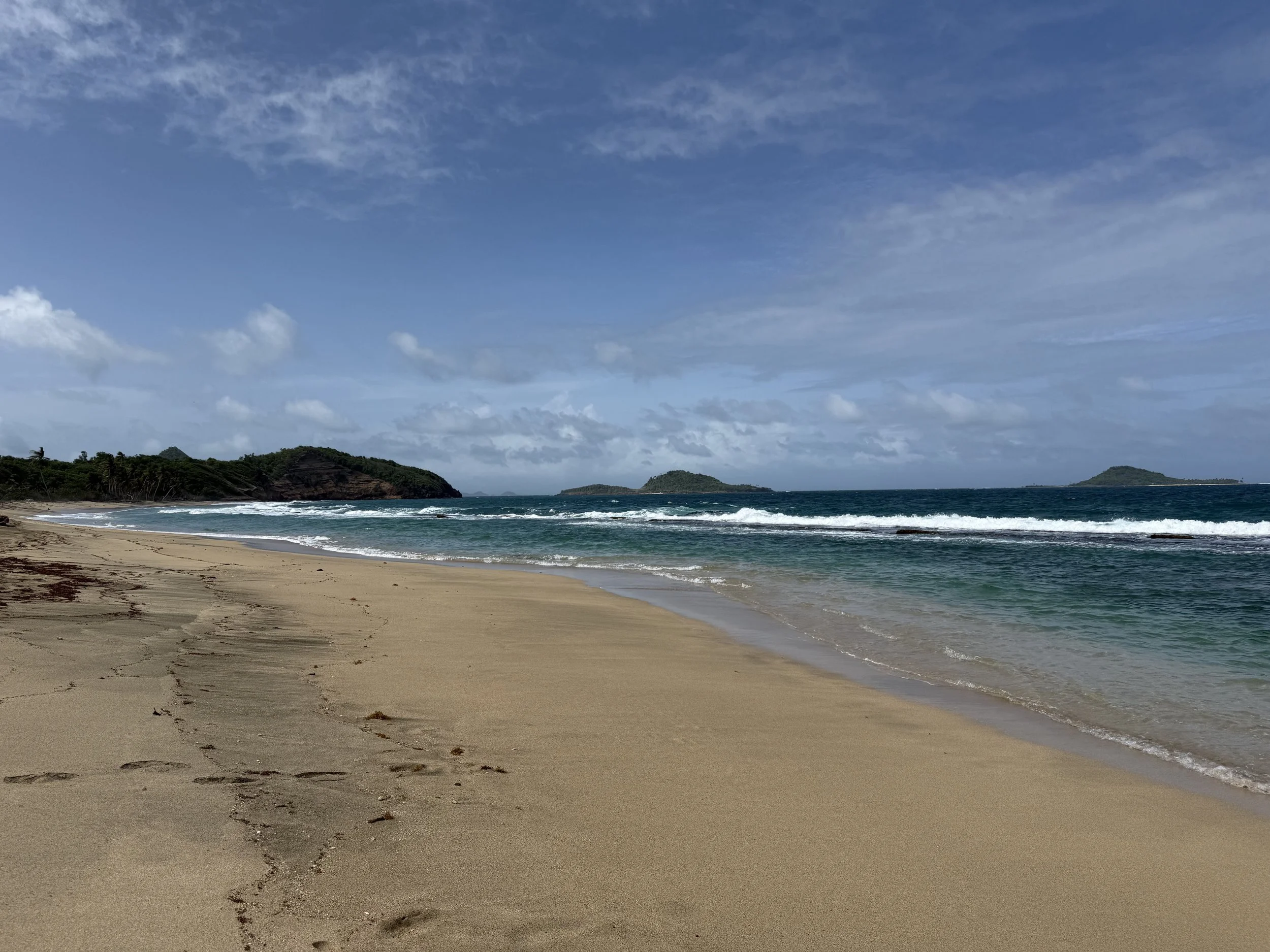
Lunch was at Bathway Beach—a plate of chicken wings, fries, and an Angostura Chill (lemon-lime with bitters). There’s a public restroom, but it costs $1 EC to use, so bring change. Afterward, I walked along Levera Beach, a more rugged, undeveloped stretch of coast—less polished than Grand Anse but with plenty of natural charm.
One thing I liked about the beaches in Grenada is that they’re mostly populated by local people. Whether it was the quiet stretch at Lance aux Épines or the more open sand at Bathway, they came across as uncommercial and familiar. Most of the top destinations here are beaches, and you can tell they’re part of everyday life, not just set up for tourists.
The drive back followed the winding western coastal road, cutting through quiet fishing villages tucked between the hills and the sea. At one point, we pulled over to take a photo of brightly painted boats bobbing in the water. Nearby, a group of kids was playing along a stretch of black sand beach, tumbling in the sand and tossing each other into the air to land backflips. I smiled at its innocence and simplicity.
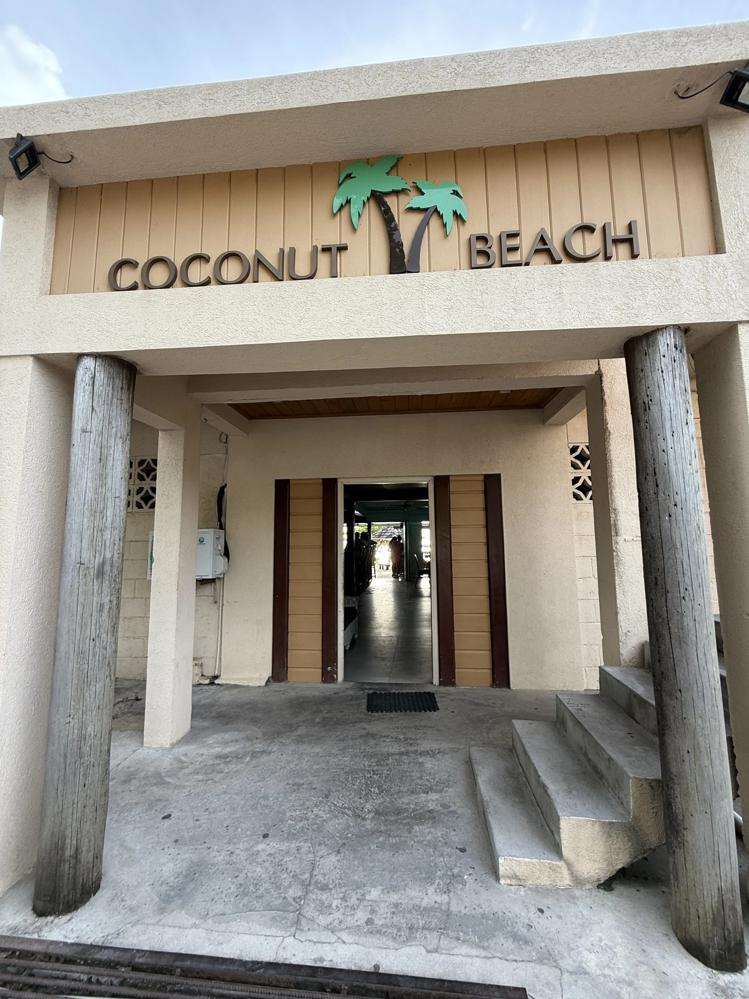
Dinner was at Coconut Beach Restaurant, right on the water, fresh seafood, relaxed atmosphere. I ate stewed chicken while watching people play in the water and a few late-afternoon speed boaters getting a last lap in. As the sun began to sink below the horizon, I headed back to the hotel. The next day, I’d be heading home.
Day 3: Rain, Rainbows, and Heading Out
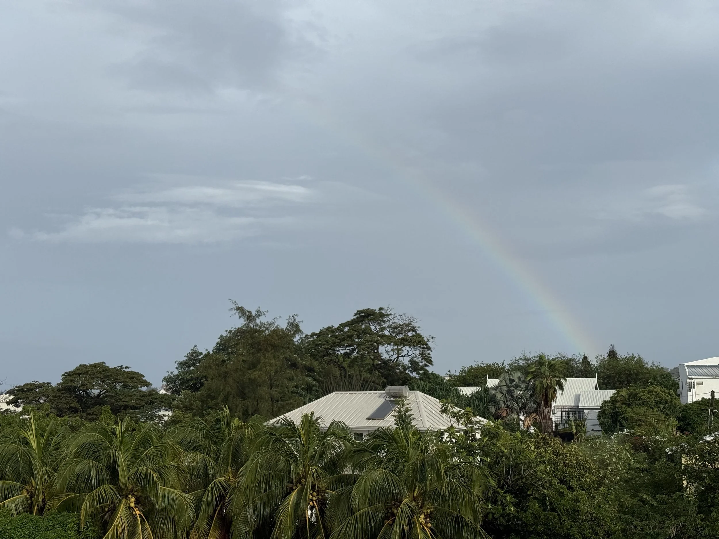
I woke to the sound of wind and rain tapping against the windows, a steady downpour that lasted about an hour. When it finally let up, I opened the window and spotted a rainbow stretching over the trees. The rest of the morning was slow and quiet. I stayed in, packed up, and relaxed until it was time to check out. Then I called a cab to the airport, and just like that, my time in Grenada came to an end.
Quick Travel Notes:
• Currency: Eastern Caribbean Dollar (XCD), but USD is widely accepted. Expect change in EC.
• Driving: Left side. Roads are paved but narrow and winding.
• Taxis: No meters—fares are negotiated upfront. My ride from the airport to Lance aux Épines was $20 USD.
• Tours: A private full-day island tour cost about $100 USD, which included pickup, fuel, and stops anywhere I wanted.
• Tap Water: Safe to drink.
• Island Size: About 134 square miles. You can drive across in under two hours.
• Language: English.
• Electricity: 230V, UK-style plugs.
• Weather: Hot and humid year-round; rainy season runs June to November.
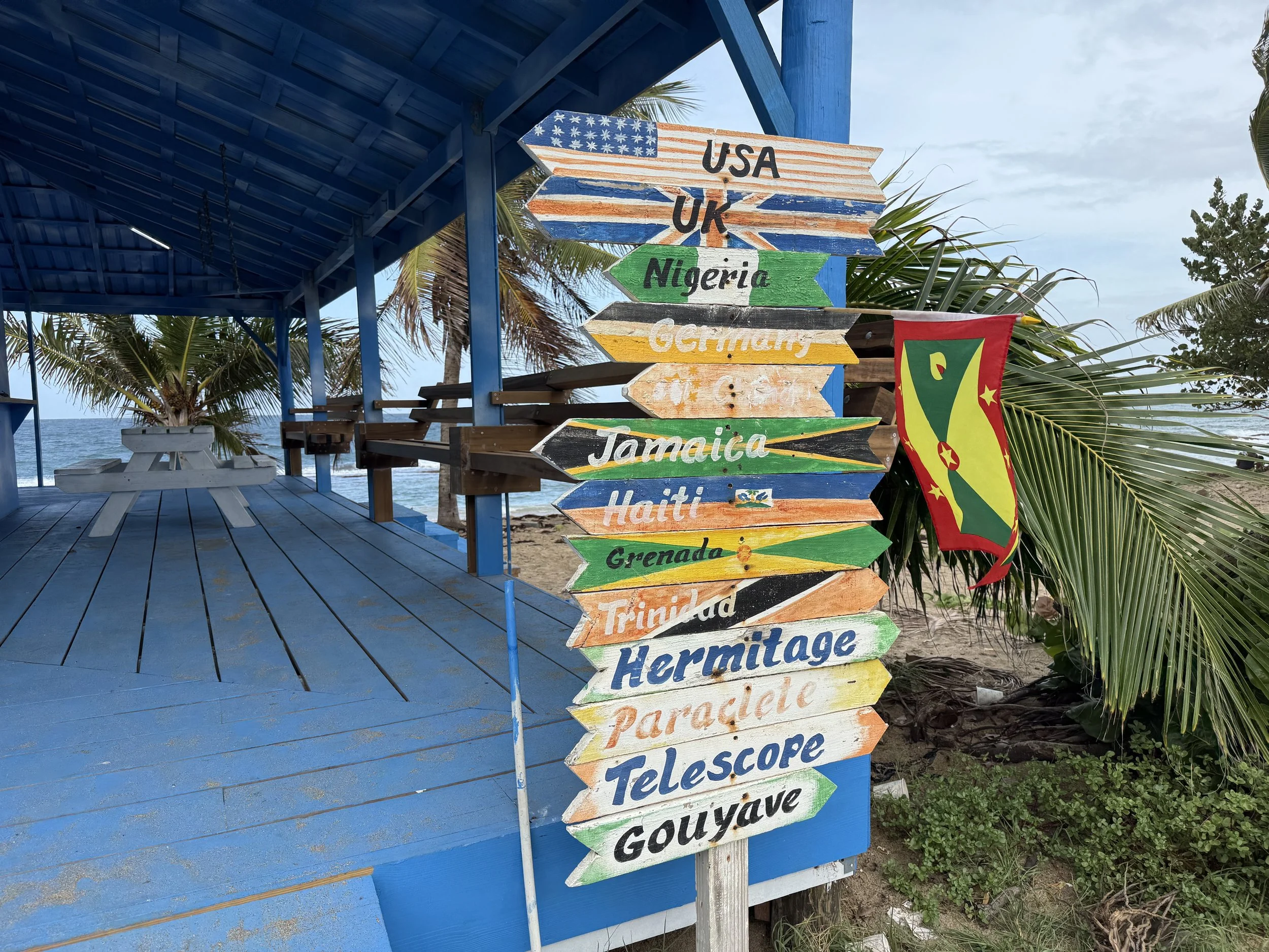
Other Places to Check Out (If You Have Time):
• Belmont Estate – A working cocoa estate with farm tours and local food
• River Antoine Rum Distillery – Home to Grenada’s strong overproof rum, made using a waterwheel
• Underwater Sculpture Park – Best accessed via snorkel or dive trip from Grand Anse or Molinière Bay
• La Sagesse Beach – Quiet, scenic beach with fewer tourists
• Gouyave Fish Friday – A local street party with fresh seafood and music (check if it’s running)
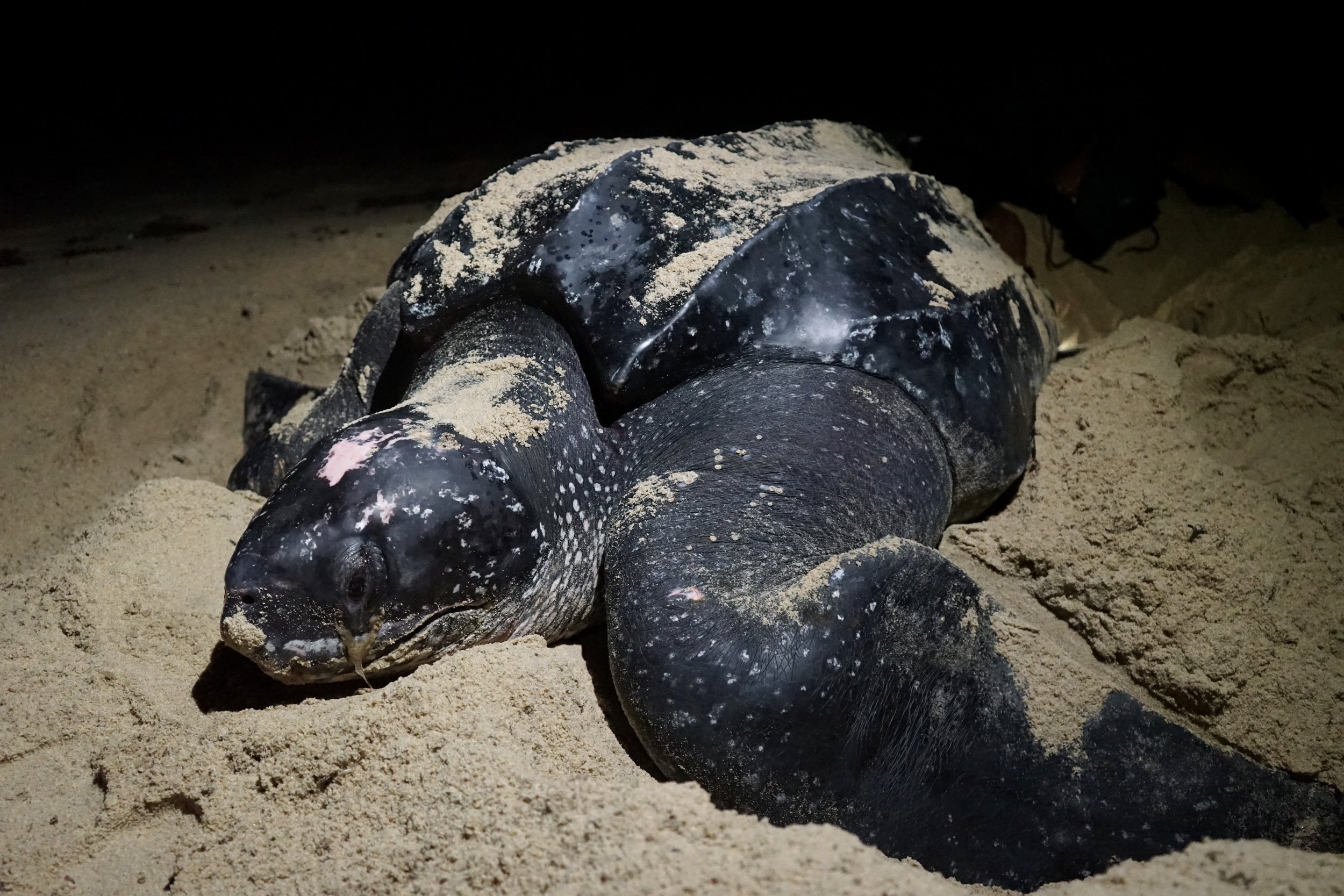
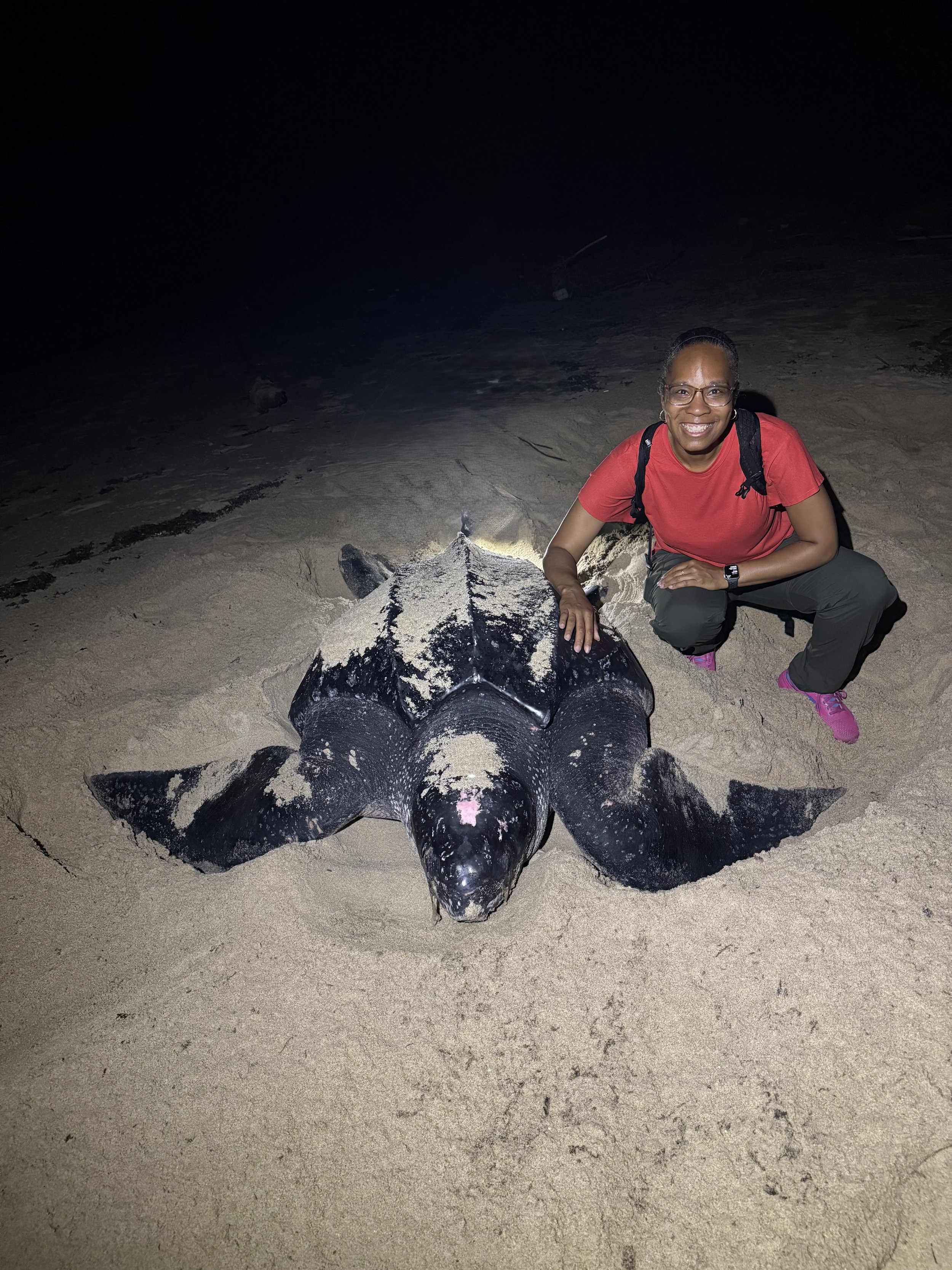
A Night with the Leatherbacks in Trinidad
Female Leatherback Sea Turtle
I traveled to Trinidad with one goal: to see the leatherback sea turtles. I’d been dreaming about witnessing these sentinel giants in person for years, and when I found out that Trinidad’s nesting season runs from March to August, I didn’t hesitate—I booked the trip.
I arrived in late June, which, to be honest, isn’t the ideal time. If you’re planning a visit specifically to see the turtles, April and May are peak nesting months. Still, I crossed my fingers and hoped for the best.
The day after I landed, I headed out on a private tour arranged by Island Experiences. My guide and driver, Kahlil, picked me up at 5:30 PM, and we made our way to the east coast of the island. Our destination: Matura Beach.
The drive took about an hour and a half, winding through countryside, small towns, and villages as the sun slipped behind the hills. Somewhere along the way, we stopped for snacks—fuel for the night ahead. Kahlil, who was both friendly and incredibly knowledgeable, explained what to expect and warned that some of the roads might be a little rough.
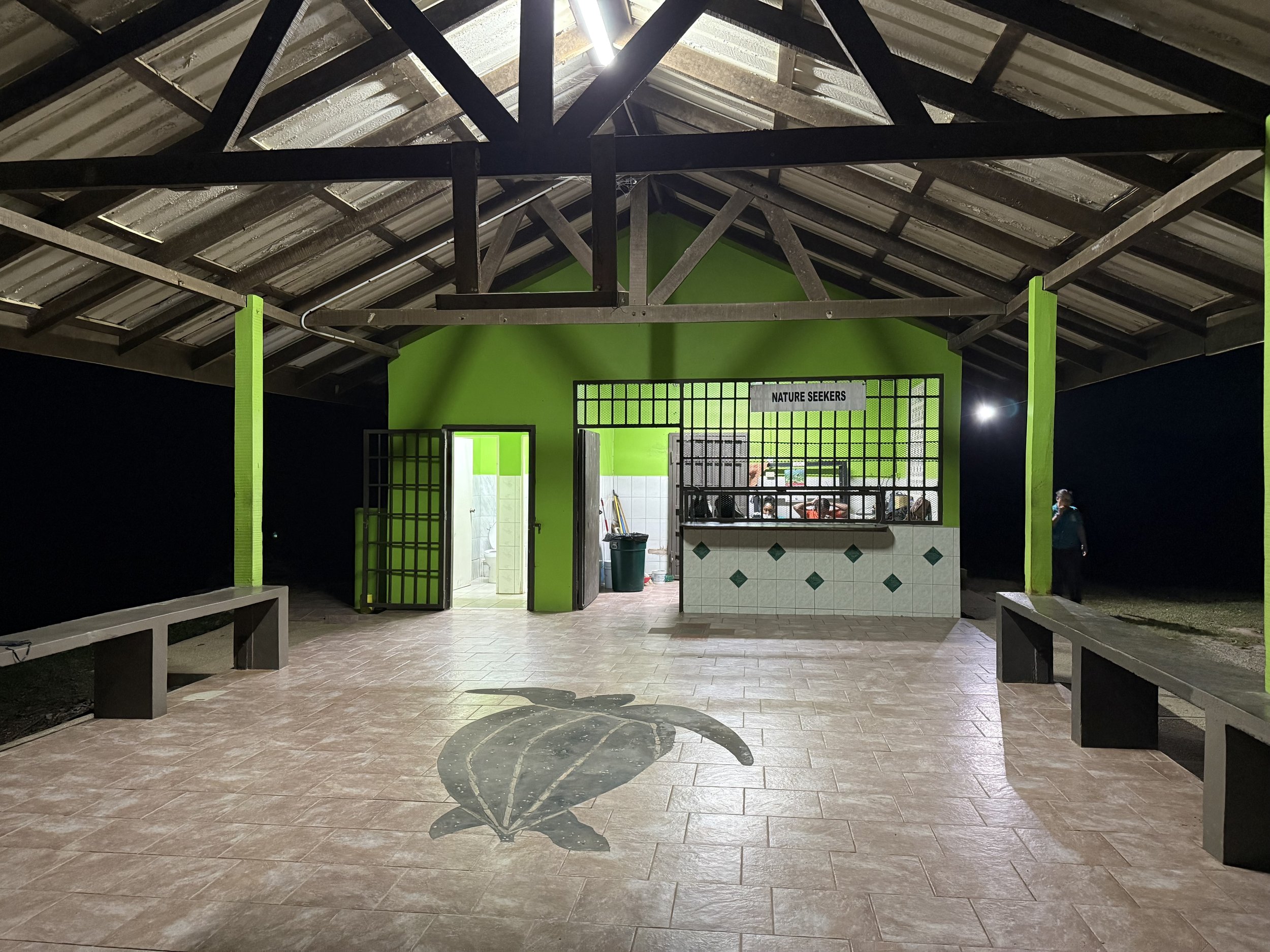
Nature Seekers Pavilion
We arrived at the Nature Seekers facility just as the night shift staff was settling in. While the team got ready to patrol the beach for turtle activity, I waited at the pavilion with Kahlil and two staff members. It took a couple of hours, but then came the call over the radio: a leatherback had emerged from the ocean. She was a bit of a walk away, though—maybe 15 minutes through a wooded area and across the sand.
I was ready.
We hiked through the darkness using only red light to guide our steps. And then, there she was—massive, glistening, and ancient-looking. A leatherback sea turtle in all her glory. Her trail in the sand was the first sign, but seeing her up close was something else entirely.
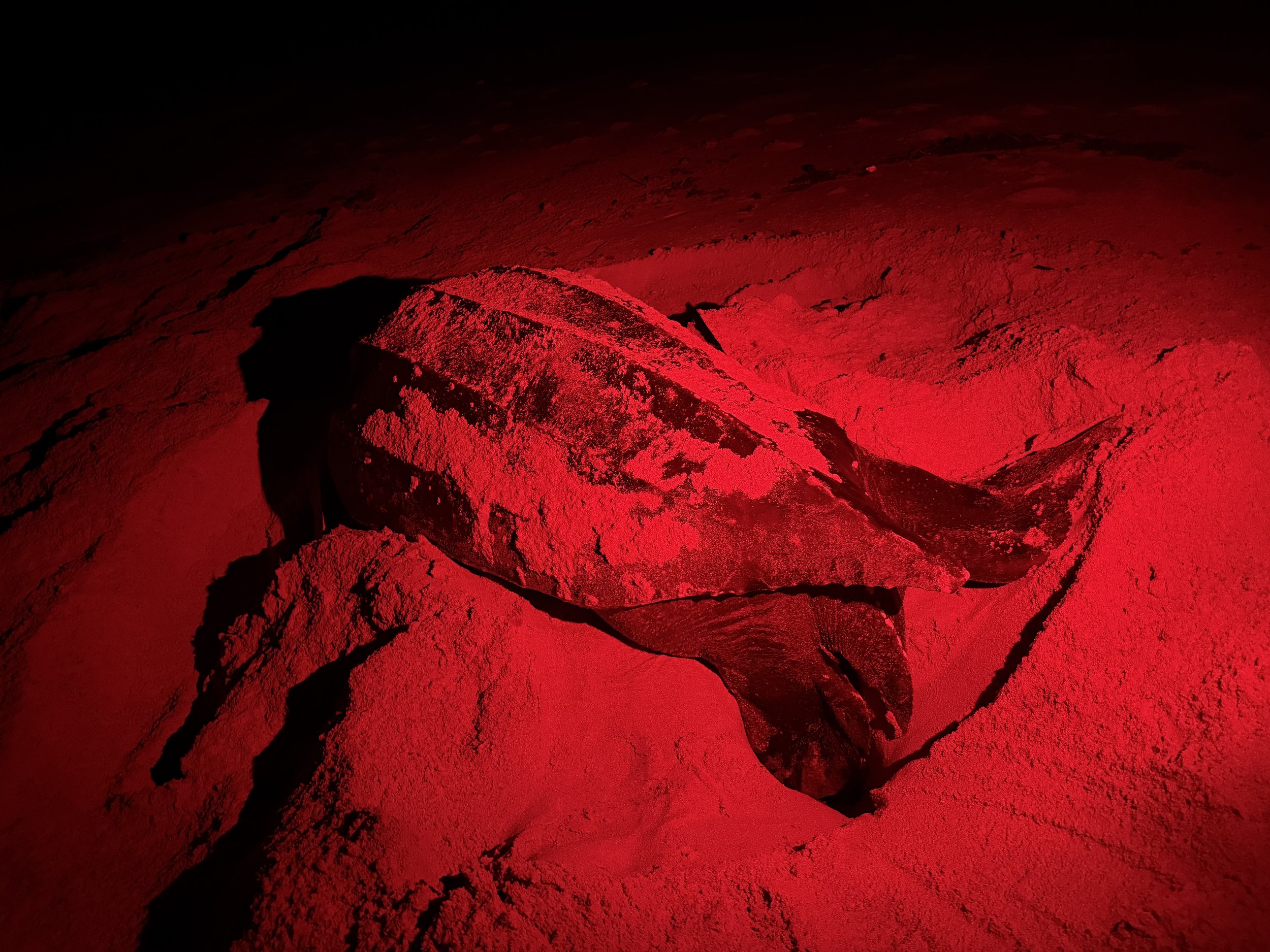
My guides on the beach, Kenisha and Thiara, were phenomenal. Their passion for their work was palpable. As the turtle began her nesting process, they explained every step: why we use red light until she begins laying (she enters a trance-like state and becomes less sensitive to disturbance), why her eyes appeared teary (a natural salt-cleansing process), and how they collect data for conservation.

Sea Turtle laying eggs
Here’s what I learned about nesting:
The female uses her powerful back flippers to dig a deep, flask-shaped hole in the sand. Once the nest is ready, she lays her eggs—some viable, some not. The non-viable eggs act as a cushion, protecting the others as she deposits as many as 100 eggs into the chamber. It’s an incredibly labor-intensive process that can take over an hour. Once she’s finished, she carefully covers the nest with sand, disguising it from predators.

Once the team completed their tagging and data collection, we stepped back and let her make her way to the water. I watched as she slowly moved toward the surf, pausing between waves until the ocean finally swept over her.
I thought that was the end of the night, but then came a surprise: I got to hold a leatherback hatchling.
Yes, you read that right.
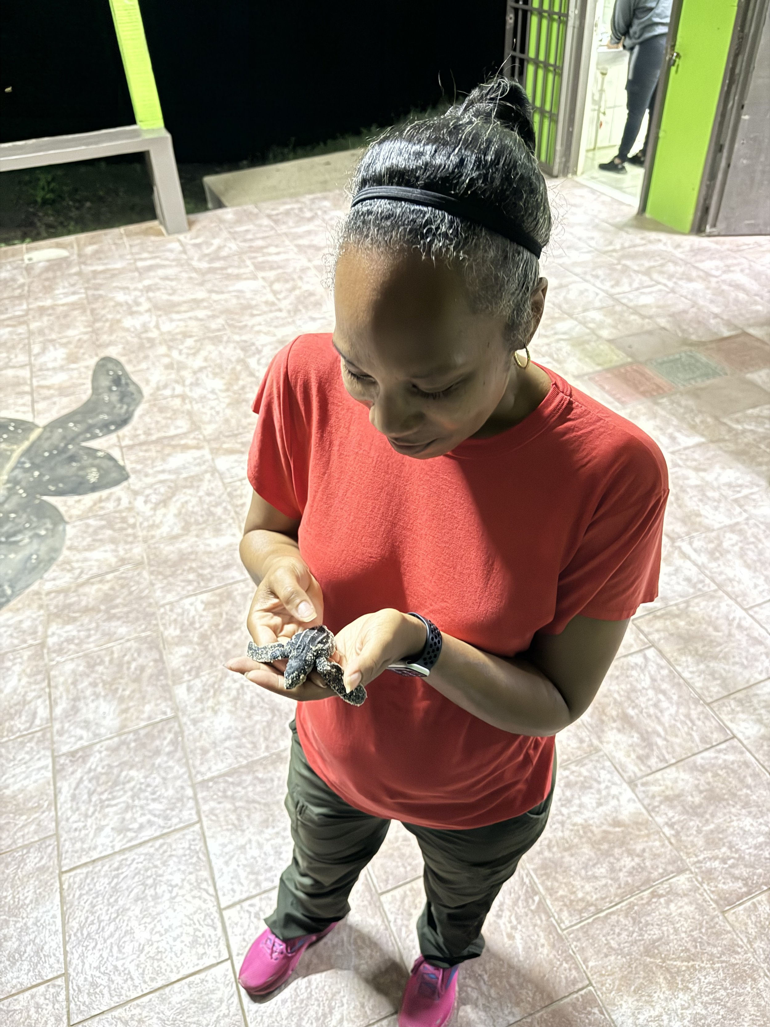
I was already riding a high from seeing the nesting female, but this sent me over the moon. The baby turtle was tiny—small enough to fit in my palm. It was wild to hold something so small that would one day grow to be five or six feet long. I carried it gently to the shoreline in a small bucket lined with beach sand. It’s important that hatchlings crawl on the beach before entering the ocean, as that’s how they imprint on the location.
The little one got a bit turned around at first, but with some patient red-light guiding, it found its way to the water. The waves came in and—just like that—it was gone.
I couldn’t stop smiling.
Overall experience: 10 out of 10. Would do again!
About Nature Seekers & How You Can Help
This incredible experience wouldn’t have been possible without the work of Nature Seekers, a local conservation group based in Matura, Trinidad. Since 1990, they’ve been protecting endangered leatherback sea turtles and educating the public about the importance of preserving these ancient creatures.
Their team—made up of passionate guides, researchers, and community members—monitors nesting sites, tags and tracks turtles, and protects eggs from poachers and predators. They also engage in reforestation, environmental education, and beach clean-ups. It’s a true community-driven conservation effort, and they’ve helped turn Matura into one of the safest nesting beaches for leatherbacks in the world.
Want to support their mission? Here’s how you can help:
• 🐢 Donate directly via their website: natureseekers.org
• 🧑🏽🤝🧑🏽 Volunteer with their turtle conservation or reforestation programs
• 📢 Spread the word by sharing their work or planning a visit of your own
Whether you’re traveling to Trinidad or just want to make a difference from afar, every bit of support helps keep these sentinel giants coming back year after year. Visit their website at natureseekers.org
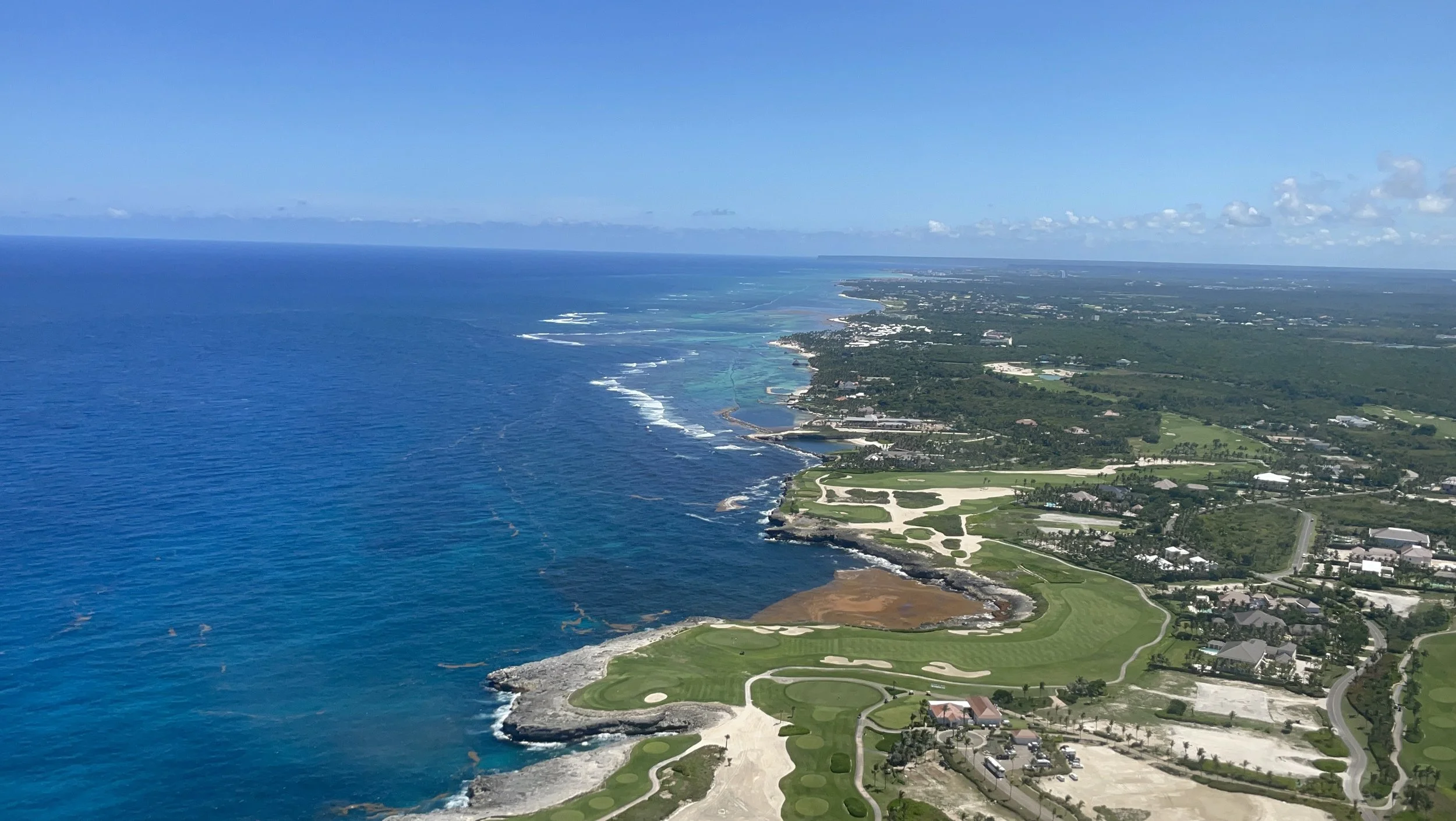
Welcome to Punta Cana, Dominican Republic
Punta Cana, on the easternmost tip of the Dominican Republic, is a tropical paradise with white-sand beaches, clear waters, and vibrant resorts. It’s a popular tourist spot with lots of activities, from relaxing on the beach to exploring nature like the nearby Indigenous Eyes Ecological Park. Punta Cana is also known for its all-inclusive resorts, golf courses, and water sports like snorkeling, scuba diving, and zip-lining. With its warm, sunny weather year-round and attractions for families and couples, Punta Cana is one of the Caribbean’s most sought-after vacation spots. Whether you’re looking for adventure or just want to relax in paradise, Punta Cana has something for everyone.
How I got there:
I flew a direct flight from Chicago’s O’Hare Airport to Punta Cana International Airport. It was a beautiful, warm, and sunny day when we arrived.
Upon landing, we took a shuttle from the plane to the main terminal to clear customs.
Once customs was done, I headed to the transportation counter where I caught the shuttle to my resort. I was a bit lost for a moment because the shuttle staging area was a bit chaotic. I eventually found my shuttle and we were off. The ride took about 30 minutes.
Where I stayed
I stayed at the Riu Hotel Bávaro, which is an all-inclusive resort in the Bávaro region of Punta Cana. It’s part of the famous Riu Resort complex. This beachfront resort has offers a plethora of amenities to cater to every need. The resort has spacious rooms, multiple restaurants, bars, and a variety of entertainment options. The Riu Hotel Bávaro is a fantastic place to stay, with a huge swimming pool, a spa, a fitness center, and tons of water sports. Whether you’re looking for a romantic getaway, a family vacation, or an exciting adventure, this resort has something for everyone.
In addition to its on-site amenities, the Resort Complex had several common areas that everyone can enjoy. There’s a thrilling water park and a lively party area with all sorts of themed parties.
Check out www.riu.com for more info.
Currency
The official currency is the Dominican Peso, but many places in tourist areas, especially resorts, shops, and restaurants, are happy to take US dollars. Just remember that the exchange rate might not always be the best, and you’ll usually get change in Dominican Pesos. It’s always a good idea to check the exchange rates and carry some local currency when you’re not using dollars.
Languages
The main language is Spanish, but in tourist areas, you’ll find a lot of English speakers. Most hotel and resort staff also speak English.
Getting Around
Taxis are relatively easy to find, especially in big cities and tourist spots. They don’t typically have meters, so it’s best to agree on a fare before you start your ride.
Motoconchos (Motorcycle Taxis): These are a fun and cheap way to get around short distances. They’re like motorcycle taxis, and they’re great for quick trips. Just be careful when you’re riding them.
Public Buses: There are affordable public buses that connect major cities and towns. They’re run by different companies, and they have different names like “guaguas.” These are minivans or small buses that follow set routes.
Private Car Rentals: Renting a car is a great way to explore the island at your own pace. Be careful about renting from non reputable establishments. Repairs on those vehicles can be questionable.
Guagua (Minibus): These are shared minibuses that travel along fixed routes and are a popular way for locals to get around. They’re super affordable and a great way to see the island.
Tourist Shuttles: Many resorts and hotels provide shuttle services for tourists, especially for airport transfers and excursions.
Bicycles and Walking: In some areas, cycling or walking can be a fun way to explore, especially in beach towns or smaller cities.