Ilhabela, Brazil
São Sebastião (St. Sebastian) Island, Ilhabela, Brazil
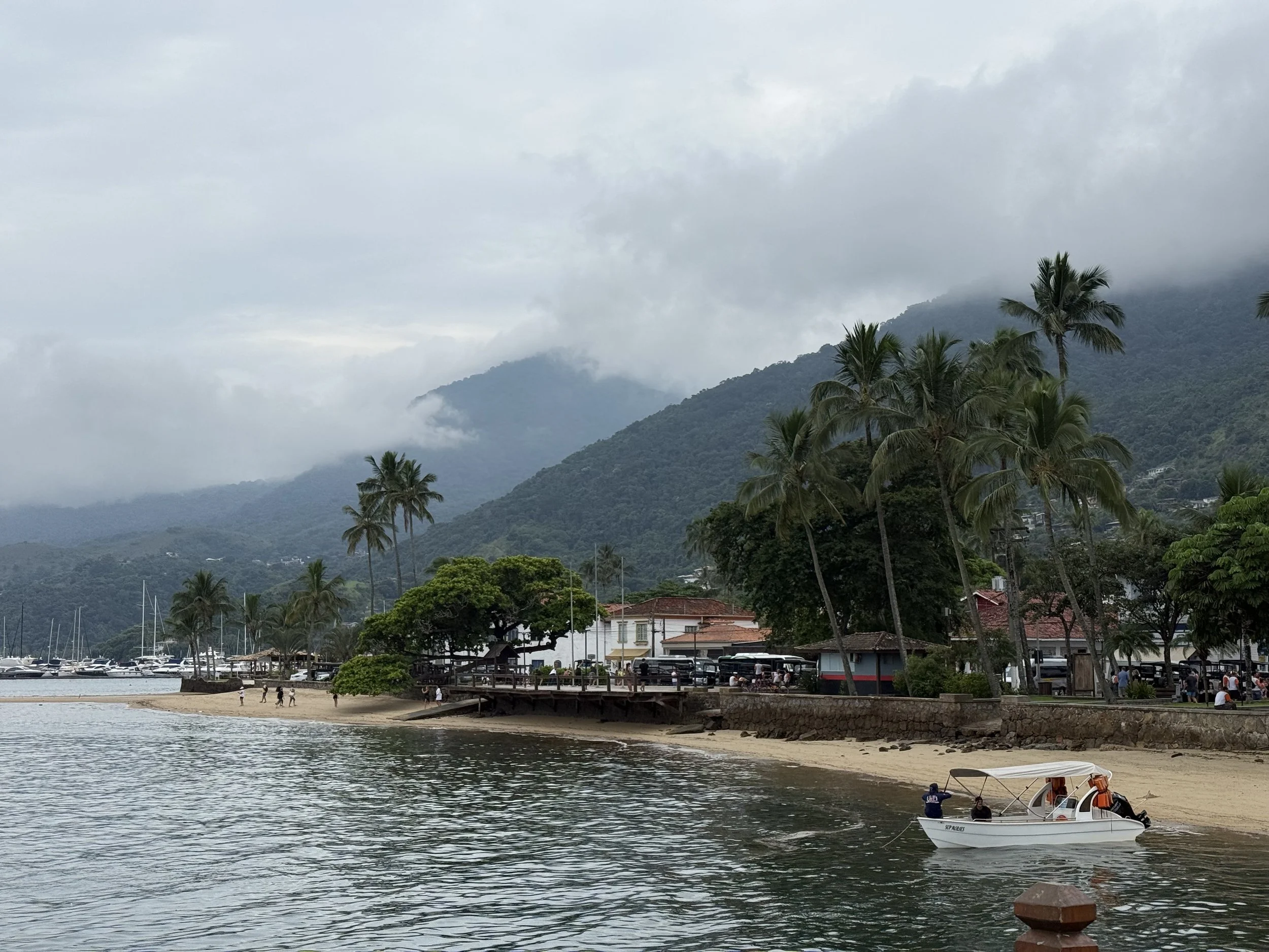
I arrived in Ilhabela by cruise ship. Because the island does not have a large port, ships anchor offshore and passengers are brought in by tender boat.
Once off the tender, you walk up a short dock that places you near Praia de Santa Tereza, a quiet, family-friendly beach close to the historic center of Ilhabela, known as Vila. It is a calm introduction to the island before heading further out.
About Ilhabela
While most visitors spend their time on the main island, Ilhabela is actually an archipelago made up of twelve islands and several smaller islets. The largest of these is São Sebastião Island, which holds the town center and most of the population. The other islands, such as Búzios, Vitória, and Pescadores, are much smaller and less developed, often home to small traditional communities.
This group of islands is a protected area, with about 85% of the land designated as the Ilhabela State Park. This preservation is the reason the interior remains covered in dense Atlantic Rainforest, with over 300 species of birds and hundreds of waterfalls. Because there are no bridges connecting the archipelago to the mainland, the only way to reach it is by the ferry system from the city of São Sebastião.
Getting to Jabaquara Beach
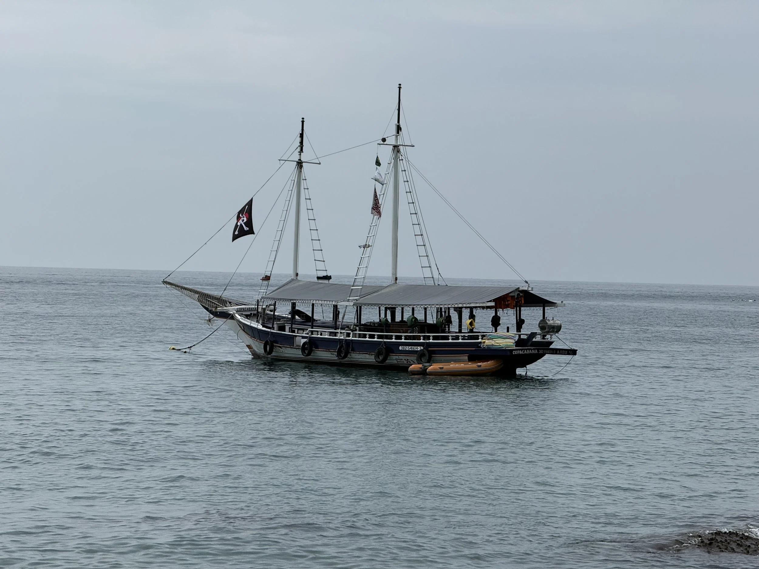
After tendering in, we walked from the dock to another departure point where we boarded a schooner headed to Jabaquara Beach.
The schooners here are traditional wooden boats, long and low with open sides, bench seating, and a covered canopy for shade. They feel more like something built for leisure rather than speed.
The ride took about an hour. The schooner towed a smaller boat behind it, which would later be used to shuttle people from the anchored vessel to shore.
On board, there was a long wooden serving trough filled with sliced watermelon. You could take pieces as you wanted, along with bottled water that was set out nearby. It was simple, but after the walk and the heat, it worked. There were also restrooms on board, though the flushing system was only partially functional.
The weather was overcast and a little rainy when we arrived, but it did not take away from the experience.
As we got closer to shore, the guide explained that we could either swim from the schooner to the beach or wait for the smaller boats. I waited.

The Bugs
Before we got off the boat, the guide gave a very specific warning about the bugs in the area.
There is a small river, Rio Jabaquara, that runs through the beach and into the ocean. That mix of fresh and salt water creates the kind of environment where insects thrive.
The main ones here are mosquitoes and biting midges, known locally as borrachudos. In other places, they are often called no-see-ums. They are small enough that you do not always notice them right away, but their bites are hard to ignore later.
Bug spray was strongly recommended.
I did not have any, which ended up being a mistake. My legs, arms, feet, and even parts of my torso were covered in bites by the end of the visit.
What stood out was how the bites behaved. They did not itch immediately, but I noticed small spots of blood forming where I had been bitten. That comes from the borrachudos, whose saliva prevents the blood from clotting at the bite site.
At the time, it did not seem like a big deal. By the next day, it was.
The itching set in all at once, and there was not much you could do except wait it out. Scratching only makes it worse.
People who used repellent still got a few bites, but far fewer. The bugs will go after any patch of skin you miss, so coverage matters.
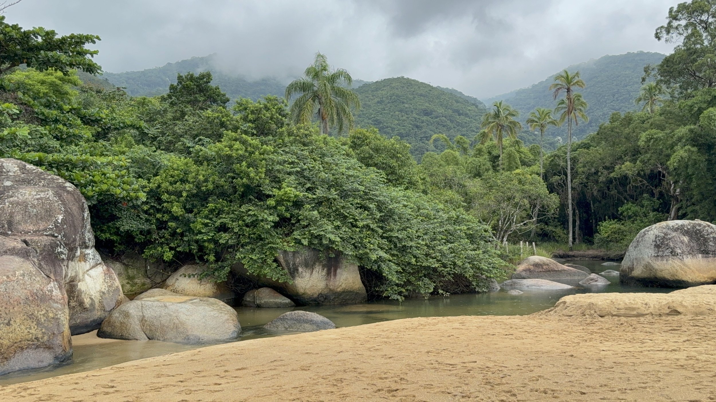
Jabaquara Beach
The beach itself is worth the effort to get there.
The sand is darker than what you might expect if you are used to Caribbean beaches. Not white and powdery, more coarse with a slightly golden tone. The water had a muted green color. It was not crystal clear, but it was clean enough to swim in.
What stood out more was the setting. The beach is backed by dense vegetation and hills, which makes it feel more enclosed and quieter than expected. There are no large resorts or long stretches of development. Just small pockets of activity surrounded by a lot of green.
It does not feel like a polished beach destination. It feels more natural and a bit removed, like somewhere you have to go out of your way to reach.
There are chairs, tables, and umbrellas available along the beach, and after the boat ride they are tempting. Just know they are not free.
Further down the beach is a small setup called Espaço Tangará Ilhabela. This is where you will find a restaurant, bathrooms, showers, and a small shop. There are signs pointing to everything, including a cashier area, which reinforces that while the beach feels remote, parts of it are organized and operated by local businesses.
English is not widely spoken here. You may come across someone who knows a little, but it is not something to rely on. Having a translation app makes things easier if you do not speak Portuguese.
Heading Back
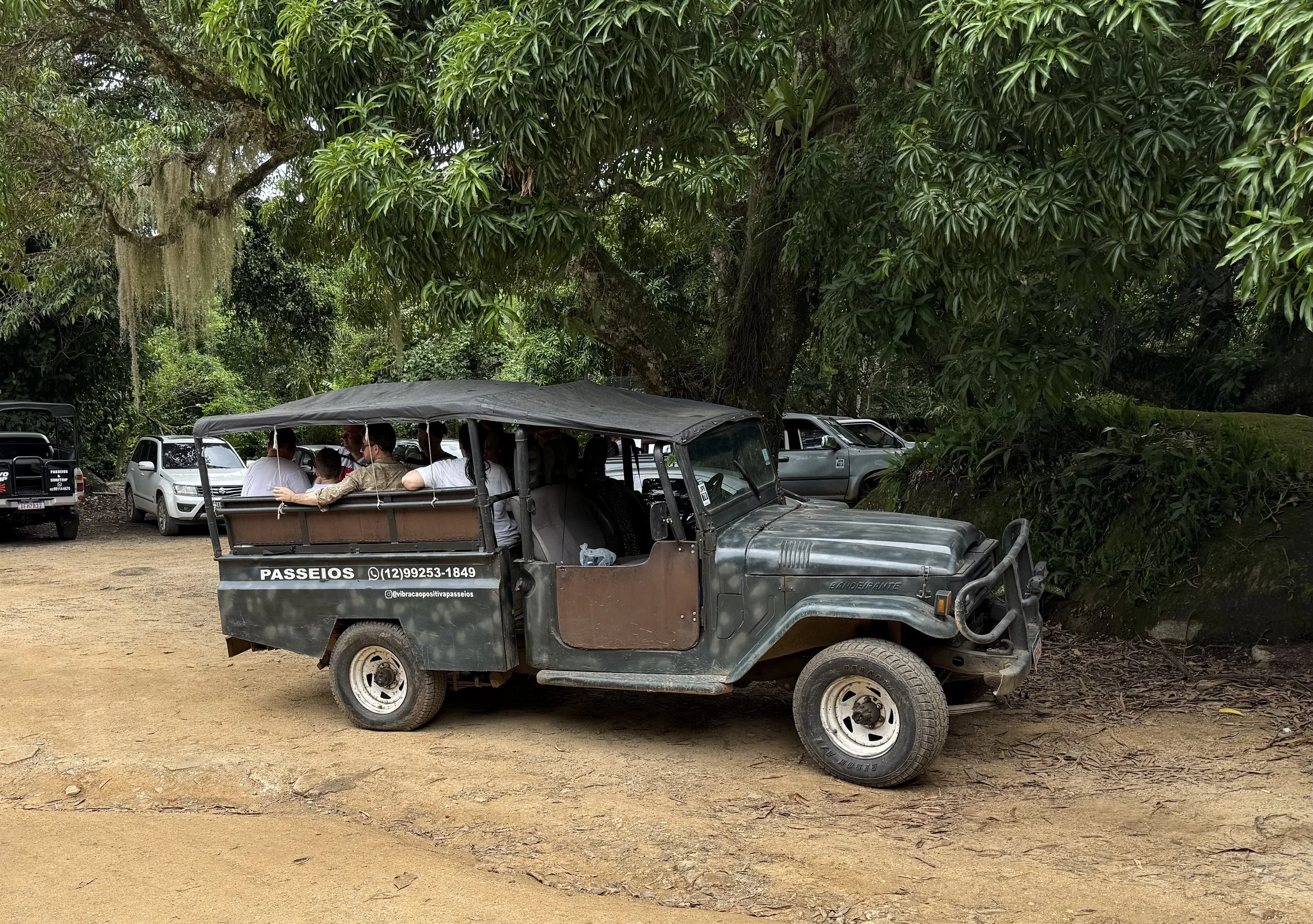
We did not take the schooner back. Instead, we returned by jeep, which ended up being one of the more interesting parts of the day.
It gave a completely different view of the island compared to arriving by water, passing through more inland areas and giving a better sense of how green and mountainous Ilhabela actually is.
On the way back, we made a quick stop at the Ilhabela sign to take photos. It is a short stop, but one of those standard moments you include in the day.
They also mentioned the singing rocks, which are said to sound like bells when struck, one of those small local details that sticks with you.
Back in Town
The area has that familiar beach town feel. Things move a little slower, but there is still enough going on to keep you engaged. There are shops, restaurants, and places where people are just sitting, talking, or taking a break from the heat.
Nothing feels rushed. It is the kind of place where you can move without a plan and still feel like you are doing something.
We ended up stopping for food and trying a few local options.
I stopped at Free Port Cafe for a chocolate ball called a brigadeiro. It is rich, dense, and much heavier than it looks. Made with sweetened condensed milk, cocoa powder, butter, and chocolate sprinkles, they are a chocolate lovers dream.
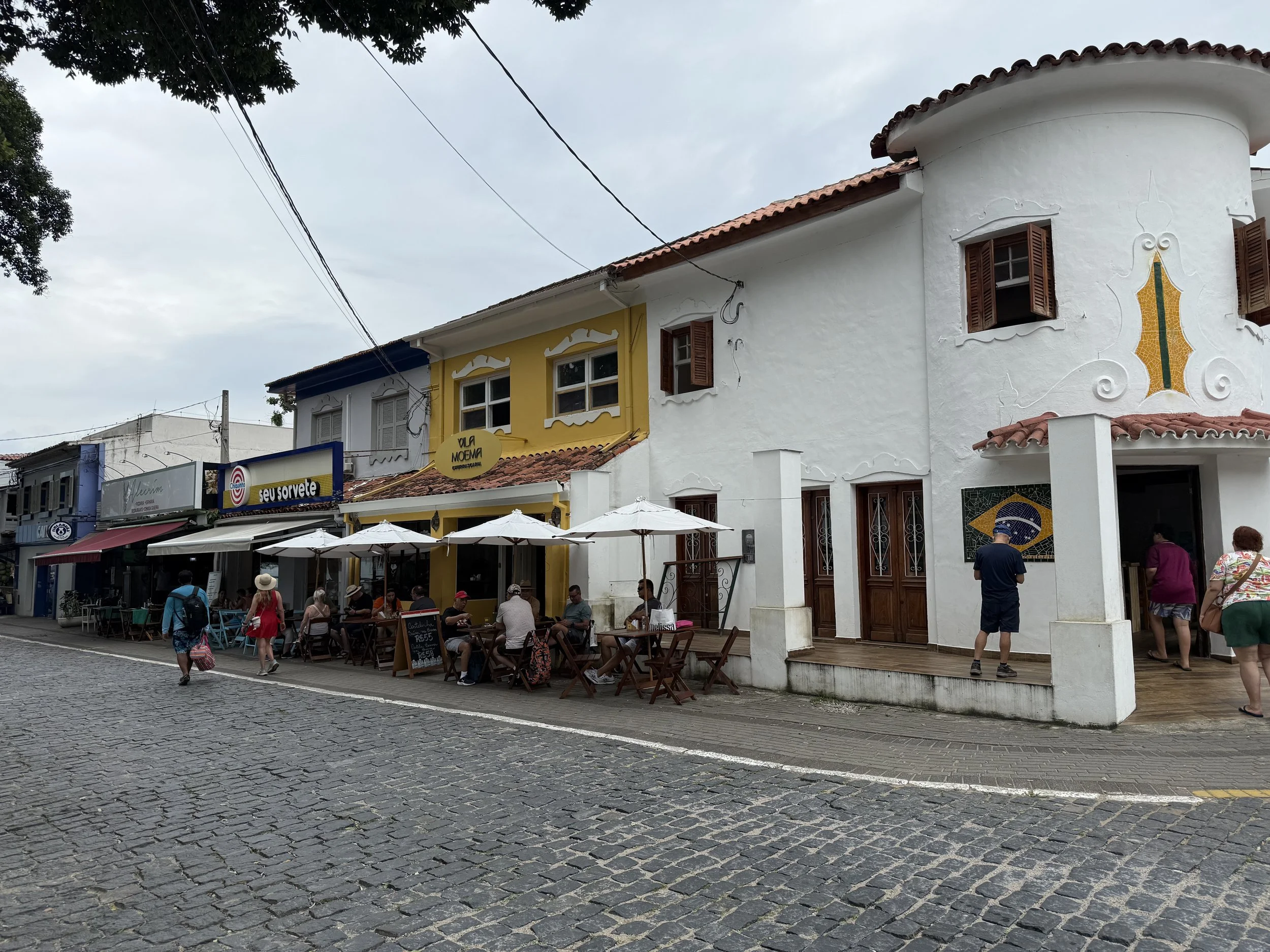
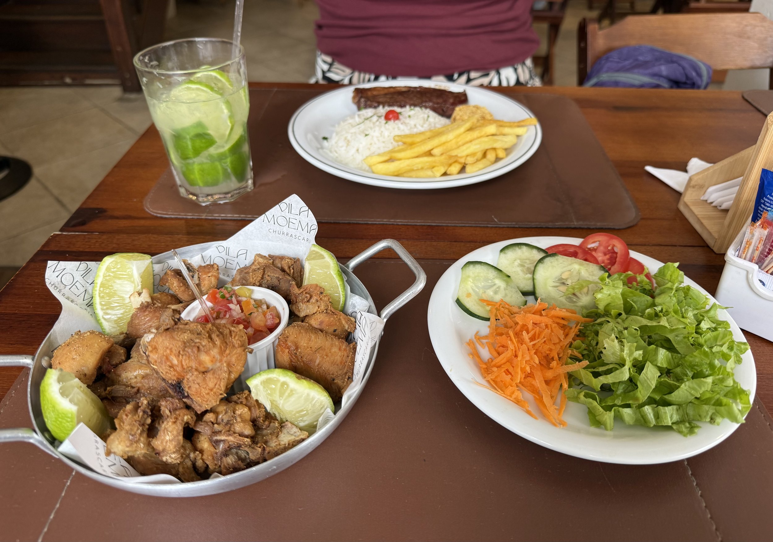
Nearby at Vila Moema Churrascaria, a bright yellow building in the historic center, I stopped for a meal. As a sit down restaurant, it offers a more structured experience with grilled meats being cooked over open heat. They were simple and well-seasoned. It fit the setting perfectly: something local and then back to walking.
Local Guide: Eating and Living Like a Local
The Vila Experience: The historic center, or Vila, is the island social hub. Beyond the main waterfront, look for the Igreja Matriz de Nossa Senhora d’Ajuda, a church built in the 1800s with a grand staircase. Walking the side streets near Praia de Santa Tereza reveals more of the traditional architecture and the lifestyle of the permanent residents.
Island Flavors: While the Free Port Cafe is a primary spot for brigadeiros, these sweets are often paired with a strong cafezinho (small coffee) during mid-afternoon breaks. Look for local variations that might use coconut or nuts.
Traditional Dining: Vila Moema Churrascaria offers the rodizio style of service common in Brazil, where different cuts of meat are served at the table. If you prefer a fixed meal, many sit down spots also offer a prato feito, a standard plate with rice, beans, a protein, and farofa (toasted cassava flour).
The Singing Rocks: Known locally as Pedra do Sino, these phonolite rocks are located on the northern coast. There is a wooden walkway leading to the site. If you strike the rocks with a small stone, they emit a metallic, bell-like ring.
Caiçara Culture: The local culture is rooted in the Caiçara heritage, which is a blend of indigenous, European, and African influences. Learning basic Portuguese greetings like Bom dia (Good morning) or Obrigado (Thank you) is helpful when visiting smaller, family-run establishments.
⸻
Things to Do
Visit Jabaquara Beach for a more remote beach experience.
Stay near Vila for an easier, walkable day with shops and restaurants.
Walk along the waterfront near the tender area.
Stop at the Ilhabela sign for photos.
Try local food from small restaurants or sit down spots like Vila Moema Churrascaria.
If you have more time, look into waterfalls and hiking areas inland.
Getting Around
The area near the tender dock and Vila is walkable.
Beaches like Jabaquara require transportation or an organized excursion.
Boat tours are a common way to reach more remote beaches.
Jeeps and local drivers are used for inland travel.
Plan extra time to return to the ship due to tendering.
Currency
The local currency is the Brazilian Real (R$).
Credit cards are accepted in most restaurants and shops near Vila.
Cash is useful for beach setups, small vendors, and tips.
Prices are generally reasonable compared to U.S. tourist destinations.
Safety
Ilhabela felt safe in the main areas near the port and Vila.
Stay aware of your surroundings, especially in crowded areas.
Keep personal items secure while walking through shops and along the waterfront.
The biggest concern is environmental.
Bug bites at Jabaquara Beach can be significant without repellent.
Be mindful of water conditions and weather when swimming.
Other Things to Consider
This is a tender port, so getting on and off the ship takes time.
Excursions like Jabaquara Beach take up most of the day.
Beach chairs and umbrellas are not free.
English is not widely spoken.
A translation app can be helpful.
Bug spray is essential for certain areas of the island.
Weather can change quickly, including rain.
Welcome to the Galapagos Islands: Info to Know Before You Go!
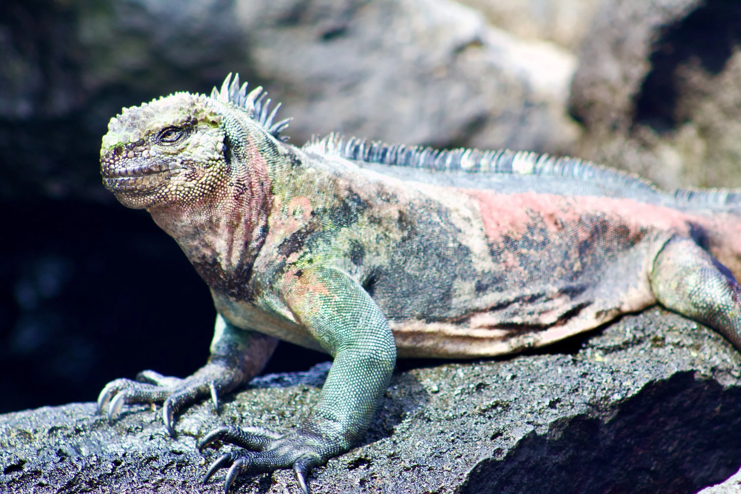
Marine Iguana
The Galápagos Islands are an archipelago of volcanic islands located in the Pacific Ocean, approximately 600 miles (1,000 km) off the coast of Ecuador. The islands straddle the equator and are renowned for their incredible biodiversity, much of which inspired Charles Darwin’s theory of evolution. The Galápagos are a bucket-list destination for nature lovers, adventure seekers, and wildlife enthusiasts alike.
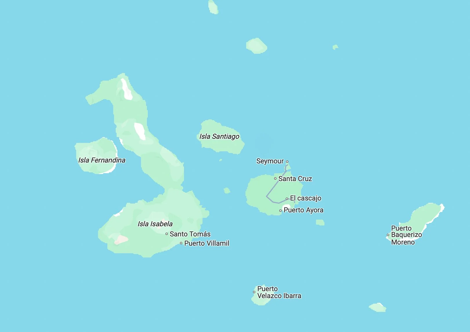
Image from Google Maps
The Islands
The Galápagos consist of 13 major islands, 6 smaller islands, and over 100 islets and rocks. Some of the most well-known islands include:
Santa Cruz – The central hub with the largest town, Puerto Ayora.
San Cristóbal – Home to Puerto Baquerizo Moreno, the capital of the Galápagos province.
Isabela – The largest island, known for its volcanic landscapes and abundant wildlife.
Floreana – Famous for its history of whalers and pirates.
Fernandina – The most pristine island, home to the highest concentration of marine iguanas.
Santiago – A great spot for snorkeling and observing fur seals.
Genovesa – A birdwatcher’s paradise, often called "Bird Island."
Inhabited Islands
Although most of the Galápagos is uninhabited, there are four main islands where people live:
Santa Cruz – The most developed, with hotels, restaurants, and the Charles Darwin Research Station.
San Cristóbal – The capital island, offering a mix of nature and small-town life.
Isabela – More remote but increasingly popular with eco-tourists.
Floreana – Home to a small population and a rich pirate history.
Getting There and Entry Requirements
To reach the Galápagos, travelers must first fly to Ecuador (Quito or Guayaquil). From there, domestic flights operate to the islands' two main airports:
Seymour Airport (GPS) on Baltra Island (for Santa Cruz access).
San Cristóbal Airport (SCY) on San Cristóbal Island.
Passport, Visa, and Entry Process
Most travelers entering Ecuador, including the Galápagos, do not need a visa for stays up to 90 days if they are from the U.S., Canada, the EU, and many other countries. However, you do need a passport that is valid for at least 6 months after the date you arrive.
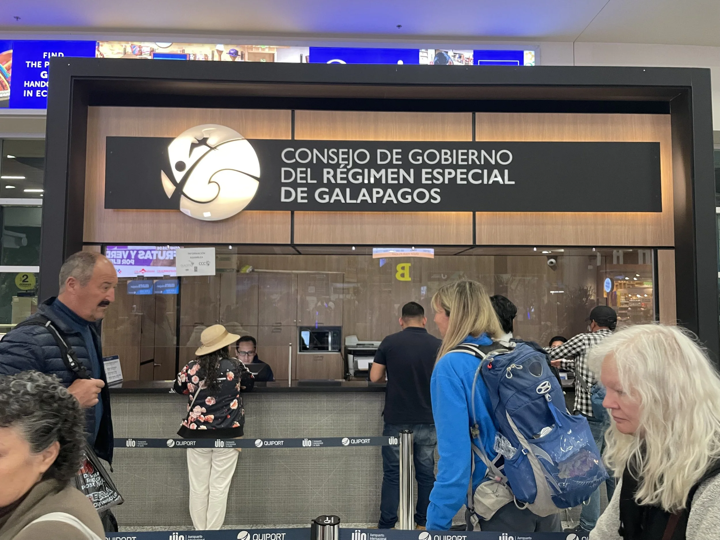
Before traveling to the Galápagos, visitors must:
Obtain a Transit Control Card (TCT) at Quito or Guayaquil airport ($20 per person). This can be obtained at the Consejo De Gobierno Del Regimen Especial De Galapagos (Governing Council of the Special Regime of Galapagos) counter. There is usually a line, so come with your passport, patience, and a payment method.
Show proof of return tickets and hotel or tour reservations.
Pay the Galápagos National Park Entrance Fee ($200 for adults, $100 for children under 12).
Go through an agricultural inspection to ensure no banned items (such as fresh fruits, vegetables, or soil) are being brought to the islands.
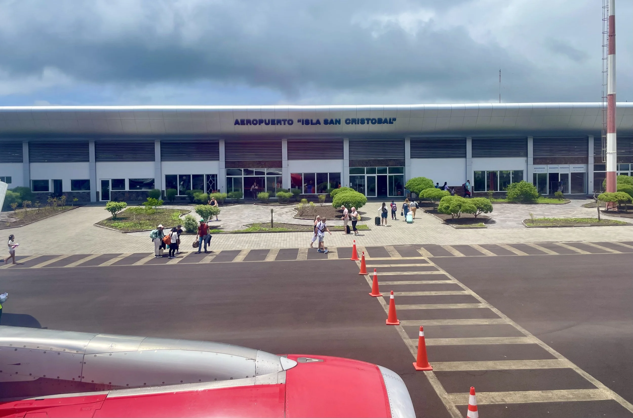
Arriving at the Galápagos Airports
Upon arrival, passengers must walk directly off the plane onto the tarmac, as there are no jet bridges. The airports are small and semi-open-air, reflecting the islands' remote and eco-conscious nature. Expect a warm (hot) breeze and a unique first impression of the volcanic landscape.
At customs and immigration, visitors go through a brief luggage check to ensure compliance with conservation regulations. Drug-sniffing dogs and X-ray machines scan bags for restricted items. Once cleared, travelers can proceed to taxis, buses, or ferries to their final destination.
Things to Do in the Galápagos
Wildlife Viewing
Giant Tortoises – Visit the Charles Darwin Research Station (Santa Cruz) or El Chato Reserve.
Marine Iguanas – Best seen in Fernandina, Santa Cruz, and Isabela.
Blue-footed Boobies & Frigatebirds – Common in North Seymour, San Cristóbal, and Genovesa.
Galápagos Penguins – Found on Isabela, Fernandina, and Bartolomé.
Snorkeling & Diving
Kicker Rock (San Cristóbal) – Hammerhead sharks and rays.
Devil’s Crown (Floreana) – Coral reefs and tropical fish.
Gordon Rocks (Santa Cruz) – Advanced divers can see hammerheads and sea turtles.
Wolf & Darwin Islands – Remote sites with the best scuba diving experiences.
Hiking & Exploring Volcanic Landscapes
Sierra Negra Volcano (Isabela Island) – One of the largest active volcanic craters.
Bartolomé Island – Moon-like landscapes and panoramic views.
Lava Tunnels (Santa Cruz & Isabela) – Walk through underground lava formations.
Other Activities
Kayaking & Paddleboarding – Explore Puerto Ayora, Gardner Bay, and Puerto Villamil.
Beach Relaxation – Best beaches include Tortuga Bay (Santa Cruz), Gardner Bay (Española), and Puerto Villamil Beach (Isabela).
Best Time to Visit
December to May (Warm & Wet Season) – Warmer waters, better snorkeling, lush landscapes.
June to November (Cool & Dry Season) – Cooler waters, better for diving, abundant marine life.
Packing Tips
Light clothing, swimsuits, and hiking shoes.
Reef-safe sunscreen and sunglasses.
Motion sickness medication (for boat rides).
Binoculars and an underwater camera.
Health & Safety Considerations
Seasickness is common – Take precautions if traveling between islands.
Medical facilities are limited – Bring necessary medications.
Follow conservation rules – Avoid touching or feeding wildlife.
Cost of Travel
Round-trip flights from Ecuador: appx. $250–$500
National Park Entrance Fee: $200 (adults), $100 (children under 12)
Transit Control Card (TCT): $20 per person
Hotels: Budget from $40/night, luxury from $500/night
Island-hopping tours: $150–$300 per day
Luxury cruises: $2,000–$7,000 per trip
Exploring the Galápagos Independently: Can You Wander Alone?
The Galápagos Islands have strict regulations in place to protect their fragile ecosystem, and these rules extend to how visitors can explore. You can wander freely in certain areas, but many parts of the islands require a certified guide. Here’s what you need to know:
Where You Can Explore Alone
If you’re staying on one of the four inhabited islands (Santa Cruz, San Cristóbal, Isabela, and Floreana), you can explore:
• Towns and villages – You’re free to roam places like Puerto Ayora (Santa Cruz) and Puerto Baquerizo Moreno (San Cristóbal).
• Beaches and designated hiking trails – Some areas are accessible without a guide, such as:
• Tortuga Bay (Santa Cruz) – A stunning white-sand beach.
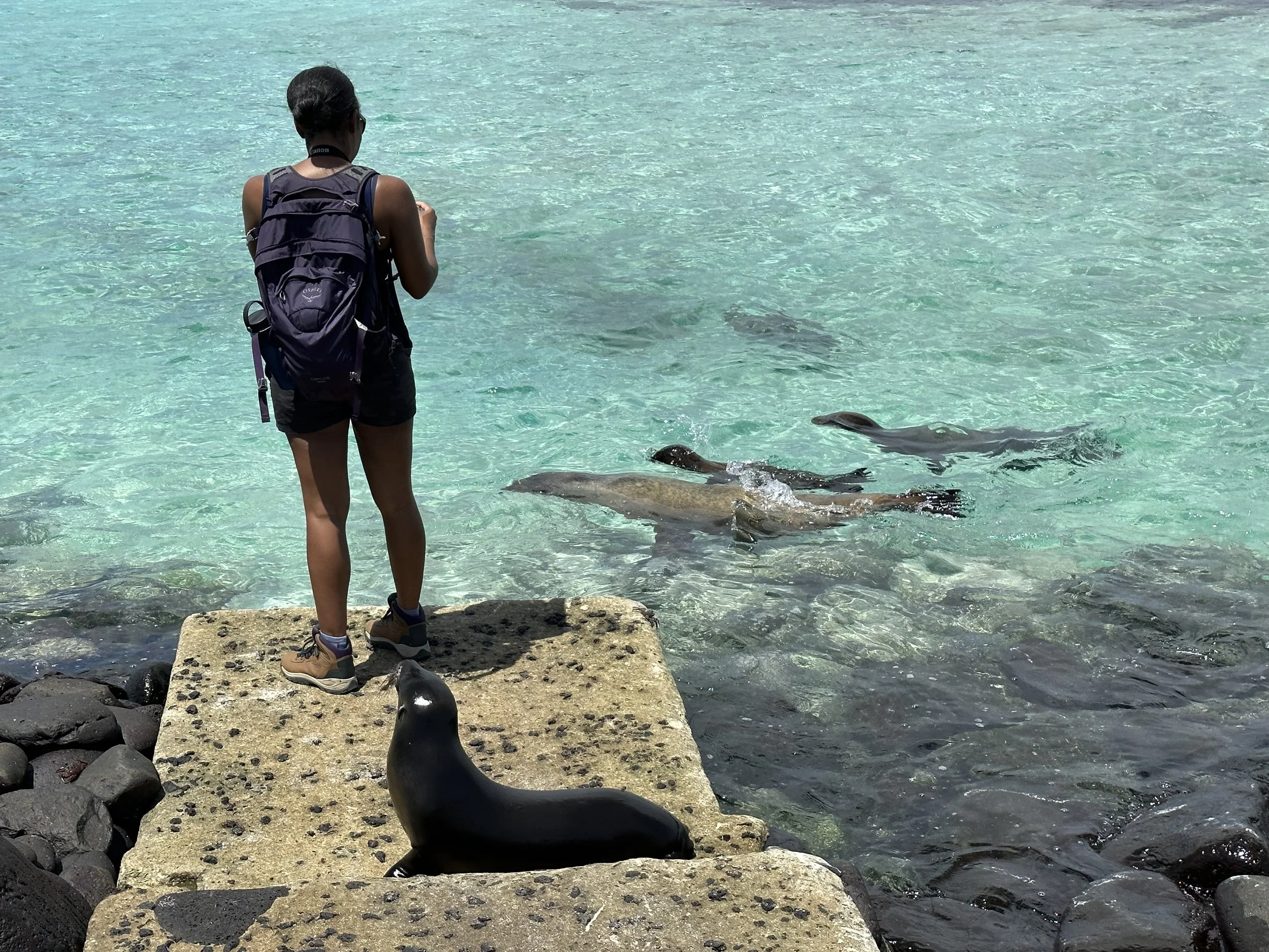
• La Lobería (San Cristóbal) – A great spot to see sea lions and marine iguanas.
• Concha de Perla (Isabela) – A calm lagoon for snorkeling.
• Highlands of Santa Cruz – Includes the Los Gemelos craters and lava tunnels.
Where You Need a Guide
Many sites, especially those with significant wildlife populations or sensitive environments, require a certified naturalist guide. These include:
• Uninhabited islands (e.g., Bartolomé, North Seymour, Española).
• National Park trails that lead to protected wildlife areas.
• Certain snorkeling/diving spots, like Kicker Rock and Los Tuneles.
If you’re visiting without a guide and attempt to enter a restricted area, park rangers may turn you away or fine you.
Getting Around Without a Tour
If you’re not on a structured tour, you still have several ways to move between and within the islands:
1. Inter-Island Ferries
Ferries run between the inhabited islands and are the primary way independent travelers move between them.
• Routes: Santa Cruz ↔ San Cristóbal / Santa Cruz ↔ Isabela / Santa Cruz ↔ Floreana.
• Cost: ~$30–$40 per trip.
• Schedule: Typically, early morning (~6 AM) and afternoon (~2 PM).
• Duration: 2-2.5 hours depending on the route.
Tip: The rides can be bumpy, so bring motion sickness medication if you’re prone to seasickness.
2. Speedboats & Water Taxis
• Used for shorter trips, such as getting from Puerto Ayora to nearby islets or across harbors.
• Water taxis cost $1–$5 depending on the distance.
3. Small Planes (Inter-Island Flights)
Emetebe Airlines operates small planes connecting San Cristóbal, Isabela, and Baltra.
• Cost: ~$150 per flight.
• Time-Saving Option: A 30-minute flight instead of a 2-hour ferry ride.
4. Renting Bikes, Scooters, or Walking
• Many areas on Santa Cruz and San Cristóbal can be explored by bike or scooter (rentals from $10–$20 per day).
• Walking is an easy way to explore town areas and nearby beaches.
For up to date information visit galapagos.gob.ec. Keep in mind the site is in Spanish so a translate app may be needed.
One Day In Quito Ecuador
Departing Bogota
Arriving Quito
Arrival:
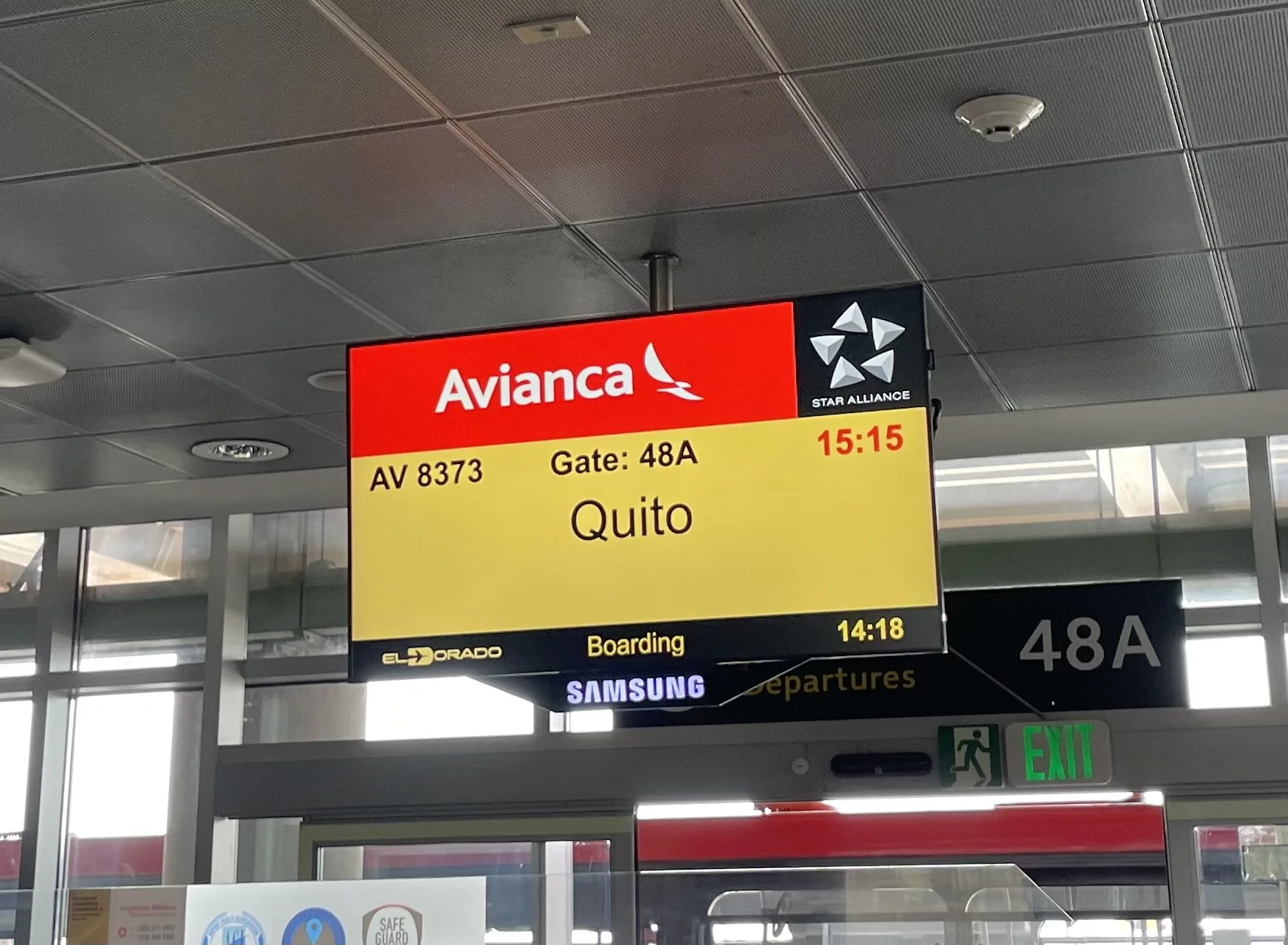
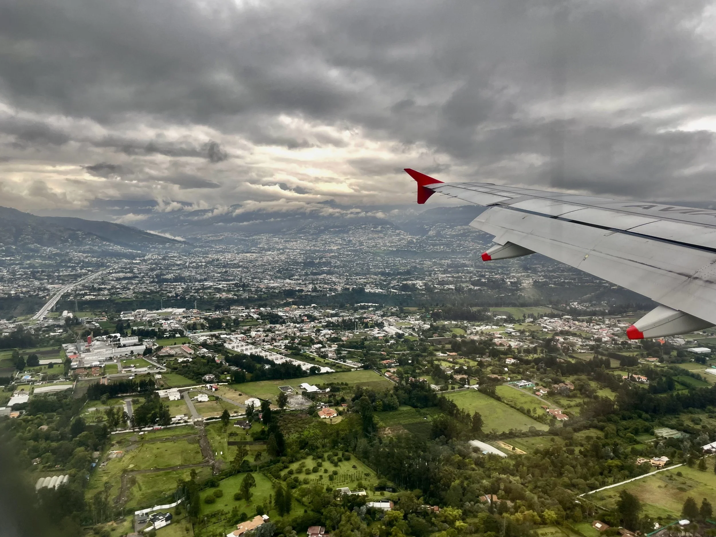
I arrived in Quito on a rainy April afternoon, flying with Avianca Airlines from El Dorado International Airport in Bogotá, Colombia, to Mariscal Sucre International Airport (UIO) in Quito. After clearing customs and collecting my luggage, I made my way to the hotel. The drive took about 45-50 minutes, offering a glimpse of the city’s landscape along the way.
Local Currency:
Quito, like the rest of Ecuador, uses the United States Dollar (USD) as its official currency. Ecuador adopted the dollar in 2000, and it's the primary currency for all transactions. Ecuador also uses centavo coins (1, 5, 10, 25, and 50 cents), as well as standard U.S. dollar coins.

JW Marriott Quito
Where I Stayed:
I stayed at the JW Marriott Hotel Quito, a 5-star hotel right in the heart of the city. The hotel is ideally located at the intersection of Avenida Orellana 1172 and Avenida Amazonas, offering easy access to popular attractions like Santo Domingo Church and the House of Ecuadorian Culture.
The hotel boasts 259 rooms and suites, each designed with modern amenities such as plush bedding, plasma TVs, minibars, and stunning city views. Guests can enjoy a variety of dining options, including:
Bistro Latino: Serving international cuisine for breakfast and lunch.
La Hacienda Grill: Specializing in steak and seafood.
Café Gourmet and Exchange Bar: Great spots for drinks and coffee.
The Zumay Health Club provides relaxation options, including Turkish baths, a sauna, hot tubs, and a well-equipped fitness center. There's also an outdoor swimming pool with panoramic views of the city.
Unfortunately, due to my late arrival, tiredness, and the rainy weather, I didn't get to fully explore the hotel's amenities. However, I did appreciate the wallet-sized information card provided by the hotel, which warned guests about common scams to watch out for while exploring the city.
Getting Around:
Walking was my primary mode of transportation while in Quito. I used taxis to get to and from the airport and took buses to visit key tourist attractions, but I mostly walked around the city to absorb the local atmosphere.
However, for those who prefer alternatives, Quito offers various options:
Public Transport:
Trolebus: A popular electric bus system covering important neighborhoods.
Ecovía: Another bus system that serves the eastern part of the city.
Regular Buses: Extensive, but can get crowded during rush hours.
Taxis & Ridesharing:
Taxis are abundant, but it's best to ensure the meter is used or agree on the price upfront. Ridesharing services like Uber and Cabify are widely used and often safer.Bicycles:
Quito is becoming more bike-friendly, with rental stations like BiciQuito. There are bike lanes, especially along Avenida de los Shyris.Cable Cars:
Teleférico is a must-do to reach Pichincha Volcano, offering incredible city views.Private Car or Rentals:
If you're planning to explore outside the city, renting a car gives you more flexibility.Mototaxis:
These small motorcycle taxis are cheaper but not the safest option, typically for short trips.Tourist Shuttles:
Shuttle buses are available for popular attractions like Mitad del Mundo and Teleférico.
Pro Tips:
Prioritize safety when using taxis or ridesharing services, especially at night.
Download maps or transportation apps to navigate public transport.
Quito sits at a high altitude (2850m/9350ft), so take it slow and hydrate to avoid altitude sickness.
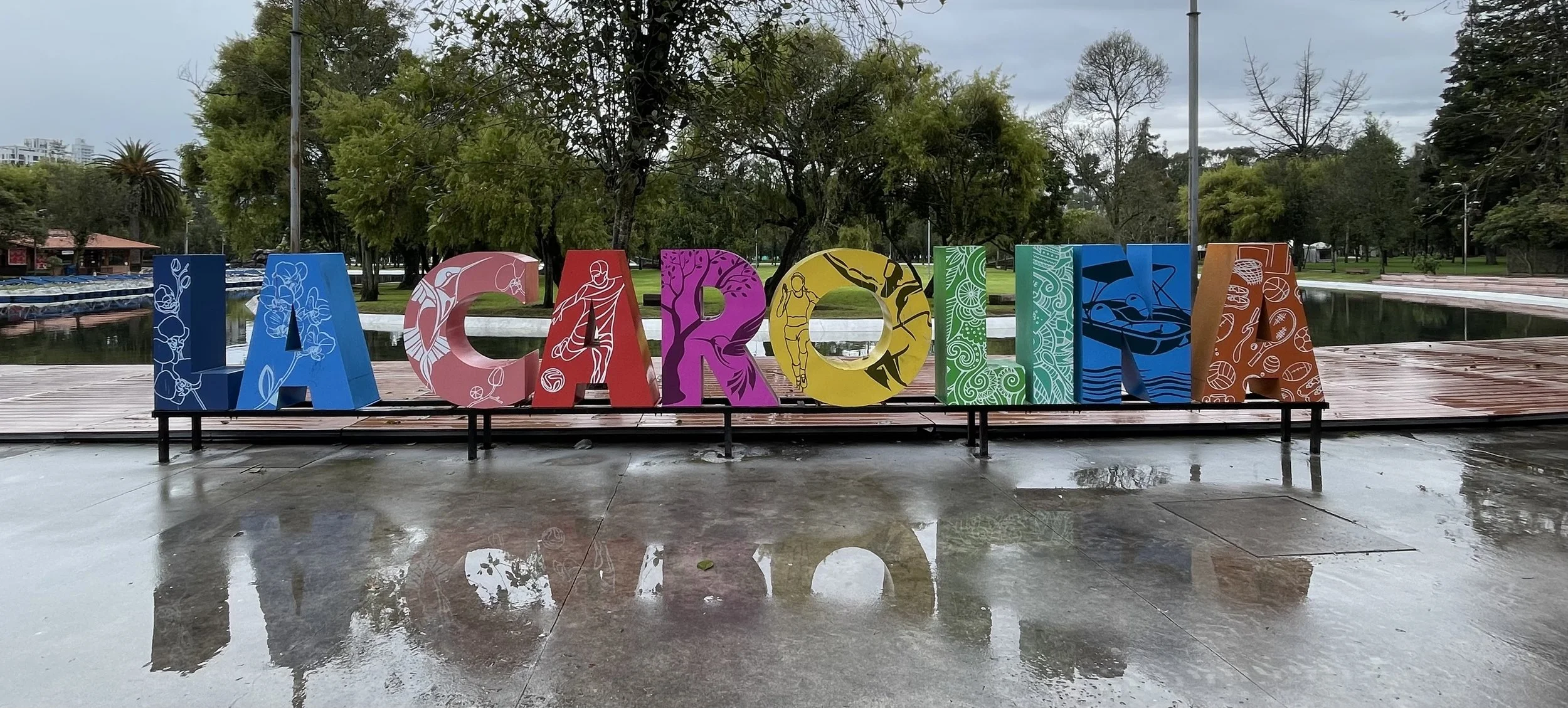
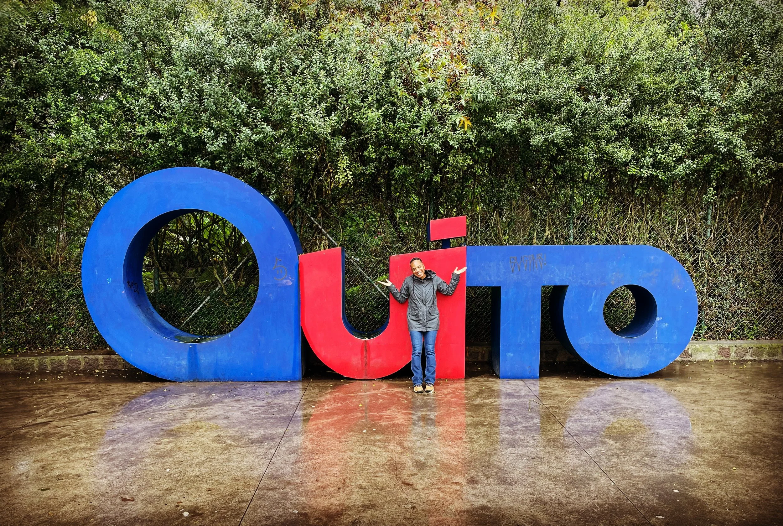
What I Did:
I walked a lot, making the most of my one full day in Quito. I started my day early, strolling from the hotel through Parque La Carolina, one of Quito’s largest parks. The park offers numerous activities, including picnics, visits to the Botanical Garden, climbing the Cerro (hill) for a great city view, or exploring the Planetarium and El Árbol de la Vida sculpture.
Given the wet weather and early hour, the park was relatively quiet. I also spotted Quicentro Mall across from the park and decided to pop in. Inside, I found an expansive shopping and dining space. Although I didn’t need a backpack, I ended up buying one anyway—because, who doesn't love a new travel accessory?
Around 11:15 a.m., I hopped on the Quito City Tour Double Decker Bus. It seemed like the quickest way to see the city's top sights. The $15 ticket gave me access to 11 stops, and a guide provided interesting commentary along the way. Here are the highlights:
Parque El Ejido: The starting point of the tour.
La Mariscal (Plaza Foch): A lively neighborhood with great dining and nightlife.
Parque La Carolina: Where I boarded the bus, a large park with various activities.
Museo Nacional (National Museum): A museum housing Ecuadorian art and artifacts.
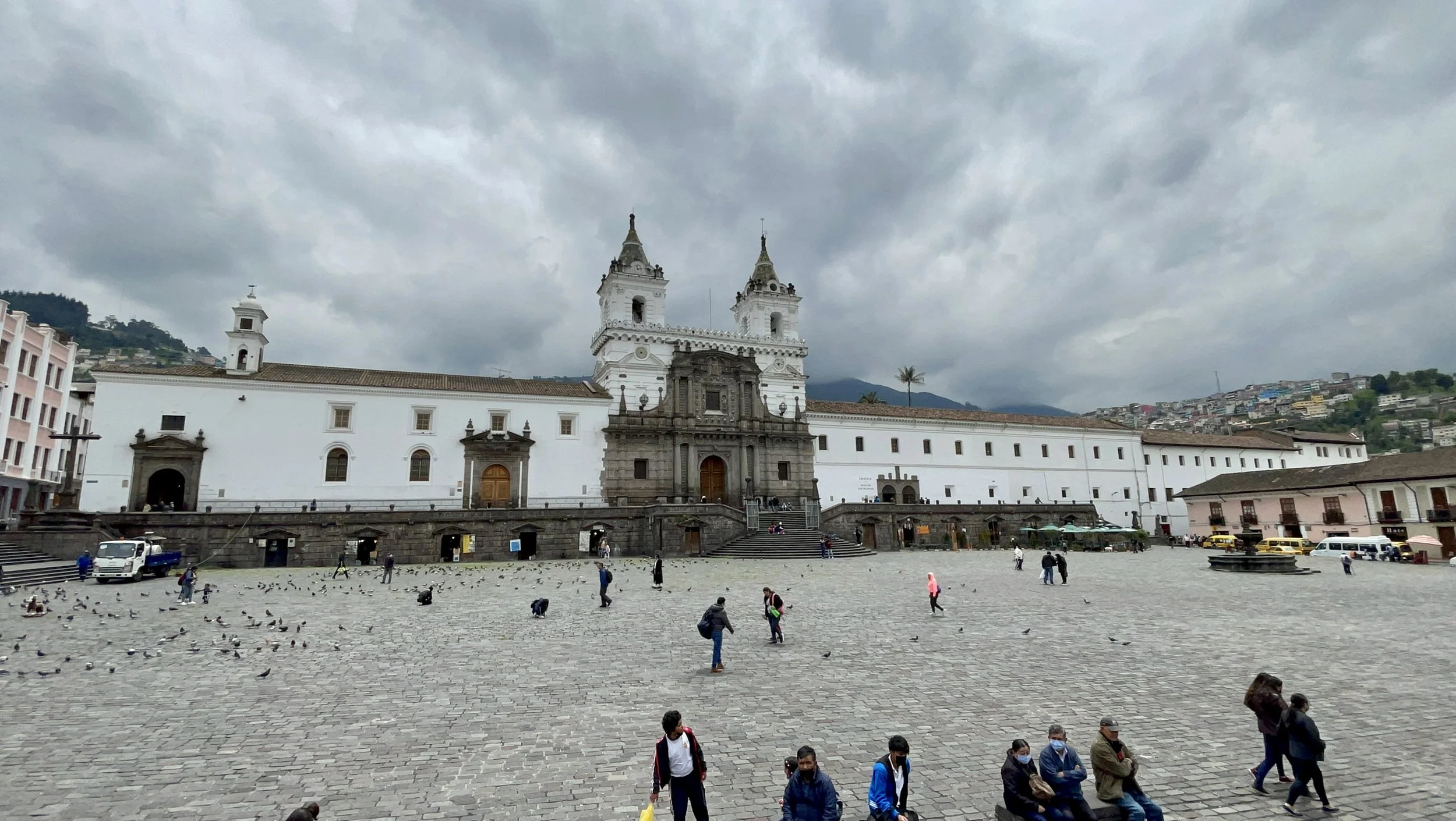
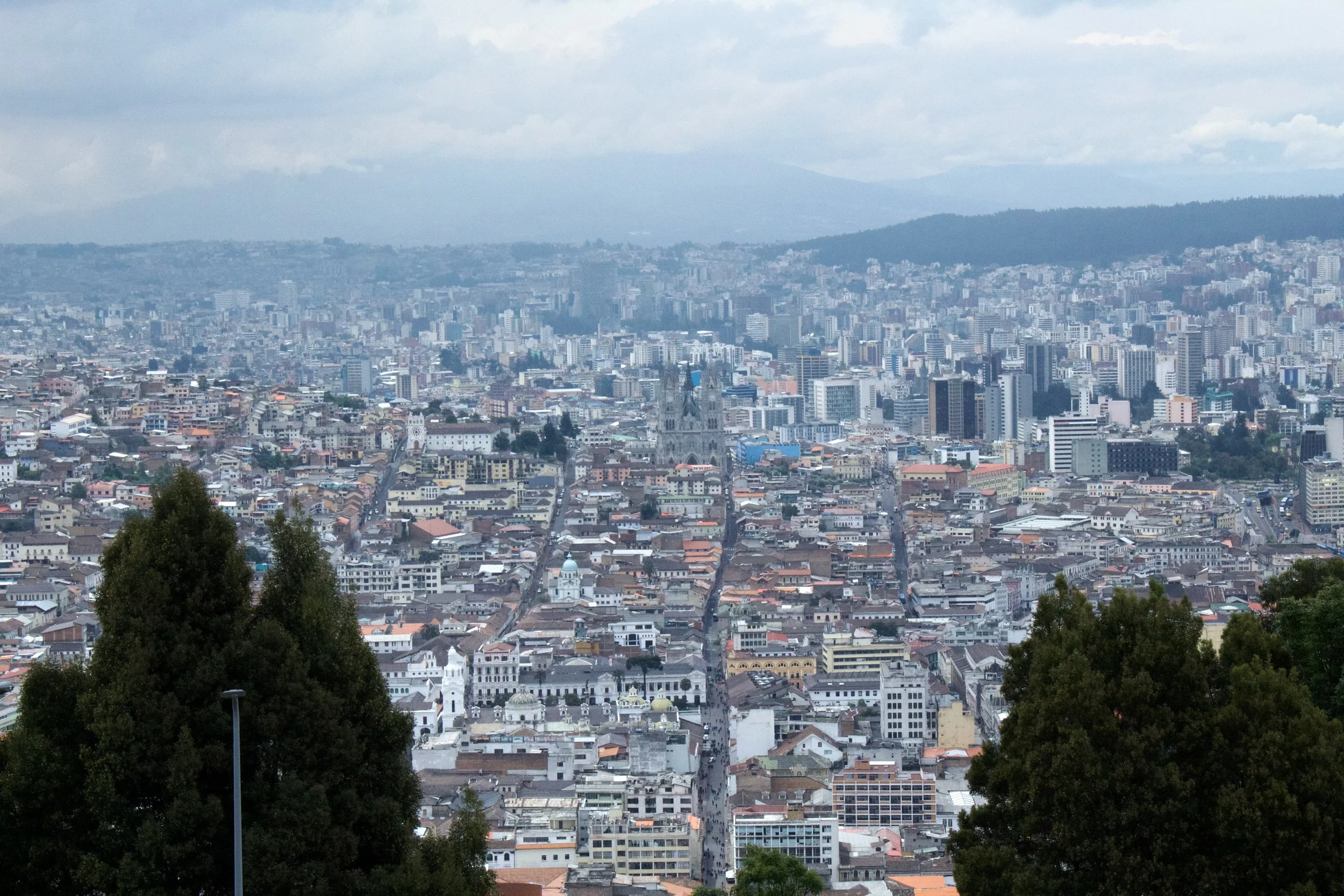
Centro Histórico: Quito’s UNESCO-listed old town with historic churches, plazas, and colonial buildings.
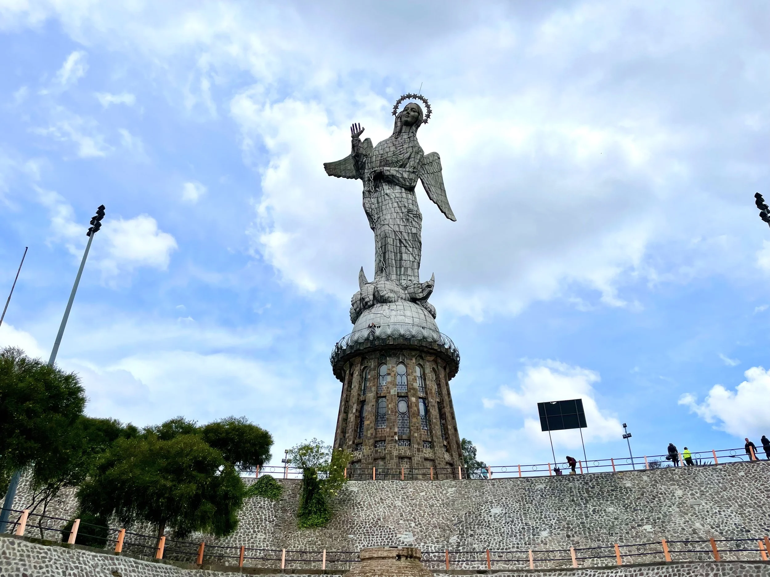
Panecillo Hill: Offering stunning views of the city and the Virgin of El Panecillo statue. I also noticed several stray dogs, which seemed to be part of the hill's charm.
La Ronda: A historic street filled with cafes, restaurants, and artisan shops.
Mitad del Mundo: The iconic stop at the Mitad del Mundo Monument, marking the equator. I didn't have time to visit this one, but it’s definitely on my list for next time.
Teleférico (Cable Car): The cable car ride offers panoramic views of Quito and the surrounding mountains, including Pichincha Volcano.
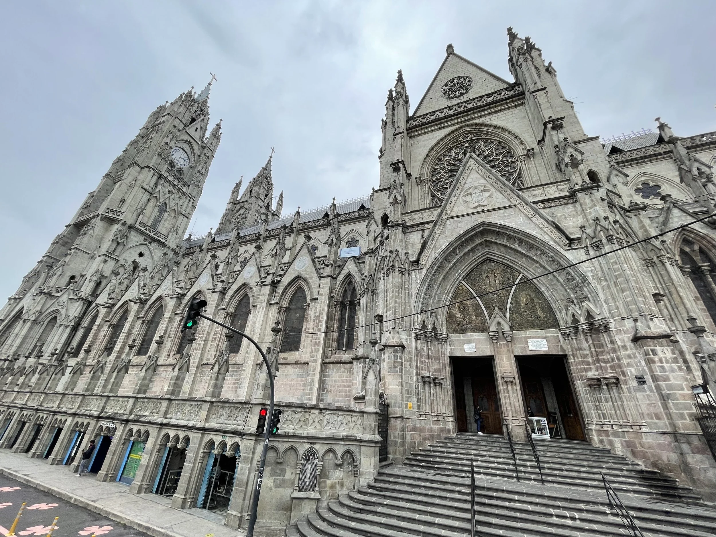
Basilica del Voto Nacional: One of the largest churches in Ecuador, known for its Gothic architecture and views of the city from its towers.
Plaza Grande: The historic square, surrounded by important buildings like the Presidential Palace and Archbishop’s Palace.
It was a packed, fun day in Quito. I ended the day early as I had an early departure to the Galápagos Islands the next day!