


#11 Joshua Tree National Park, California
Joshua Tree National Park will forever be etched in my memory as the place where I nearly sat on a black widow spider. How did that happen, you ask? Let me take you through my early morning adventure.
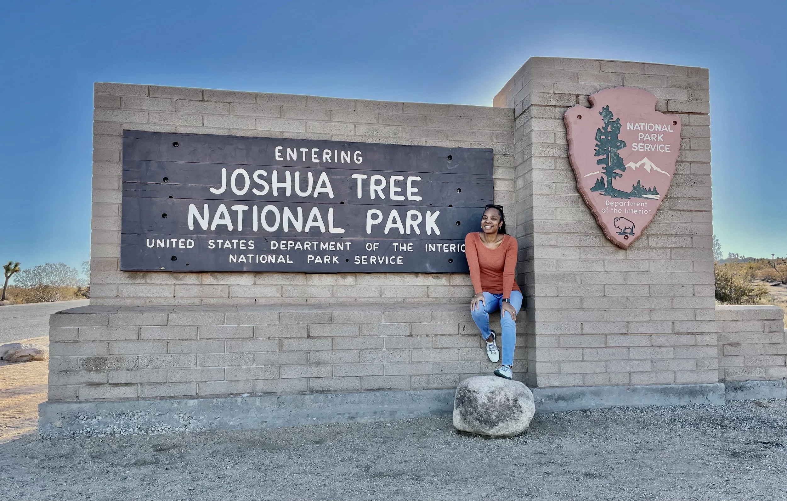
I arrived at Joshua Tree on a crisp January morning, eager to catch the sunrise over the park’s rugged landscape. Before heading into the park, I stopped by the Joshua Tree Visitor Center, just a mile from the entrance, to grab my stamp and maps. It’s a great spot to get oriented, offering helpful exhibits about the park’s natural and cultural history.
With maps in hand, I drove to the park entrance. I had to pulling over to snap a photo with the Joshua Tree National Park sign. After posing, I stood up—only to spot a black widow spider crouching in the corner of the sign’s ledge. My heart almost stopped as I realized how close I had come to an unfortunate encounter. Grateful for my luck, I warned the visitors behind me of the inconspicuous occupant before continuing my journey into the park.
About Joshua Tree National Park
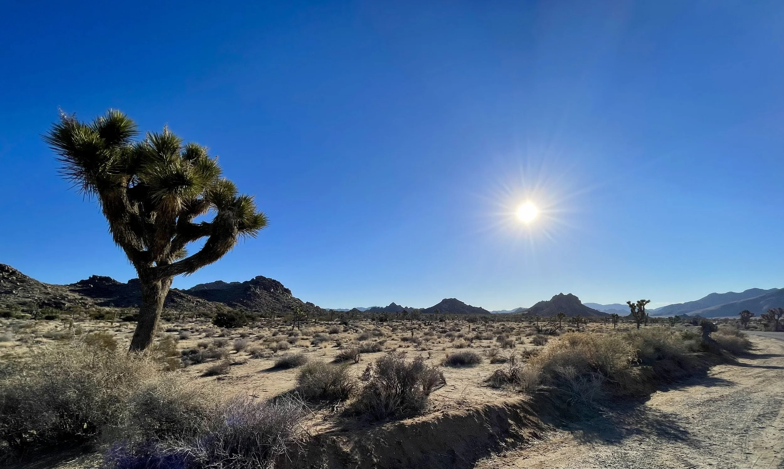
Located in southeastern California, Joshua Tree National Park spans over 790,000 acres, where the Mojave and Colorado Deserts converge. It’s a place of stark beauty, with twisted Joshua Trees (Yucca brevifolia) giving the park its name, as well as fascinating rock formations, rich wildlife, and some of the clearest night skies in the U.S.
The park is renowned for attracting rock climbers, hikers, and stargazers, all drawn to its sprawling landscape and beautiful vistas.
Notable Highlights
Joshua Trees: These unique trees with spiky, twisted branches are a signature of the park and a symbol of the American Southwest.
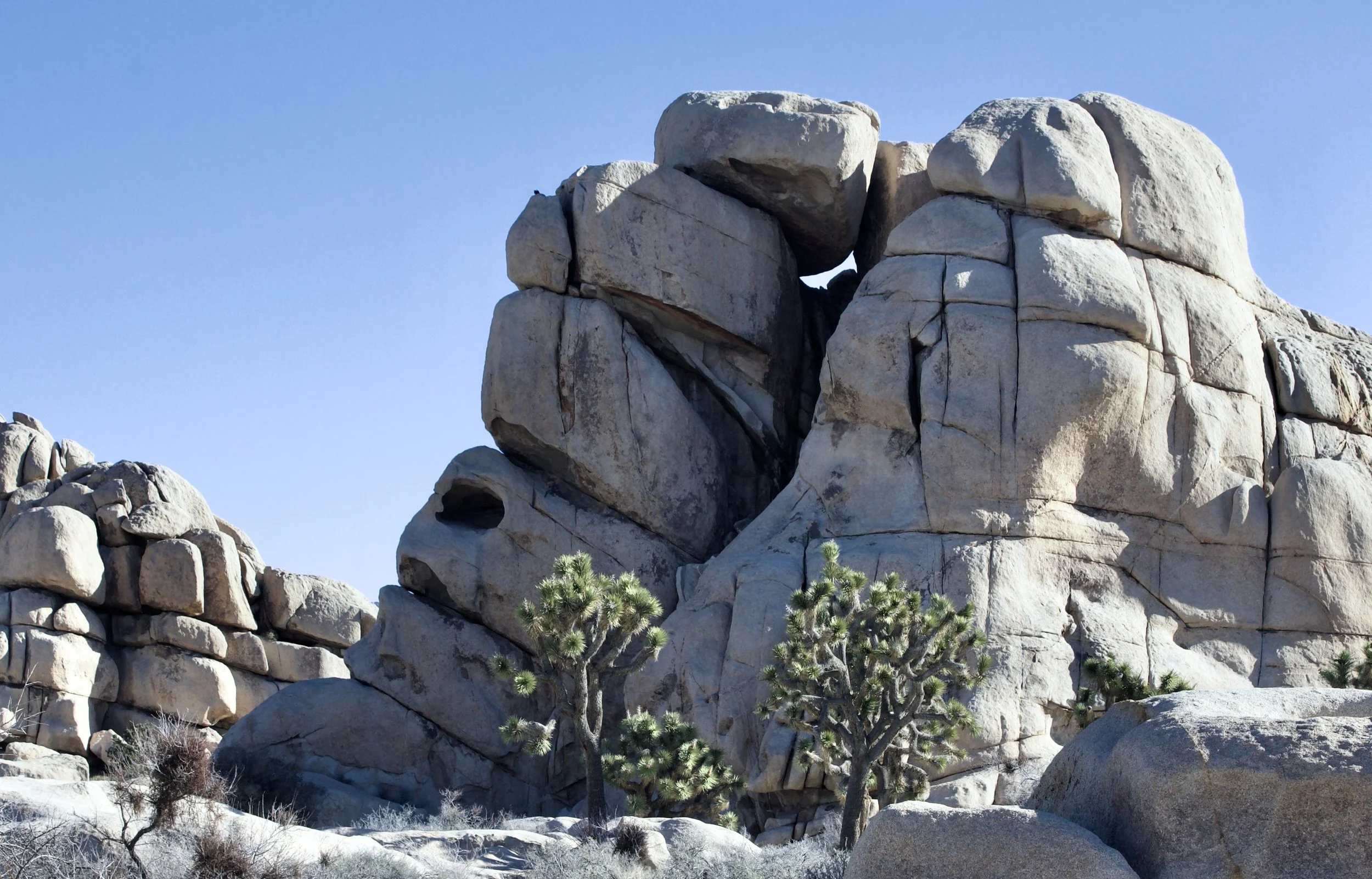
Rock Formations: The park is famous for its giant boulders and natural formations, like Skull Rock, Arch Rock, and Hidden Valley, which also double as prime rock climbing and photography spots.
Wildlife: Joshua Tree is home to desert tortoises, bighorn sheep, coyotes, and a variety of bird species. Of course, black widow spiders also reside here, though they’re not typically in the tourist hotspots!
Stargazing: As a Dark Sky Park, Joshua Tree offers exceptional stargazing, with minimal light pollution making it perfect for viewing the Milky Way and meteor showers.
Climate: The park has a desert climate with hot summers and chilly winters, especially in the mornings and evenings, so come prepared for varying temperatures.
Visitor Centers
There are 3 visitor centers around Joshua Tree:
Joshua Tree Visitor Center: Located just a mile from the park entrance, this is the main center, offering maps, information on hiking and climbing, and a gift shop.
Barker Dam Visitor Center: Located near Barker Dam, this center focuses on the park’s cultural history, including water sources and early human habitation.
Cottonwood Visitor Center: Found at the park’s southern entrance, this center offers information about the southern desert and its wildlife.
Park Fees
Vehicle Entrance Fee: $30 per vehicle, valid for 7 days.
Motorcycle Entrance Fee: $25 per motorcycle, valid for 7 days.
Individual Entrance Fee: $15 per person (on foot, bike, or horseback), valid for 7 days.
Annual Pass: $55 for unlimited entry for one year.
Additional fees may apply for special activities, and it’s worth checking the park’s website for up-to-date info on seasonal changes or closures.
Must-See Sights and Hikes
Joshua Tree offers a variety of trails and viewpoints, ranging from easy strolls to challenging treks. Here are a few of the park’s best sights:
Hidden Valley: This popular loop trail is an excellent introduction to the park’s rock formations and desert flora. It’s also a favorite spot for rock climbers.
Skull Rock: A quirky rock formation shaped like a skull, perfect for a quick photo op.
Keys View: One of the park’s best panoramic viewpoints, offering sweeping vistas of the Coachella Valley and, on clear days, even Mexico.
Cholla Cactus Garden: A surreal landscape filled with dense clusters of cholla cacti. It’s especially magical at sunrise or sunset.
Barker Dam: A relatively easy hike leading to a historic water reservoir built by early cattle ranchers. Depending on the season, you may even spot bighorn sheep near the water.
Arch Rock: A short hike to a natural rock arch, perfect for photographers and hikers.
Ryan Mountain: For a more challenging experience, this strenuous hike offers incredible 360-degree views from the summit.
Keys Ranch: A preserved 19th-century homestead offering guided tours that provide insight into the lives of early settlers.
Best Hikes by Difficulty
Easy Hikes:
Skull Rock Trail (1.7 miles, loop)
Cholla Cactus Garden Trail (0.25 miles, loop)
Hidden Valley Trail (1 mile, loop)
Barker Dam Trail (1.3 miles, loop)
Arch Rock Trail (1.4 miles, out & back)
Moderate Hikes:
Mastodon Peak Trail (3 miles, loop)
Lost Horse Mine Trail (4 miles, out & back)
Wall Street Mill Trail (2.4 miles, out & back)
Challenging Hikes:
Ryan Mountain Trail (3 miles, out & back)
Lost Palms Oasis Trail (7.5 miles, out & back)
Boy Scout Trail (8 miles, point-to-point)
Skull Rock
Best Photography Spots
For Sunrise:
Cholla Cactus Garden – The golden light creates a beautiful contrast with the cacti.
Keys View – A fantastic spot for catching the sun rising over the Coachella Valley.
For Sunset:
Hidden Valley – The rock formations glow as the sun sets.
Skull Rock – The evening light adds dramatic shadows, perfect for photos.
For Night Photography:
Arch Rock – The arch beautifully frames the Milky Way.
Hidden Valley – Ideal for astrophotography with minimal light pollution.
Belle or White Tank Campgrounds – These quieter spots offer great foreground elements for night shots.
Best Camping Spots
Joshua Tree’s campgrounds offer access to stunning views and great hikes:
Hidden Valley Campground: Popular among climbers and centrally located to major routes. First-come, first-served.
Jumbo Rocks Campground: A popular choice with massive boulders and great stargazing.
Belle Campground: A quieter option, perfect for astrophotography.
White Tank Campground: Remote and close to Arch Rock for great photography opportunities.
Cottonwood Campground: Located near the southern entrance, ideal for exploring the Lost Palms Oasis Trail.
The cost of camping at Joshua Tree National Park varies depending on the campground and whether you have a reservation. Here are the general rates:
Campground Fees:
$20 per night for standard campsites at most campgrounds (Hidden Valley, Jumbo Rocks, Ryan, Belle, White Tank, and Black Rock).
$25 per night for group campsites at locations like Cottonwood and Black Rock (for larger groups of 9–25 people).
Backcountry Camping:
Free (permits required for backcountry camping, which can be obtained at the park visitor centers).
Reservations:
Most campgrounds operate on a first-come, first-served basis, but a few campgrounds (like Cottonwood Springand Black Rock) accept reservations through Recreation.gov.
Jumbo Rocks and Hidden Valley can be especially busy during peak season (fall and spring), so it’s recommended to arrive early or secure a reservation.
Best Rock Climbing Spots
Intersection Rock – A classic destination with a variety of routes.
Echo Rock – Great for beginners with accessible climbs.
The Wonderland of Rocks – Remote and challenging, with fewer crowds.
Hemingway Buttress – Perfect for intermediate climbers looking for sport climbs.
The Split Rock Area – Offers cracks and face climbs for all levels.
There is no additional fee for rock climbing at Joshua Tree National Park beyond the standard park entrance fees. This includes access to all climbing areas within the park.
However, if you choose to hire a guide or take a guided climbing tour, those services will come with their own fees. Climbing schools and guide services, such as Joshua Tree Rock Climbing School, offer lessons and guided climbs for various skill levels, and pricing typically ranges from around $100 to $300 per person, depending on the duration and type of service.
It's important to note that climbing permits are not required for most climbing areas.
Best Wildlife Spotting Locations
Barker Dam Trail – A great spot to see bighorn sheep.
Keys View – Ideal for spotting birds of prey.
Cottonwood Spring – A desert oasis with migratory birds and bobcats.
Hidden Valley – A great spot for jackrabbits, coyotes, and desert tortoises.
Cholla Cactus Garden – At dawn or dusk, you might spot nocturnal creatures like kangaroo rats.
For the most up to date info on the park visit the National Park Service Website
#10 Everglade National Park, Florida
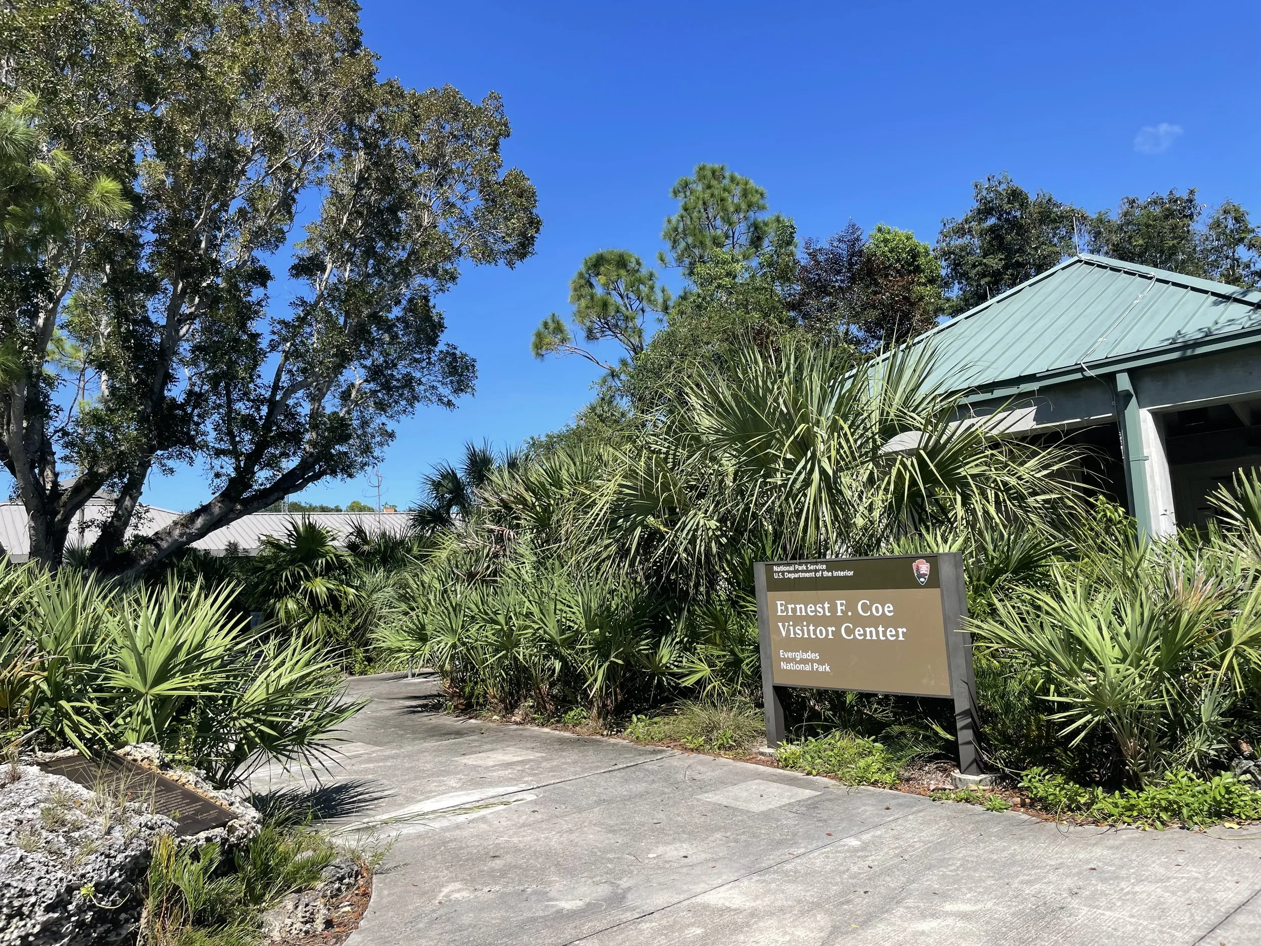
Having once lived in Florida, I had the privilege of exploring the Everglades on multiple occasions. I've fallen in, driven through, and flown over this vast wetland. I’ve even visited the Ernest F. Coe Visitor Center once, just to get my passport stamp. The Everglades are huge, even in their reduced size—once spanning approximately 11,000 square miles of South Florida, from Lake Okeechobee to Florida Bay. Though smaller now, the Everglades still offer an unparalleled wilderness experience.
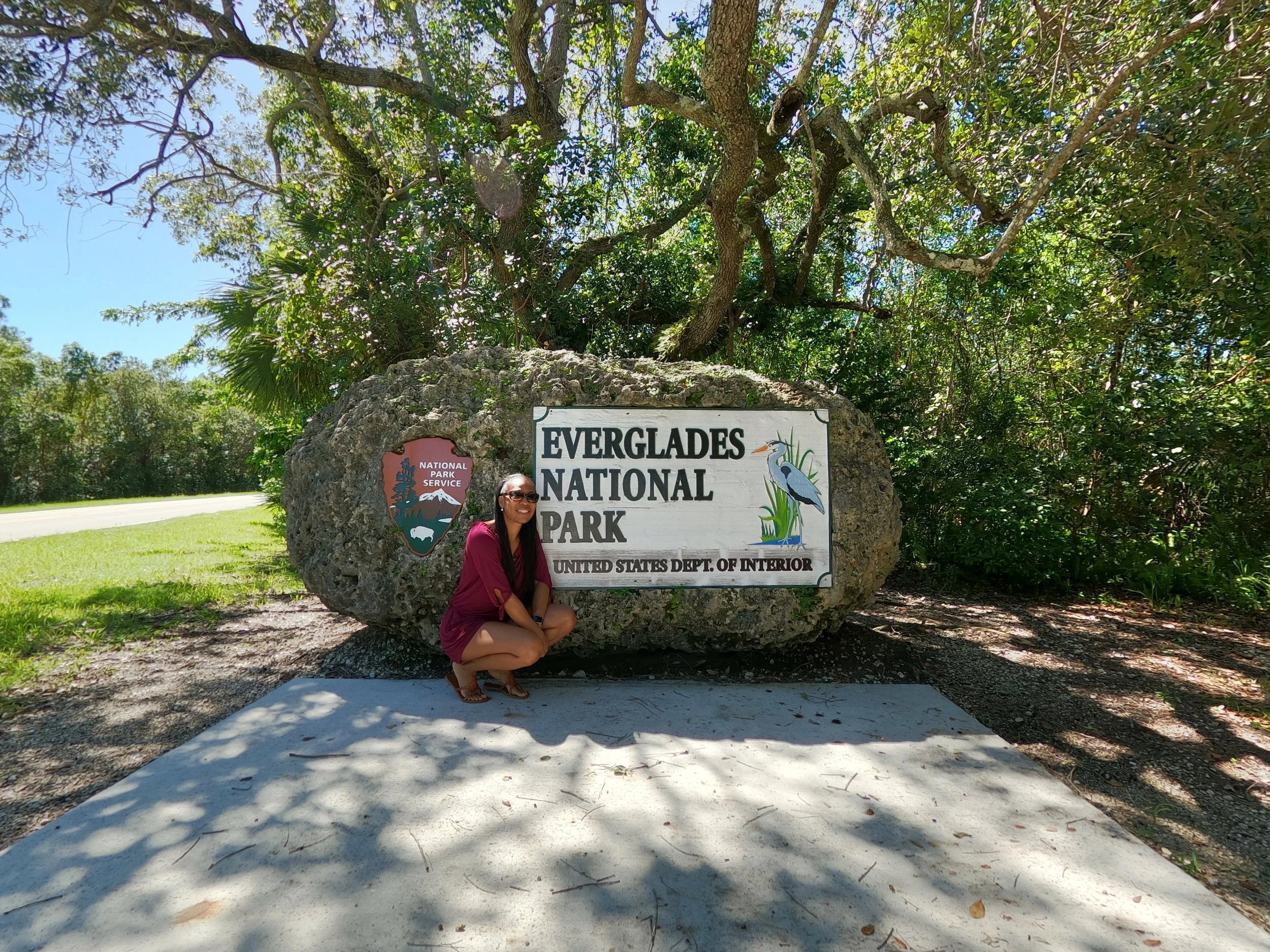
Everglades National Park, a UNESCO World Heritage Site and one of the most unique ecosystems in the world. This expansive park covers 1.5 million acres of wetlands, offering a rare and untouched environment where freshwater and saltwater meet. From dense mangroves to expansive sawgrass prairies and vibrant wildlife, the Everglades is a haven for outdoor exploration and discovery.
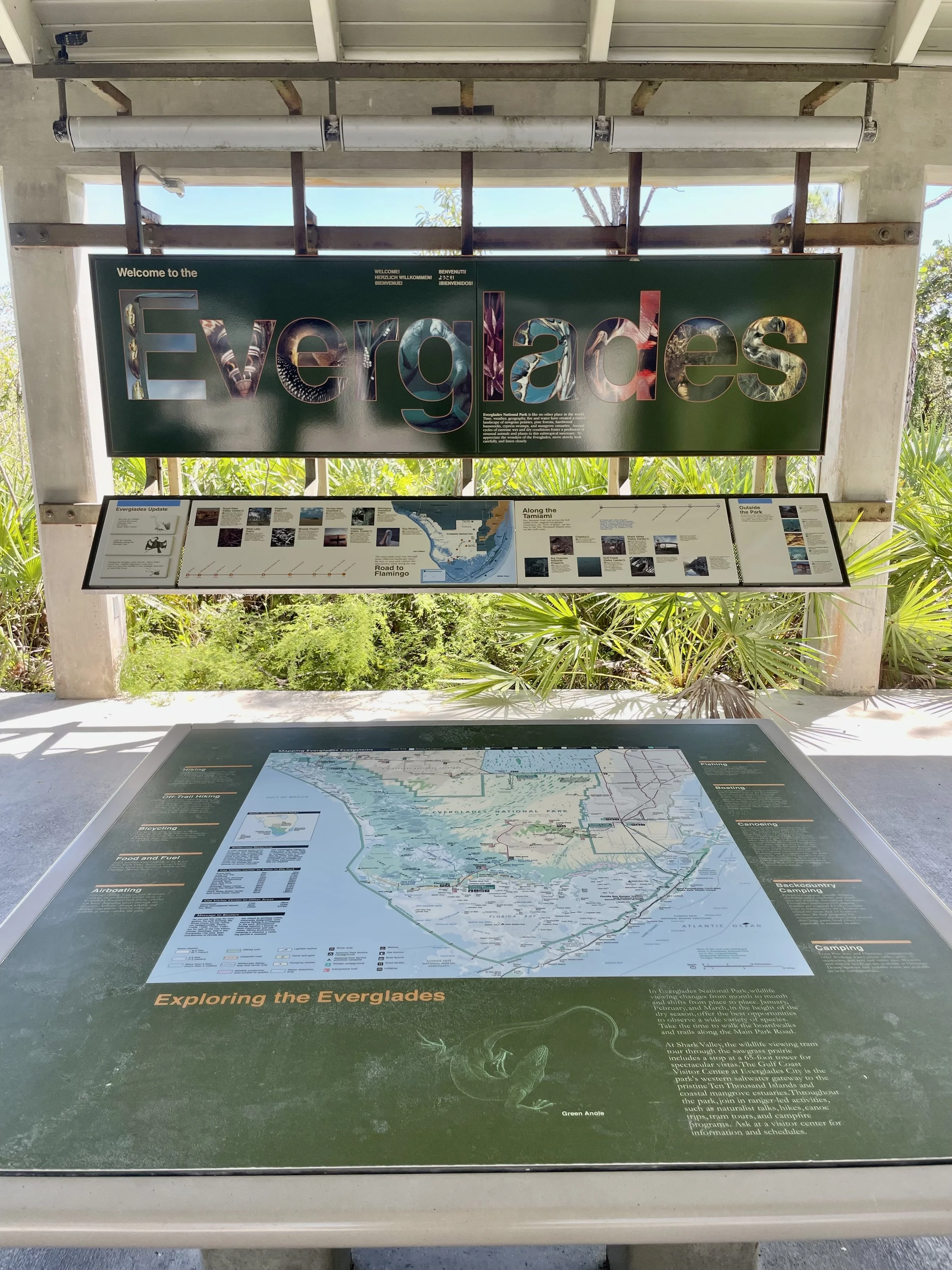
Planning Your Visit to Everglades National Park
With its vast size and diverse ecosystems, the Everglades offers something for everyone. Whether you’re exploring by foot, bike, or boat, each visitor center provides access to different parts of the park and a variety of adventures.
Best Time to Visit: The winter months (December to April) offer cooler temperatures, making it the ideal time for wildlife viewing. The summer months (May to November) are hot and humid, with a higher chance of rain and mosquitoes.
Park Entrance Fees: The entrance fee for a vehicle is $30, valid for seven consecutive days. An annual pass is available for $55.
Things to Bring: Be sure to wear sunscreen, comfortable walking shoes, and bring insect repellent (because those mosquitoes are vicious), especially in summer. Don’t forget a water bottle and a camera to capture the diverse wildlife and stunning landscapes.
Visitor Centers in Everglades National Park
To make the most of your visit, Everglades National Park features several visitor centers, each offering educational resources, maps, and opportunities to learn about the park’s history, wildlife, and conservation efforts. Below are the main centers you shouldn’t miss:
1. Ernest F. Coe Visitor Center (Main Entrance - Homestead)
Located at the park’s main entrance in Homestead, this is the ideal starting point for exploring the Everglades. Open daily, the center offers exhibits on the park’s wildlife, history, and unique ecosystems. You can also meet park rangers who can recommend trails, boat tours, and provide helpful advice on what to see based on the season. There's a small bookstore where you can grab educational materials and souvenirs to take home. Key Highlights:
Exhibits on the Everglades ecosystem.
Ranger-led programs and educational talks.
Access to the nearby Anhinga Trail, one of the most popular wildlife viewing areas in the park.
2. Shark Valley Visitor Center (North Entrance - Near Miami)
Situated at the northern entrance of the park, Shark Valley offers a unique perspective on the Everglades’ wetlands. This center is ideal for those interested in the abundant wildlife, including birds and alligators. Shark Valley is famous for its 15-mile-long loop road, which you can explore by tram, bike, or on foot, offering stunning views of the landscape. Key Highlights:
15-mile tram tour with guided commentary on local wildlife and plant life.
An observation tower offering a panoramic view of the Everglades.
A variety of wildlife, including alligators, birds, and turtles.
3. Gulf Coast Visitor Center (Everglades City)
Located on the park's western edge in Everglades City, this center gives access to some of the most serene and remote areas of the park, including the Ten Thousand Islands. It’s perfect for those who want to explore the coastal areas by boat. The visitor center provides information on guided boat tours, canoe rentals, fishing, and kayaking. Key Highlights:
Boat tours through the Ten Thousand Islands, a maze of islands and waterways teeming with wildlife.
Canoe and kayak rentals for exploring the waterways.
Exhibits on the region’s cultural history and local ecosystems.
4. Flamingo Visitor Center (Southern Entrance - Florida Keys)
Located in the southernmost part of the park, the Flamingo Visitor Center is your gateway to the Everglades’ tropical and coastal environment. Positioned on Florida Bay, Flamingo is a haven for birdwatchers, with opportunities to spot species like roseate spoonbills, pelicans, and even flamingos. It’s also a great place to rent kayaks or canoes and explore the mangrove forests or the bay. Key Highlights:
Canoe and kayak rentals for exploring the mangroves and coastal waters.
Ranger-led programs focusing on wildlife and conservation.
Access to Eco Pond and Mahogany Hammock, excellent locations for birdwatching and nature walks.
5. Royal Palm Visitor Center (Near Ernest F. Coe Entrance)
This smaller, quieter center is located near the Ernest F. Coe Visitor Center and is a great entry point to some of the park's most accessible trails. The Royal Palm Visitor Center serves as the starting point for the Anhinga Trail and Gumbo Limbo Trail, two of the park's most popular and easy-to-navigate paths. Key Highlights:
Anhinga Trail – A short, accessible trail known for its abundance of alligators and birdlife.
Gumbo Limbo Trail – A shaded loop trail offering views of the Everglades’ hardwood forests.
Educational programs on local flora and fauna.
Be sure to check the National Park website for any updates about the park.
#9 Biscayne National Park, Florida
Biscayne Bay National Park is located just south of Miami. At the heart of Biscayne Bay National Park lies its marine ecosystem. The park is home to over 170,000 acres of water, offering the perfect setting for a variety of aquatic adventures. Here, visitors can dive into a world teeming with life—coral reefs, seagrass beds, and mangrove forests support a rich variety of species, from colorful tropical fish to playful dolphins and graceful sea turtles.
Whether you’re snorkeling or scuba diving along the coral reefs, or simply kayaking across the calm waters, Biscayne Bay allows you to experience the underwater wonders up close. For a truly unique experience, consider exploring the shipwrecks scattered across the bay, which offer a glimpse into the area’s maritime history.
Visitor Center
The Visitor Center is conveniently located at the entrance to the park, just off Biscayne National Park’s scenic shoreline. Before heading out for your day of adventures pop in and grab a few maps, pick up souvenirs, and speak with park rangers about current conditions and activities. The Visitor Center also has exhibits that offer insight into the park’s diverse ecosystems and rich history.
Visitor Center Address: Biscayne National Park Visitor Center
9700 SW 328th St, Homestead, FL 33033
Fees and Hours
Visiting Biscayne Bay National Park is affordable, with no entrance fee required to access the park’s waters or land-based areas. However, some activities and services, like boat tours and camping, may have associated costs.
Visitor Center Hours: Open daily from 9:00 AM to 5:00 PM.
Boat Tours: Prices for boat tours vary based on the type of tour, so be sure to check the current schedule and fees.
Things To Do
Snorkeling & Scuba Diving: The park is home to one of the largest coral reef systems in the United States, making it a top spot for underwater exploration.
Kayaking & Paddleboarding: Paddle through the crystal-clear waters of the bay and explore the park’s scenic beauty at your own pace.
Boating: If you have access to a boat, you can explore the many islands and hidden coves that make up the park. There are also several boat tours available for those who prefer a guided experience.
Fishing: Biscayne Bay is a popular fishing destination, offering a chance to catch everything from snapper to tarpon.
Hiking & Picnicking: On Boca Chita Key and Elliott Key, you’ll find hiking trails and scenic picnic spots, perfect for a leisurely day in nature.
Wildlife Watching: The park is home to a variety of birds, manatees, and other wildlife, making it a great place for birdwatching and nature photography.
Best Time to Visit
The park is open year-round, but the best time to visit is typically during the winter and early spring months when the weather is cooler, and the crowds are smaller. If you plan to visit in summer, expect warmer temperatures and higher humidity, and mosquitos.
To help you navigate the park’s waters and trails, you can view and download the official Biscayne National Park map from the park's website. The map provides detailed information on the park’s islands, reefs, hiking trails, and boating routes, so you can make the most of your visit.
So grab your sunscreen, pack your camera, and set off on an adventure in one of Florida’s most beautiful national parks!
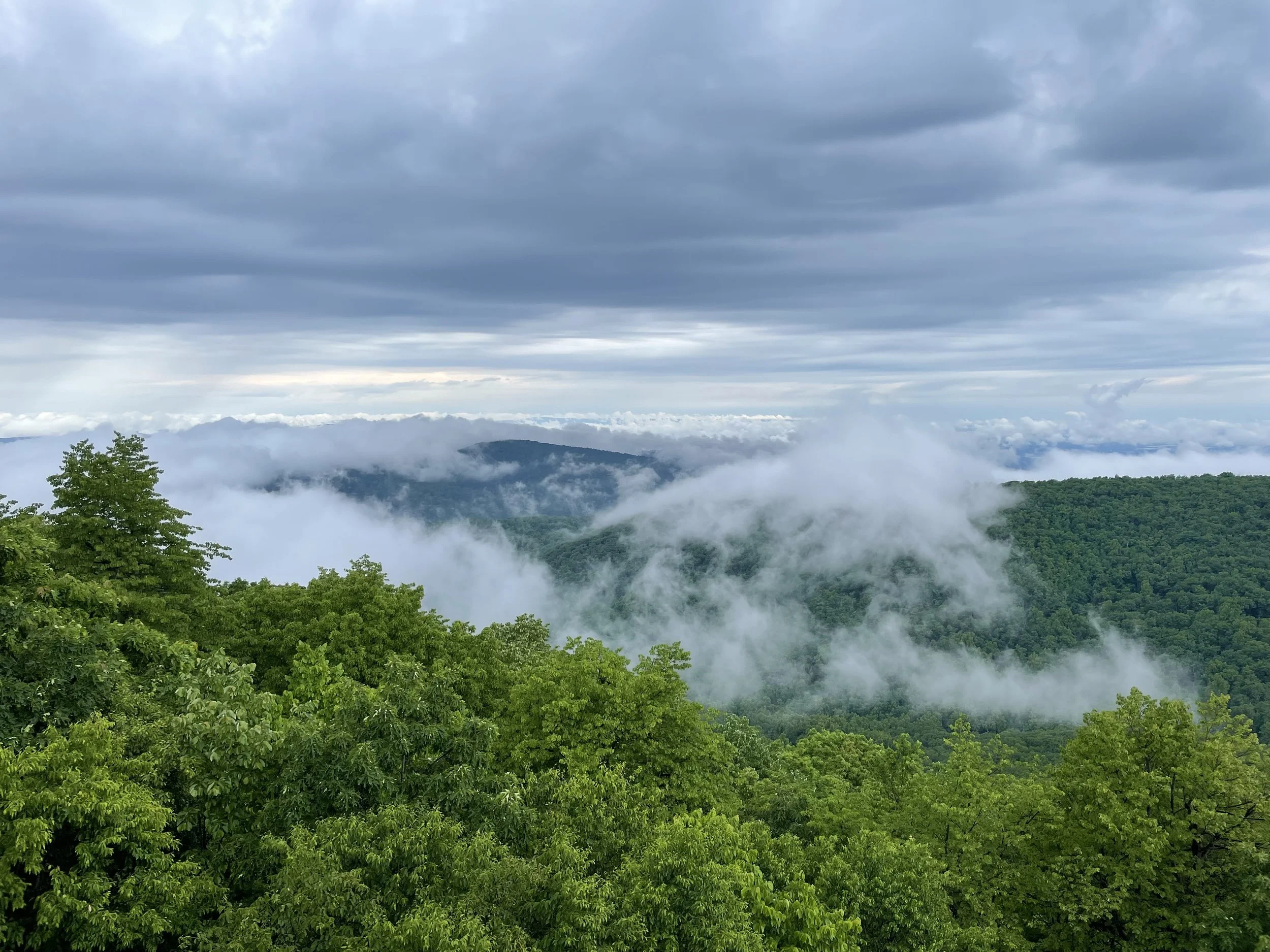
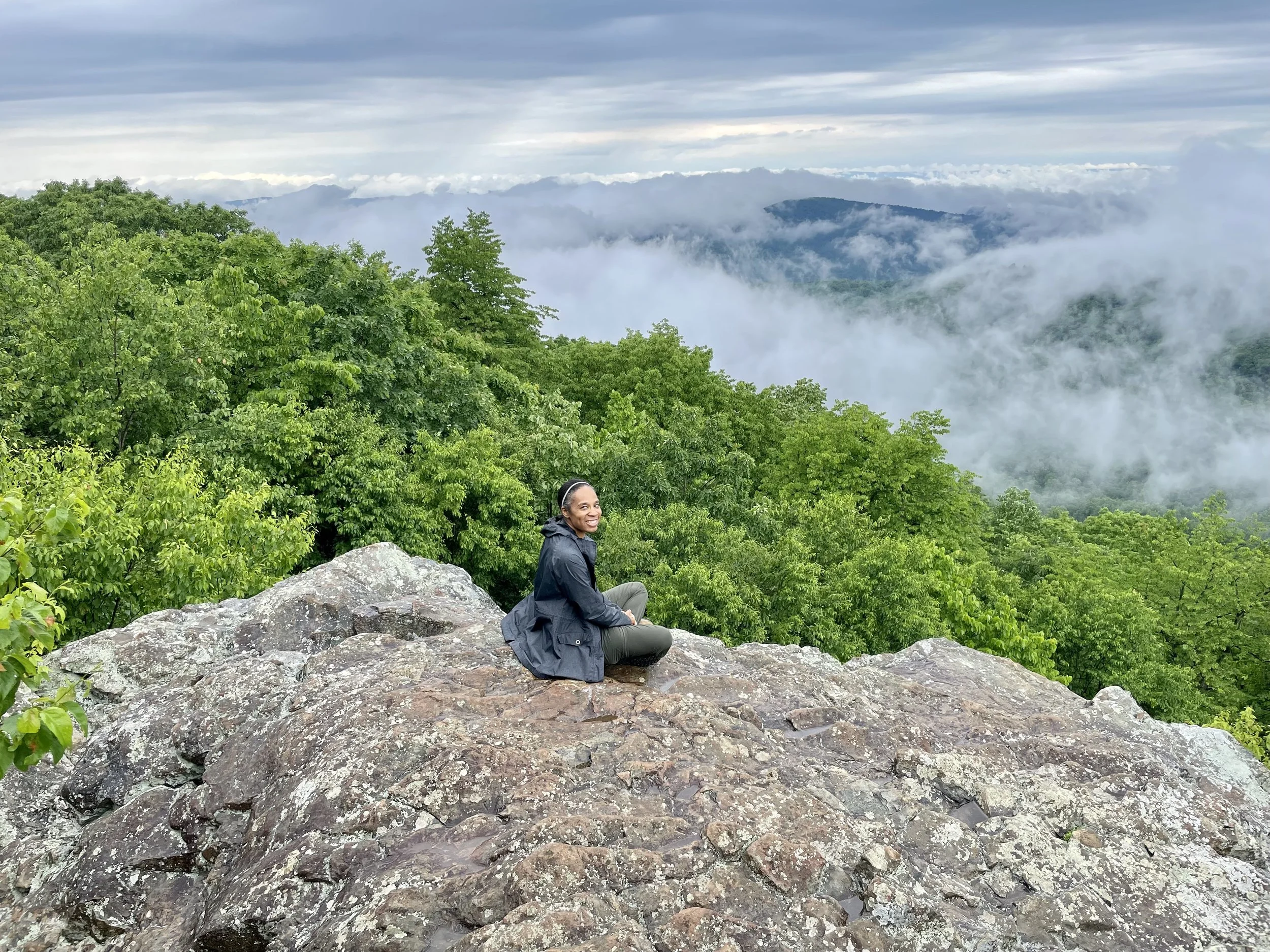
#8 Shenandoah National Park, Virginia
Shenandoah National Park is spectacular! Located in Virginia’s Blue Ridge Mountains, it is known for its stunning views, abundant wildlife, and miles of hiking trails—including a famous stretch of the Appalachian Trail (AT).
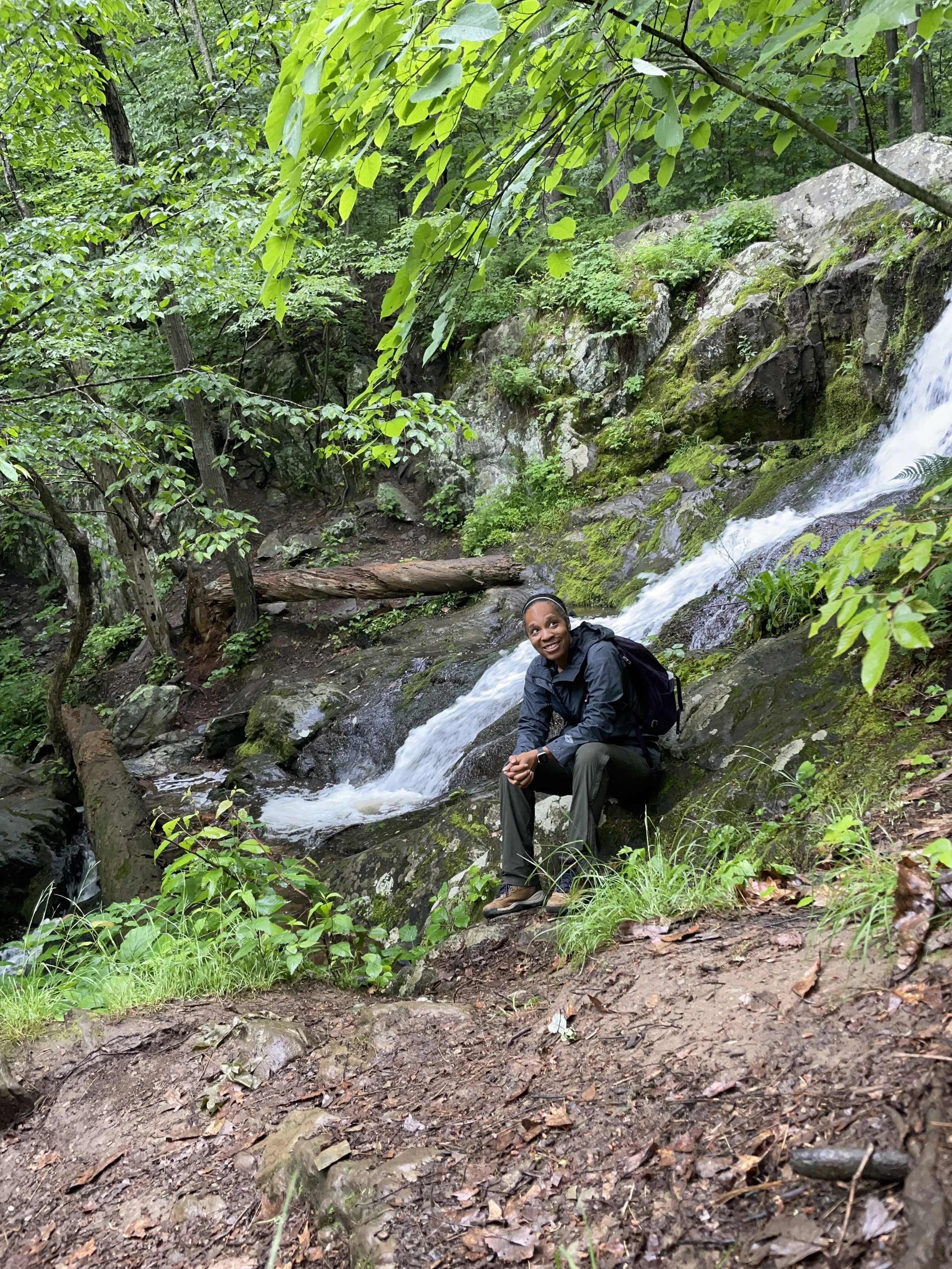
The day I visit to Shenandoah, the weather didn’t exactly cooperate—it was a drizzly June day. Clouds hung low over the valley giving the park a moody and magical feel. The air was filled with the earthy scent of wet trees and soil.
Before heading off to explore, I made my obligatory stop in front of the famous Shenandoah National Park entrance sign for a quick photo. After all, no visit to a national park is complete without taking that shot!
Next, I drove to the visitor center, but unfortunately, it was closed when I arrived. Undeterred, I spent about 45 minutes strolling around the grounds, taking in the peaceful views over the valley. Once the center opened, I eagerly headed inside, National Park passport in hand, and made a beeline for the cancellation stamps—another must have souvenir from my national park visits!
Cancelation stamp secured, I spoke briefly with a ranger to get trail recommendations. They highlighted several areas on the provided maps and I was off.
The Shenandoah National Park Visitor Center is located in Big Meadows. The center is a great place to get maps, advice, and any updates on trail conditions, especially important if you’re hiking in rainy weather. The staff is friendly and always ready to help you plan your visit!
Visitor Center Address:
Shenandoah National Park Visitor Center
3655 US Highway 211 East
Luray, VA 22835
Fees:
Vehicle Entrance Fee: $30 per vehicle (valid for 7 days)
Motorcycle Entrance Fee: $25
Pedestrian/Bicycle Entrance Fee: $15
If you’re planning to explore the park over multiple days, there’s also an annual pass available for $55, which is a great deal if you plan on returning or visiting other national park.
Hitting The Trails
One of the best ways to experience Shenandoah is by hiking a portion of the Appalachian Trail, which runs through the park. On my hike, I encountered a few through hikers trekking north on the AT. These determined souls were braving the wet conditions as they made their way along this famous long-distance trail, which stretches all the way from Georgia to Maine. Seeing them in the rain gave me a real sense of what the trail is all about—a true test of endurance and spirit. While wet and a bit smelly, they were kind people.
A Peaceful and Quiet Escape
On a rainy day, Shenandoah’s beauty is amplified by the solitude and quiet it brings. There’s something incredibly peaceful about wandering through the misty woods, listening to the sound of raindrops hitting the leaves, and taking in the lush greenery all around. Whether you're hiking, driving along Skyline Drive, or simply sitting and enjoying the view, the park offers an unforgettable, tranquil experience.
I hiked to one of the ridges, sat down and took in the wonder that was all around me. Keeping safety and the wet conditions in mind I did not get to close to the edge. I wanted to return home with memories and nothing more. I did somehow mange to scratch myself on the edge of one of the rocks while crawling off the ridge. The resulting scar forever reminds me of my beautiful afternoon at the park.
Final Thoughts
I’m sure sunny days in Shenandoah are lovely, however there’s something special about experiencing the park on an overcast day. The Appalachian Trail, the misty views, and the peaceful solitude made my visit unforgettable. So, if you’re planning a trip to Shenandoah, don’t let a little rain scare you off. Whether you’re a hiker, photographer, or nature lover, Shenandoah National Park has something special waiting for you.
#7 Cuyahoga Valley National Park, Ohio
Cuyahoga Valley National Park, located between the cities of Cleveland and Akron in Ohio, is a peaceful retreat that offers a lush, scenic escape into nature. This 33,000-acre park features a rich mix of forests, wetlands, and meadows, with the Cuyahoga River winding through its heart. One of the park’s most stunning attractions is the iconic Brandywine Falls, a 65-foot waterfall that draws visitors for its beauty and tranquility. The park is also home to numerous hiking and biking trails, including the populaNestled between Cleveland and Akron, Ohio, Cuyahoga Valley National Park offers a peaceful escape into nature, spanning over 33,000 acres of forests, wetlands, and meadows. The park’s centerpiece is the Cuyahoga River, adding to its serene beauty. One of its most captivating features is Brandywine Falls, a breathtaking 65-foot waterfall that captivates visitors with its tranquil charm and picturesque setting. The water flow at the falls varies depending on the season.
The park has a network of hiking and biking trails, with the Ohio & Erie Canal Towpath Trail being one of the most popular. This trail follows the historic canal route that once connected Lake Erie to the Ohio River, providing a glimpse into the region’s past. Whether you’re seeking a leisurely stroll, a bike ride, or simply to immerse yourself in nature’s beauty, Cuyahoga Valley has something for everyone.
Nature enthusiasts will be delighted by the park’s diverse wildlife, and birdwatching is a particularly popular activity, especially during migration seasons. Cuyahoga Valley also offers a rich cultural heritage, with various historical sites and remnants of the canal’s history scattered throughout the landscape.
Entrance Fees
Cuyahoga Valley National Park is an accessible destination for all visitors, as it doesn’t charge an entrance fee. However, fees may apply for specific activities or services within the park, such as guided tours or parking in certain areas. For more information on fees, special events, and updates, please visit the official Cuyahoga Valley National Park website. https://www.nps.gov/cuva/index.htm
The Boston Mills Visitor Center is conveniently located at 6947 Riverview Rd, Peninsula, OH 44264.
#6 Gateway Arch National Park, Missouri
Gateway Arch National Park, located in the heart of St. Louis, Missouri, is an iconic symbol of America's westward expansion and the nation's pioneering spirit. As one of the few national parks located in an urban area, it combines natural beauty with historical significance, offering visitors a unique chance to connect with America's past while enjoying the sights and sounds of the present.
At the heart of the park stands the stunning Gateway Arch, a 630-foot stainless steel monument that holds the title of the tallest arch in the world. This architectural marvel is a tribute to the exploration, migration, and settlement of the American frontier, marking the Gateway to the West.
Scenic Trails and Walking Paths
The park offers more than just a view of the Arch. The surrounding grounds feature lush green spaces and scenic walking paths that lead visitors through tranquil areas with beautiful views of the Arch and the Mississippi River. Whether you're walking along the riverfront or taking a break in the park's peaceful green areas, there's plenty to enjoy on foot.
Tram Ride to the Top of the Arch
For those looking to experience Gateway Arch from a new perspective, a tram ride to the top is a must-do. The tram takes visitors to the top of the Arch for stunning panoramic views of St. Louis and the mighty Mississippi River. Along the way, you’ll get a brief pre-boarding tour that shares fascinating details about the history of the Arch and the city.
The tram ride itself lasts about 45 to 60 minutes, and ticket prices vary depending on the time of your visit:
Adult: $15 - $19
Child (ages 3–15): $11 - $15
America the Beautiful Pass holders: $12 - $16
Historical Sites and Museum
The Gateway Arch is more than just a monument; it’s part of a rich historical narrative that spans centuries. The park is home to a museum where visitors can delve into the region’s past, with exhibits about the Lewis and Clark Expedition and the American frontier. Additionally, several national monuments and historic sites surround the Arch, such as the Old Courthouse and the Underground Railroad Freedom Network, offering even more layers of history to explore.
Plan Your Visit
The park grounds and the museum are free to visit, making it an accessible and budget-friendly destination for anyone interested in American history and stunning architecture. Whether you're taking a walk through the park, heading to the top of the Arch, or exploring the museum, Gateway Arch National Park is a must-see for anyone in the St. Louis area.
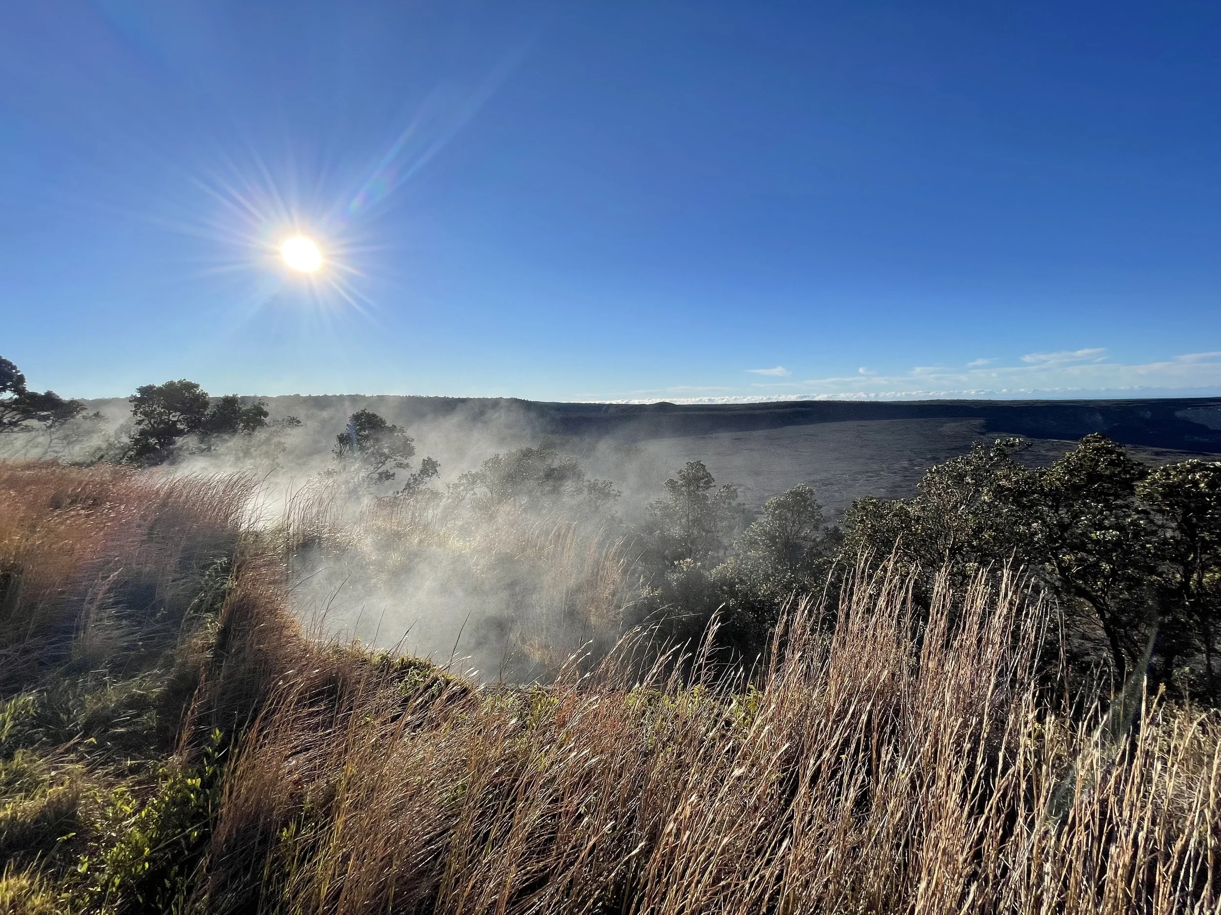
#5 Hawai'i Volcanos National Park, Hawaii
Hawai’i Volcanoes National Park, situated on the Big Island of Hawaii, is a truly captivating destination that offers an awe-inspiring glimpse into the raw power of Earth’s geology. Nestled within the park’s boundaries are two of the world’s most active volcanoes, Kīlauea and Mauna Loa, providing visitors with an opportunity to witness volcanic activity firsthand. From the steam vents that belch forth hot gases to the mesmerizing flow of molten lava and the awe-inspiring beauty of its craters, the park presents a unique landscape that captivates the senses.
The park’s diverse landscapes range from lush rainforests teeming with life to dramatic, lava fields that stretch as far as the eye can see. This makes it an ideal destination for exploration, offering a variety of activities to suit different interests. Hikers can venture into the hardened lava tubes, while those seeking a more leisurely pace can stroll along the rim of Kīlauea’s caldera. Additionally, visitors can immerse themselves in the unique ecosystems that thrive in this constantly evolving environment, encountering a rich tapestry of flora and fauna.
Beyond its geological wonders, Hawai’i Volcanoes National Park holds deep cultural significance for Native Hawaiians, who have long regarded this land as sacred. The park’s volcanic scenery, eruptions, and rich history offer an opportunity for visitors to learn about the profound connection between the Hawaiian people and their ancestral home.
As of 2023, the entrance fee to the park is $30 per vehicle for a 7-day pass. For individuals on foot or by bicycle, the fee is $15 per person for a 7-day pass. Additionally, the National Park Service offers an annual pass for the park at $55. Furthermore, if you possess a National Park Pass (America the Beautiful Pass), you can enter the park for free, as it covers all national park entrance fees. However, it’s important to reference the official website for any updates or changes in the fee structure. https://www.nps.gov/havo/index.htm
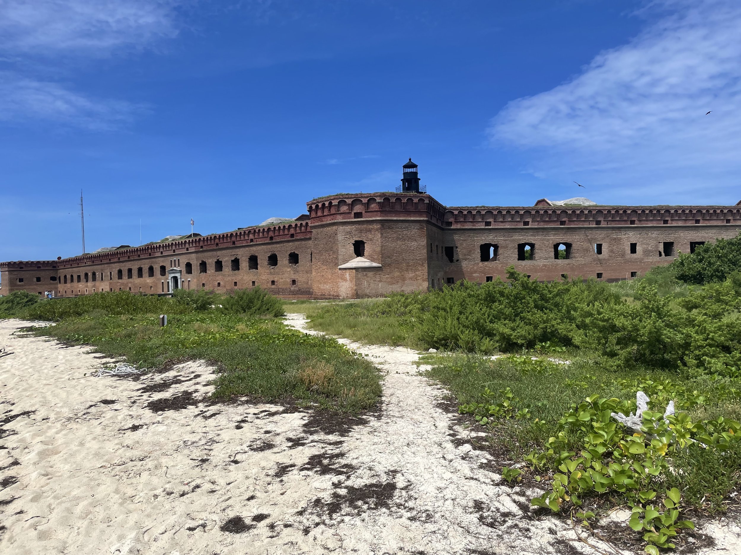
#4 Dry Tortugas National Park, Florida
Dry Tortugas National Park is a remote and enchanting paradise located about 70 miles west of Key West, Florida, and can only be reached by boat or seaplane. If you have a National Park Pass, don’t forget to bring it—there’s a discount on the ferry ride! The Yankee Freedom, operated by the National Park Service, is a high-speed catamaran that departs daily from Key West. The ferry ride is a pleasant 2.5-hour journey, making the trip to the islands an enjoyable experience.
The park consists of seven small islands, with Garden Key being the standout, home to the historic Fort Jefferson—a massive 19th-century coastal fortress.
The surrounding waters are a treasure trove of marine life, making Dry Tortugas a perfect spot for snorkeling, diving, and birdwatching. Shipwrecks lie beneath the azure depths, while the shores serve as nesting grounds for seabirds. Whether you’re drawn to the fort’s fascinating history, captivated by the vibrant underwater world, or just seeking peace on a secluded beach, Dry Tortugas offers a wonderful mix of natural beauty and cultural heritage.
A few things to keep in mind: There are no bathrooms at Fort Jefferson! However, there are toilets available on the ferry for use during the trip.
As for the name “Dry Tortugas,” it comes from a mix of Spanish and the natural features of the park. The word “Tortugas” means “turtles” in Spanish, referring to the sea turtles early explorers found in abundance around the islands. The “Dry” part refers to the lack of fresh water on the islands, making them “dry” compared to other, more fertile places. So, “Dry Tortugas” basically means “dry turtles,” a nod to both the sea turtles and the absence of fresh water on the islands.
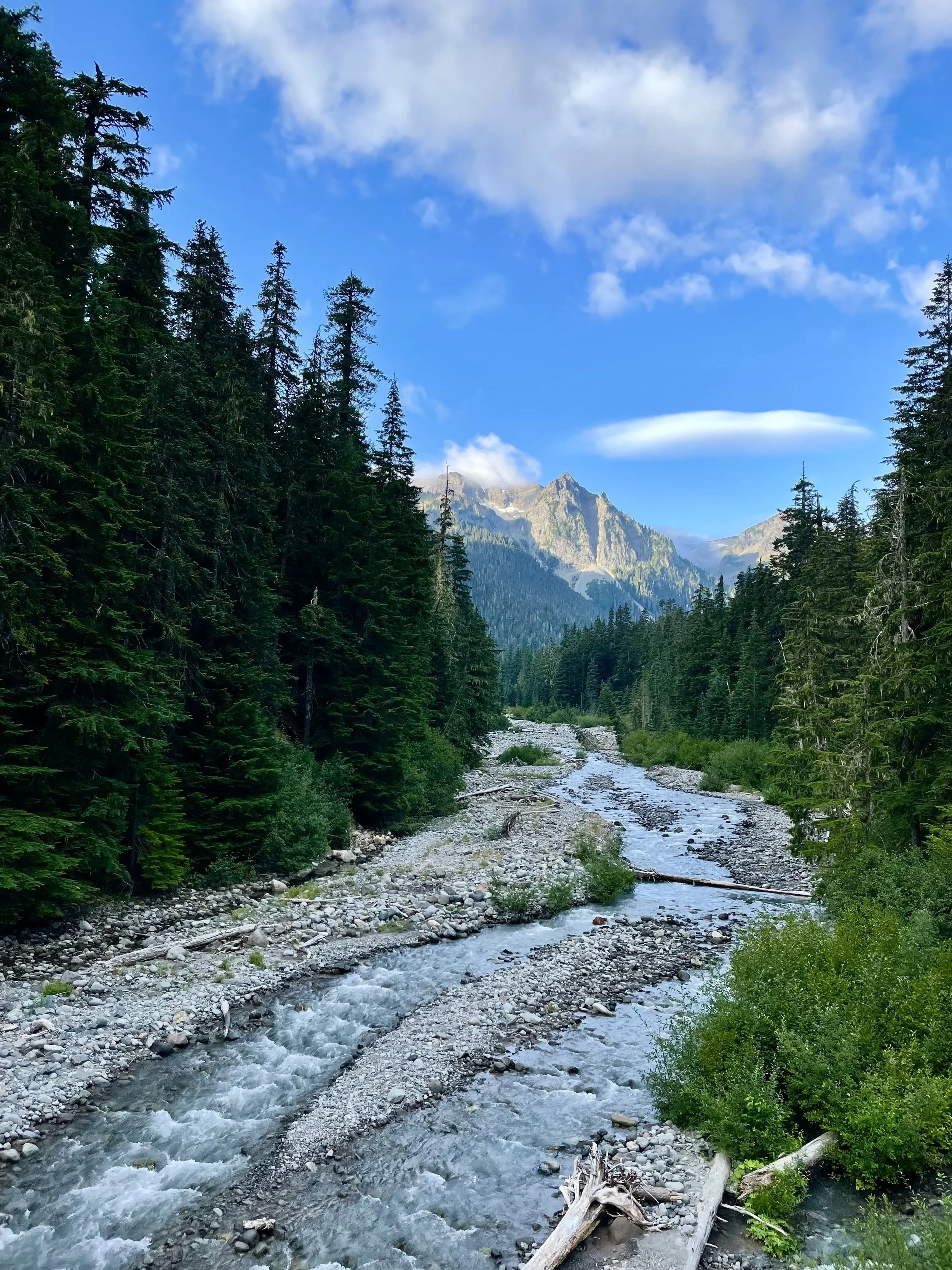
# 3 Mount Rainier National Park, Washington
In August 2021, I visited Mount Rainier National Park in Washington State, during the height of the COVID pandemic. The park, renowned for its iconic snow-capped peak, Mount Rainier, was surprisingly less crowded. The usual long lines at the entry gate and the sight of cars on the road were a fraction of what they normally are.
Mount Rainier National Park is a breathtaking destination, centered around the majestic Mount Rainier. Standing tall at 14,411 feet, it is the tallest mountain in Washington and a prominent feature of the landscape, visible from miles away. The park encompasses a diverse range of ecosystems, including lush old-growth forests, alpine meadows, glaciers, and rugged volcanic terrain.
With over 260 miles of hiking trails, visitors can embark on various adventures. Some trails lead to breathtaking viewpoints, cascading waterfalls, or wildflower-filled meadows, while others offer panoramic vistas from high altitudes. Mount Rainier is also home to a rich variety of wildlife, including black bears, elk, and mountain goats, making it a haven for nature enthusiasts.
Whether you seek challenging hikes, scenic drives, or simply immerse yourself in the peaceful surroundings, Mount Rainier National Park offers an awe-inspiring experience that perfectly captures the wild beauty of the Pacific Northwest.
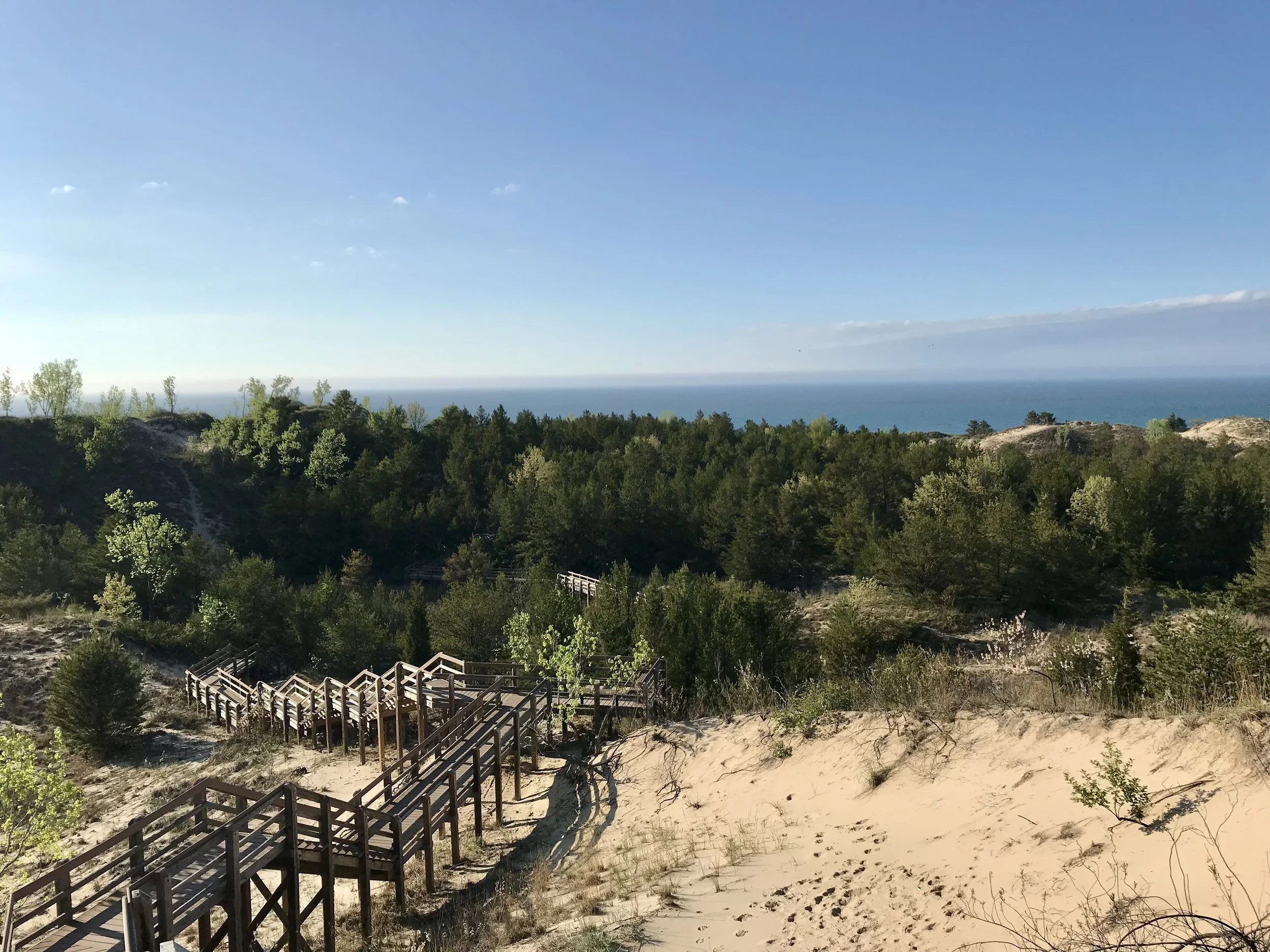
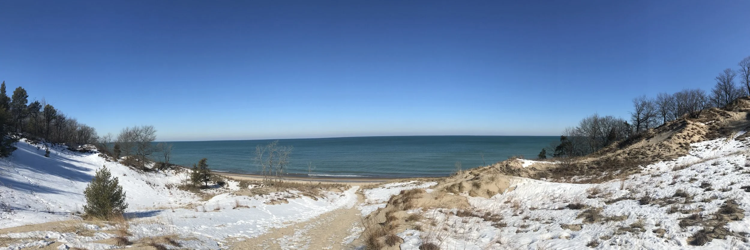
# 2 Indiana Dunes National Park, Indiana
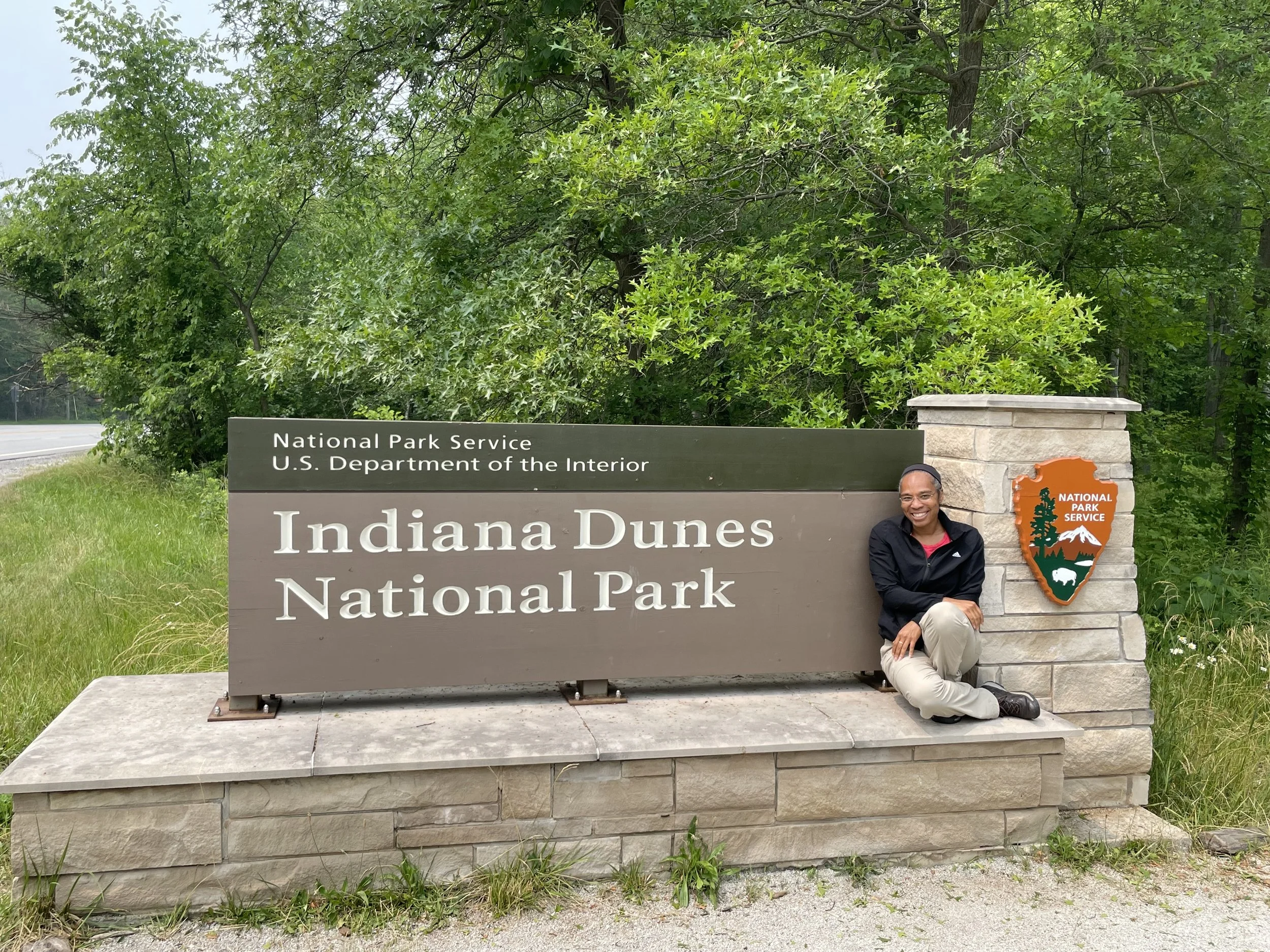
I started visiting Indiana Dunes before it officially became a national park. Back then, it was just Indiana Dunes State Park—a favorite local escape with a loyal following. These days, the area is split between sections managed by the Indiana Department of Natural Resources and others operated by the National Park Service.
Indiana Dunes is my “local” national park. It’s only a 45-minute to one-hour drive from Chicago, which makes it perfect for a quick getaway when I need a break from the city. I’ve collected at least three passport stamps over the years and was genuinely excited when they finally put up a proper national park sign. Naturally, I had to stop for a photo. I’ve visited the Dunes in every season, and it’s beautiful year-round—from snow-covered trails to sun-soaked beaches.
There’s a challenge here called the Diana of the Dunes Dare—a short but intense hike that takes you up the park’s three tallest sand dunes in a loop. It’s named after Alice Gray (aka “Diana of the Dunes”), a Chicago native who famously left city life behind in the early 1900s to live off-grid in the dunes and advocate for their preservation. I’ve hiked it several times over the years, and without fail, there’s always some industrious person running the trail loop multiple times. These days, I still enjoy sandy hikes in the summer and crisp bike rides through the park’s trails in fall.
A Bit About the Park
Located along the southern tip of Lake Michigan, Indiana Dunes National Park became the 61st national park in the U.S. in 2019. But the fight to protect this area started long before that. Conservationists first pushed to preserve the dunes in the early 20th century, recognizing the unique mix of ecosystems and the rare biodiversity here. What resulted is one of the most ecologically diverse national parks in the country—with over 1,100 native plant species packed into just 15,000 acres.
The park stretches across 15 miles of Lake Michigan shoreline and includes beaches, forests, wetlands, prairies, and—of course—dunes. Some tower over 120 feet high.

Indiana Dunes Visitor Center
Visitor Centers
There are two main visitor hubs:
Indiana Dunes Visitor Center (📍1215 N State Road 49, Porter, IN 46304) – This is the main National Park Service visitor center and your go-to for maps, passport stamps, ranger advice, and exhibits. The parking lot is large, and it’s close to the highway.
Indiana Dunes State Park Nature Center (📍1600 N 25 E, Chesterton, IN 46304) – Operated by the state, this center offers nature programs and additional hiking resources. It’s located deeper into the state park side, so it’s a good stop if you’re heading to the beach or the trails from that entrance.
Fees & Passes
Indiana Dunes National Park charges a $25 per vehicle entrance fee, valid for 7 days.
If you have the America the Beautiful pass, you’re covered for the NPS sections.
Indiana Dunes State Park charges a separate entrance fee of $7 (IN residents) or $12 (non-residents) per car.
If you’re planning to visit both in the same day, just be aware that you’ll be paying both fees unless you have the appropriate pass.
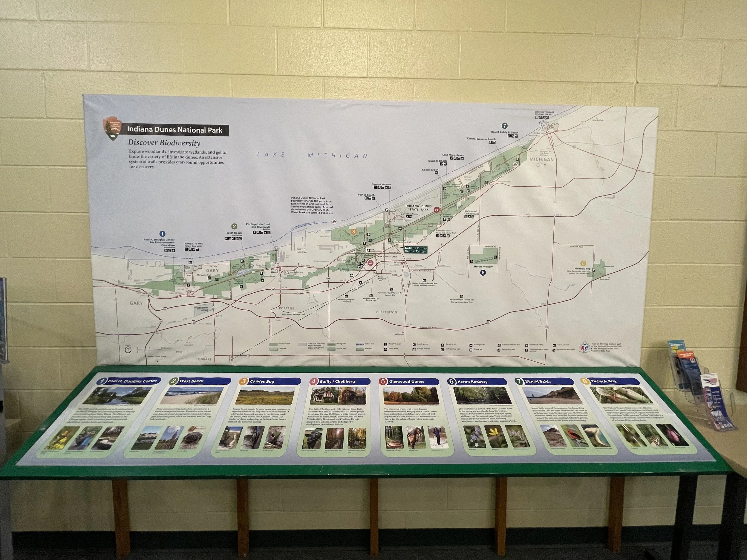
Most Visited Areas
West Beach – Probably the most developed area of the national park. There’s a beach, bathhouse, picnic area, and a few solid trail options. Expect crowds in summer.
Dune Succession Trail – A favorite short hike (0.9 miles) that climbs stairs through the dunes and gives you a great view of the lake and Chicago skyline on clear days.
Mount Baldy – One of the tallest dunes in the park. You can view it from a distance or join a ranger-led tour to climb it.
Portage Lakefront & Riverwalk – A newer addition, offering a boardwalk, fishing pier, and lake views.
Cowles Bog Trail – A more rugged trail through wetlands, forests, and dunes. Around 4.7 miles round-trip and one of the more diverse hikes in the park.

Best Hikes
Diana of the Dunes Dare (3 Dunes Challenge – State Park side)
This short but strenuous hike takes you up three of the tallest dunes in the park. It’s just 1.5 miles long, but the elevation changes make it a real leg-burner. Named in honor of Alice Gray (aka “Diana of the Dunes”), a local legend who fought to preserve the area and famously lived in a dune shack in the early 1900s.
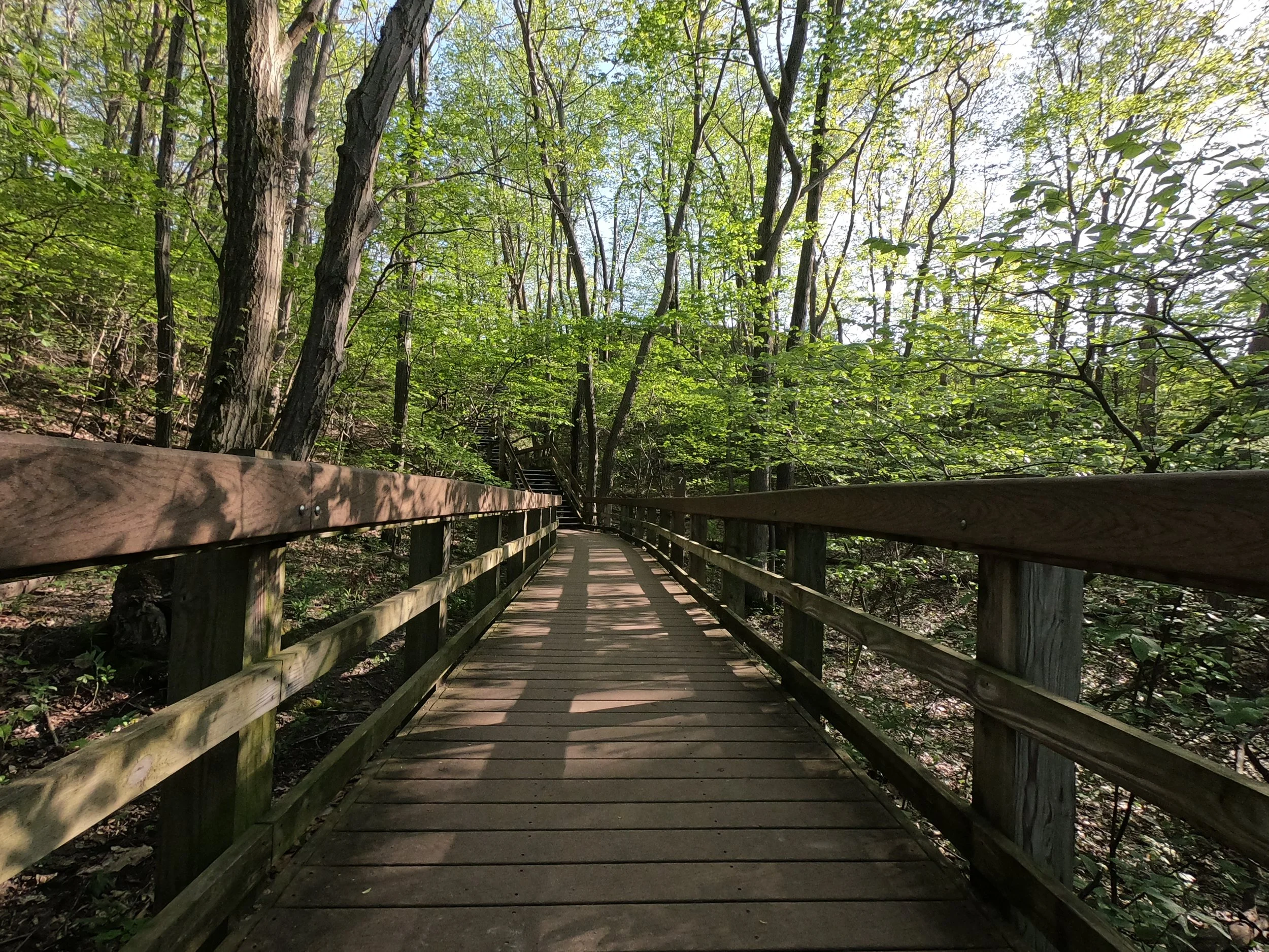
Heron Rookery Trail
A peaceful woodland trail especially nice in spring when the wildflowers bloom. Around 3.3 miles out-and-back.
Paul H. Douglas Trail (Miller Woods)
This lesser-visited trail starts near Gary, Indiana, and offers a great look at dunes, oak savanna, and wetlands. Ends at the beach.
Best Places to Take Photos
The National Park sign near the main entrance (yes, finally!)
Top of the Dune Succession Trail staircase at West Beach
Mount Baldy overlook at sunset
Along the boardwalks at Portage Lakefront or Cowles Bog
The 3 Dunes Challenge summit—bonus points if you’re sweaty and smiling
Accessibility
The Indiana Dunes Visitor Center is fully accessible.
West Beach has beach mats in the summer and accessible picnic areas.
Some trails (like Portage Lakefront’s boardwalk and parts of West Beach) are wheelchair- and stroller-friendly.
The park offers beach wheelchairs on a first-come, first-served basis at some locations.
Other Helpful Info
Parking lots fill up fast on hot weekends—arrive early if you’re planning a beach day.
There are train options from Chicago (via the South Shore Line), which drop you near some park sections if you want to skip the drive.
Swimming is allowed at multiple beaches but there are no lifeguards. Conditions can change quickly, so pay attention to the safety flags.
Tick season is real. Wear bug spray and do a quick check after hikes, especially in wooded or marshy areas.
Indiana Dunes may not be the most dramatic national park in the system, but it’s one of the most accessible—and for me, one of the most personal. Whether I’m walking the trails solo in early spring or catching a warm summer sunset by the lake, it always offers a moment of stillness and a break from city life. And sometimes, that’s exactly what you need.
#1 Mammoth Caves National Park, Kentucky
This is where my tour of the US National Parks began.
Mammoth Cave wasn’t the first national park I’d ever visited, but it’s where my national park journey really started. This is the park where I bought my first Passport to the National Parks—the small one. I didn’t know at the time how many parks I’d eventually visit, but that little book turned into something much bigger. (I upgraded to the larger version not long after.)
I visited in May 2021, when COVID restrictions had eased a bit but things were still in that weird, in-between phase. I was tired of being stuck in the house, so I decided to make the 6.5-hour drive from Chicago to Bowling Green, Kentucky. It’s the closest decent-sized city near the park, and I crashed there for the night before heading out early the next morning.
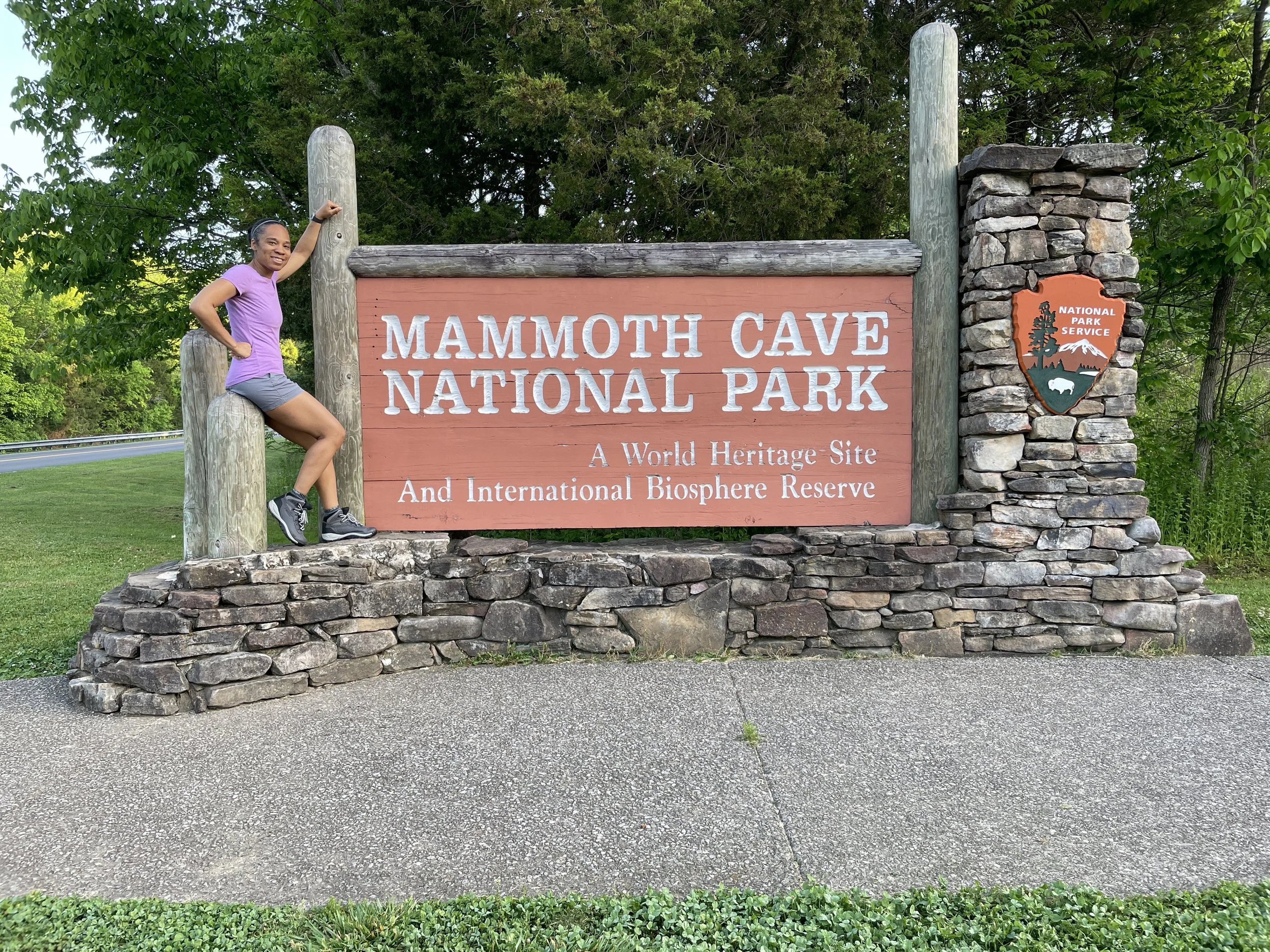
I arrived at the park about an hour before the visitor center opened. I used the time to wander the grounds, take a few photos, and just enjoy the quiet. This was actually the first national park sign I ever took a picture next to, which feels fitting in hindsight.
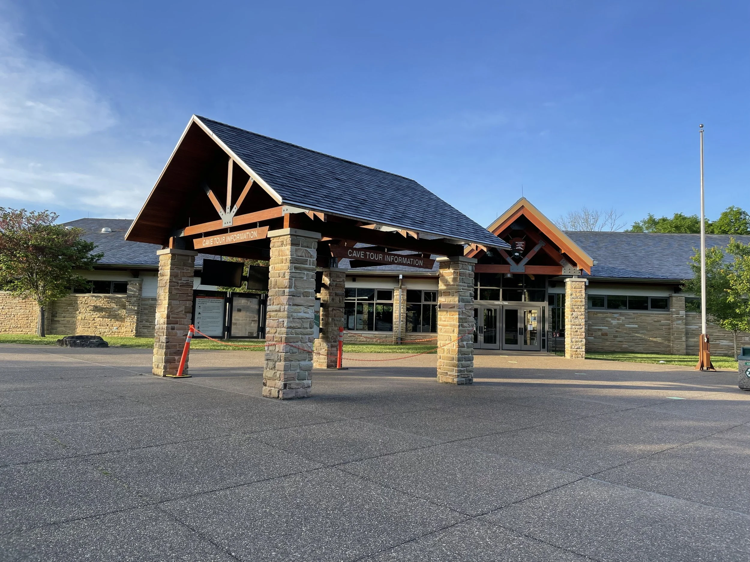
When the visitor center opened, I bought a ticket for the Historic Tour, which lasted about two hours and covered roughly two miles through some of the oldest parts of the cave. While waiting for the tour to start, I stopped by the front desk, chatted with a ranger, then wandered into the gift shop. After talking with the clerk, I decided to grab the passport book. She walked me through how it worked and helped me get my first stamp.
After the cave tour, I still had plenty of daylight left, so I stuck around and hiked a few of the trails above ground. It was spring, the weather was decent, and it felt good to stretch my legs after being underground for a while. There were still a few COVID-related rules in place, but nothing that took away from the experience.

A Bit About the Park
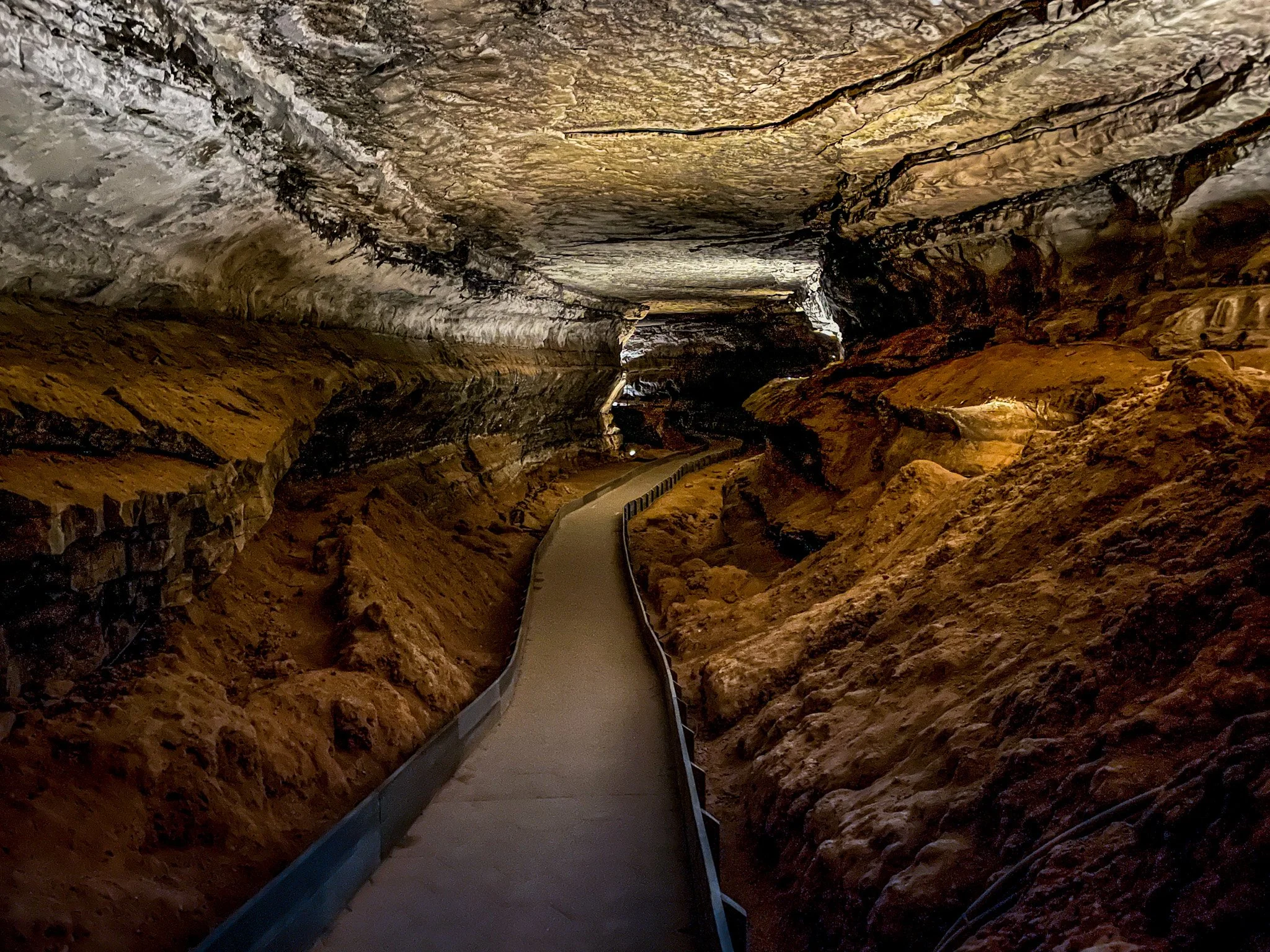
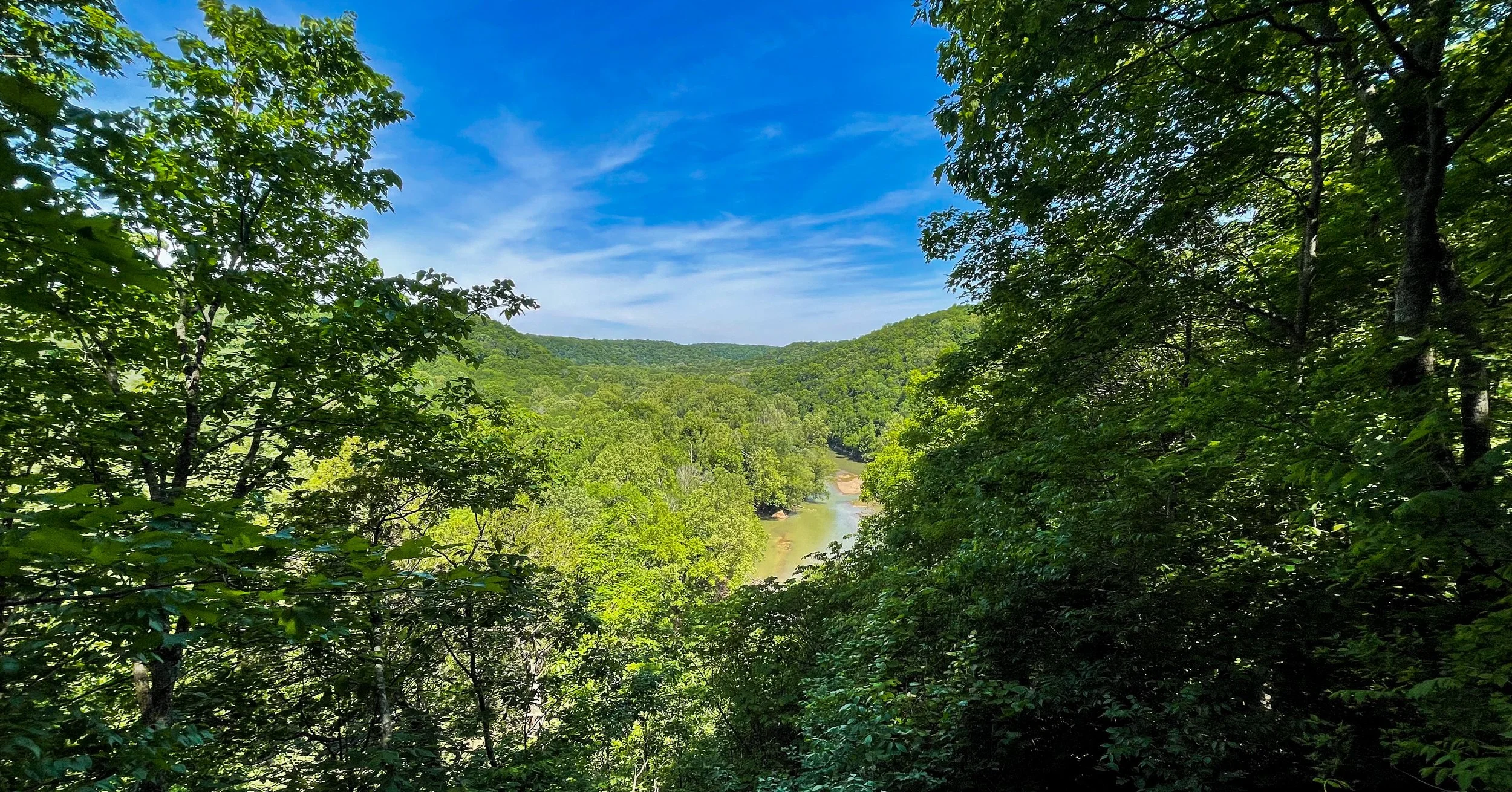
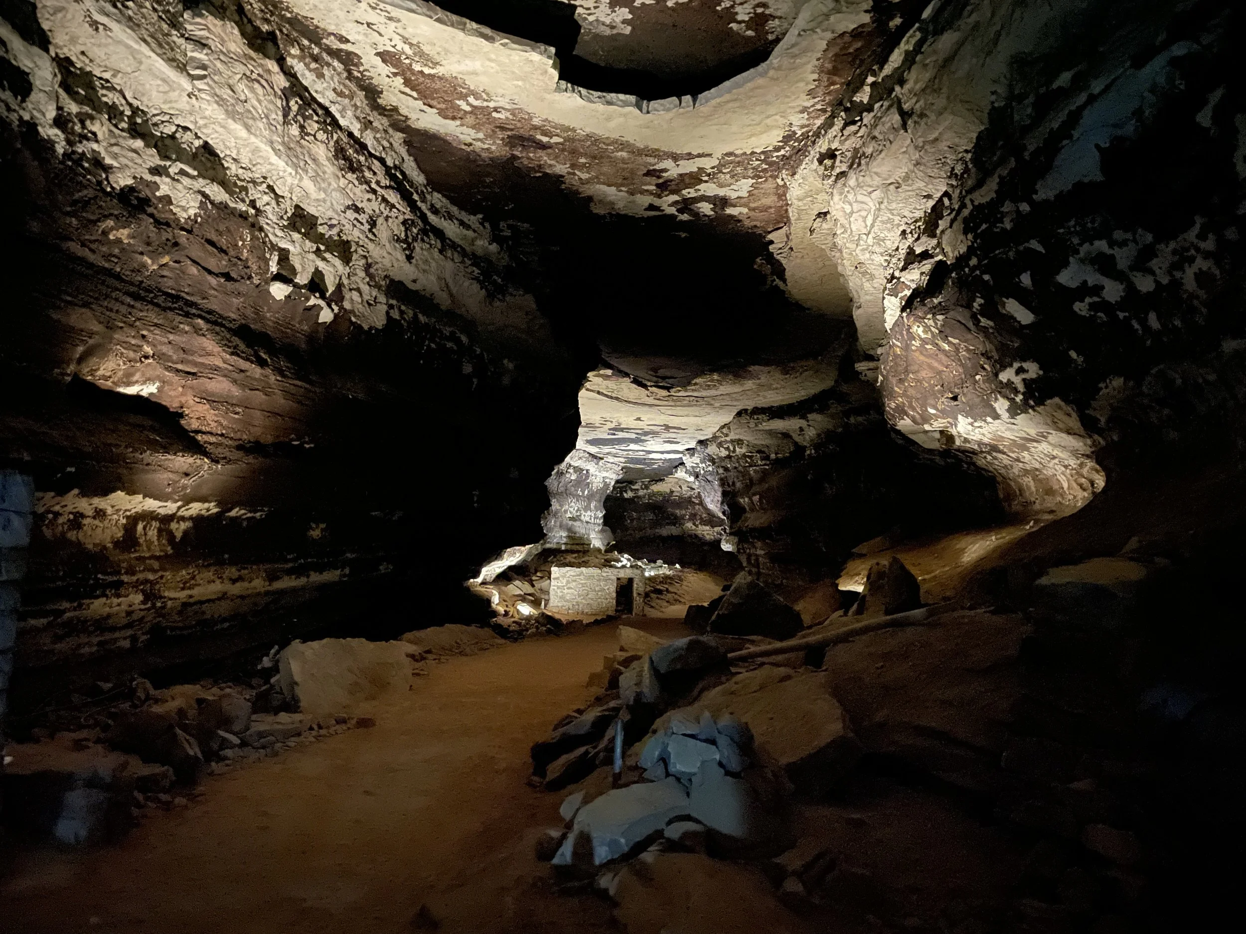
Mammoth Cave National Park is home to the longest cave system in the world—yes, the longest. With over 426 miles of mapped underground passageways and more being discovered each year, it lives up to its name. But this park isn’t just about what’s beneath your feet. Above ground, you’ll find rivers, trails, dense forest, and wildlife that make it a full-fledged national park experience, not just a cave detour.
This corner of south-central Kentucky holds layers of natural and human history. Indigenous peoples were the first to explore the cave more than 5,000 years ago. Later, during the War of 1812, the cave was mined for saltpeter (a component in gunpowder), and enslaved African Americans were tasked with much of that dangerous labor. One of them, Stephen Bishop, later became a legendary cave guide—so respected that his name still comes up on ranger tours today.
Mammoth Cave officially became a national park in 1941 and was designated a UNESCO World Heritage Site in 1981. Today, it draws visitors from around the world—many of them stunned by just how massive and intricate the cave system really is.
Visitor Centers
There’s one main visitor center here, and it’s where you’ll start pretty much everything.
📍Mammoth Cave Visitor Center
1 Mammoth Cave Parkway, Mammoth Cave, KY 42259
Open year-round (except major holidays), this is the hub for all cave tours, information, and exhibits. You can grab your park map, talk to rangers, book a tour (if you didn’t do so online already), and check out the museum-style displays about the geology and history of the area. This is also where you’ll pick up your national park passport stamp.
There’s a small gift shop and a café nearby if you need a bite before or after heading underground.
Entrance Fees and Tour Costs
Access to the park itself is free—that includes hiking, river access, and the visitor center. However, you must purchase tickets to enter the cave. Tour prices vary depending on the route, length, and intensity. Most range from $10 to $30, and some popular tours book out well in advance. If you’re planning a visit during spring, summer, or fall weekends, make reservations on Recreation.gov ahead of time.
Best Cave Tours
There are more than a dozen tours offered, ranging from easy walks to full-on cave crawls. Some highlights:
Historic Tour: This is the classic. You’ll follow in the footsteps of early explorers and miners. 2 hours, 2 miles. Moderate difficulty with lots of stairs.
Domes & Dripstones Tour: Focuses more on formations than history. You’ll see stalactites and stalagmites in the Frozen Niagara section. 1.25 hours, 0.75 miles.
Frozen Niagara Tour: The shortest and easiest tour. Great for families or anyone with limited mobility. Less than an hour.
Wild Cave Tour: Not for the faint of heart. This one involves crawling, squeezing, climbing, and getting dirty. You’ll need to be fit, wear old clothes, and mentally prepared. 6 hours long.
Tours change seasonally, and some routes may close due to conditions or bat protection efforts, so double-check before you go.
Things to Do Above Ground
Don’t sleep on the surface of Mammoth Cave. The park protects over 52,000 acres of forest, plus stretches of the Green and Nolin Rivers. It’s a great place for:
Hiking: More than 80 miles of trails, including the Green River Bluffs Trail, Echo River Spring Trail (accessible), and Sinkhole Trail.
Biking: Several trails allow bikes, especially around the Maple Springs area.
Paddling: Canoes and kayaks are allowed on the Green River, with boat launches inside the park.
Camping: There are three campgrounds and several backcountry sites. Mammoth Cave Campground is the most popular.
Best Places to Take Photos
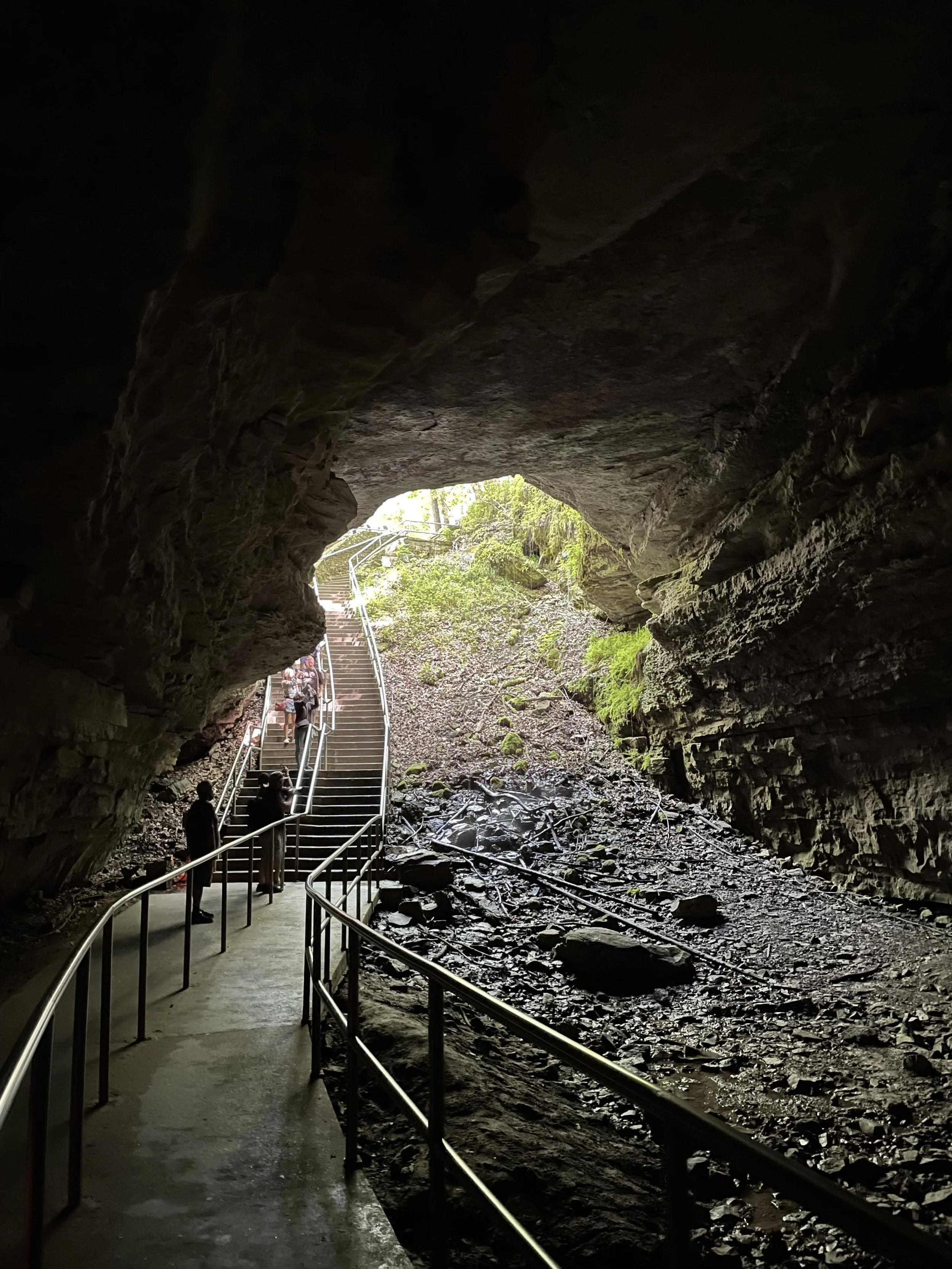
The Historic Entrance—even if you don’t go on a tour, you can walk up to the massive mouth of the cave. It’s haunting and cool (literally).
Frozen Niagara formations if you’re on that tour.
Above ground, the Green River ferry, the overlooks on the Green River Bluffs Trail, and the Heritage Trail boardwalk offer scenic shots.
The visitor center area has some excellent signage if you’re collecting those national park sign photos.
Accessibility Notes
Mammoth Cave has made notable strides in accessibility:
The Frozen Niagara Tour is the most accessible cave tour, though it still involves stairs. However, the Heritage Trail outside the visitor center is fully accessible, paved, and flat.
The Echo River Spring Trail is a standout—it’s a fully accessible trail that even includes tactile maps and audio-enhanced panels for visually impaired visitors.
The visitor center is wheelchair-accessible, and assistive listening devices are available for many tours.
Other Helpful Info
Dress in layers for cave tours. It stays around 54°F (12°C) underground, year-round.
No bags larger than a small purse are allowed in the cave. There are lockers at the visitor center.
Watch your shoes: To help stop the spread of White Nose Syndrome in bats, you may be asked to walk through a disinfectant mat after your tour.
Cell signal is spotty in the park, so download maps ahead of time.
Wildlife sightings above ground include deer, wild turkeys, and—if you’re lucky—barred owls or pileated woodpeckers.
Visiting the 63 U.S. National Parks
How it began
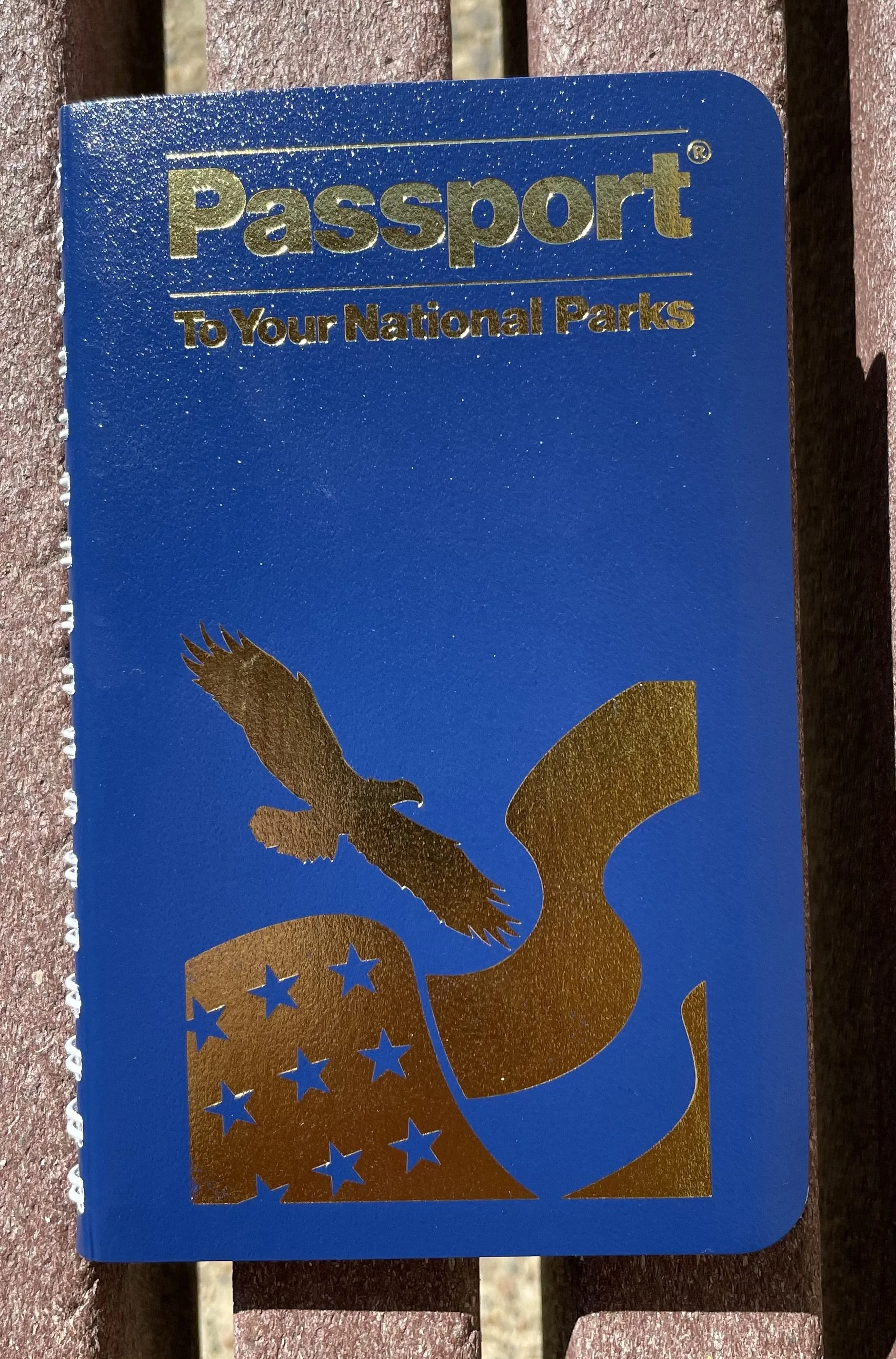
In May 2021, I visited Mammoth Cave National Park, a moment that would mark the beginning of an unexpected journey. It was here that I bought my first Passport To Your National Parks book, not realizing at the time how much that little book would become a companion in my travels. As the years went by, it would travel with me across the country, through remote corners of the wilderness and bustling cities alike.
Each stamp, represents more than just a place—it’s a memory, an adventure, a mishap, a long road, and a connection to the natural wonders of the United States.
That first stamp at Mammoth Cave sparked the idea of visiting all 63 U.S. National Parks. Along the way I have stopped at not only National Parks but also National Monuments and Historic Sites.
I am looking forward to sharing this journey with you. So lets hit, the road, skies, boats and rails. America the Beautiful is waiting.